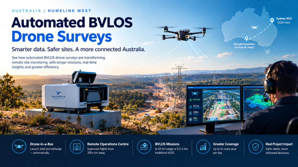
Automated BVLOS drone surveys let a docked drone fly scheduled mapping missions beyond the pilot’s line of sight while a supervisor oversees everything from a remote operations centre. In Australia, Skyports Drone Services is now using automated BVLOS drone surveys to monitor the HumeLink West transmission project from a control room more than 350 km from the site. skyportsdroneservices
For years, “drone survey” meant a pilot, a vehicle, a ute full of batteries and a long drive to site. The HumeLink West deployment shows what happens when you remove all of that. This guide explains how automated BVLOS drone surveys work, what the HumeLink West numbers actually say, how Australia’s regulator makes the model possible, and how to decide whether it suits your own project.
What Are Automated BVLOS Drone Surveys?
Automated BVLOS drone surveys are repeatable aerial data-capture missions flown by a drone that launches, flies, lands and recharges from a permanent dock, with human supervision happening remotely rather than on site. The “BVLOS” part means beyond visual line of sight: the aircraft travels farther than the pilot can see it. The “automated” part means the mission is pre-planned and executed by software, so no one needs to be standing next to the aircraft.
What does BVLOS mean in drone operations?
BVLOS stands for beyond visual line of sight. It describes any drone flight where the operator cannot keep the aircraft in direct, unaided view. Conventional visual line of sight (VLOS) flying keeps drones within roughly 0.5 to 1 km of the pilot, which is fine for a single stockpile but restrictive for a substation, a pit or a long transmission corridor. skyportsdroneservices
What is a drone-in-a-box system?
A drone-in-a-box is a weatherproof dock that houses a drone, charges it, opens to launch it and receives it after landing. At HumeLink West, Skyports uses a DJI Dock 2 installed at the Maragle substation construction site. Because the dock stays on site permanently, the survey can run without anyone travelling there. evtolinsights
What is a Remote Operations Centre?
A Remote Operations Centre (ROC) is the control room where pilots and supervisors monitor automated flights. Skyports supervises HumeLink West from its ROC in Lane Cove, Sydney. The same ROC model is spreading across the industry, and it is what turns a single drone into a scalable service. evtolinsights
Put simply, automated BVLOS drone surveys combine three ingredients: a permanently installed drone-in-a-box, a remote operations centre and a regulatory approval that allows flights beyond visual line of sight. Remove any one and the model stops working.
Automated BVLOS Drone Surveys on HumeLink West: The Numbers
HumeLink West is a high-voltage transmission project in New South Wales intended to strengthen the electricity network and support renewable energy integration. It is a useful test case because transmission projects are long, remote and full of hazards, which are exactly the conditions where remote drone surveying should pay off. evtolinsights
What did Skyports actually deploy?
The setup is compact:
- Aircraft and dock: a DJI Dock 2 at the Maragle substation construction site.
- Control location: a Sydney ROC more than 350 km away.
- Mission range: missions of roughly 8 to 10 km, compared with the 0.5 to 1 km typical of conventional VLOS work. infrastructure-now
- Coverage: Skyports says the remotely operated drone can survey up to five times more area in a single day than traditional on-site drone surveys. dronelife
- Data processing: DroneDeploy produces the 2D and 3D site models and tracks change over time. infrastructure-now
Why is this deployment a milestone?
Two reasons stand out. First, Skyports reports that HumeLink West is the first CIMIC Group project in Australia authorised for fully remote BVLOS drone operations. That matters because a major contractor has now accepted the model on a live project, not just in a trial. dronelife
Second, the programme did not appear overnight. It followed a 12-month extended visual line of sight (EVLOS) campaign delivered by the same provider. That progression, from EVLOS to fully remote BVLOS, is a practical template for other operators: prove the workflow first, then remove the people from site. infrastructure-now
The project director’s reaction is telling. According to the reporting, he said the surveys give construction teams a consistent picture of the site so they can track progress, respond to issues sooner and keep work moving. Notice the language: it is about decisions, not drones.
How often do the flights run?
Here is a discrepancy worth flagging. Most news coverage says the dock flies automated surveys every two weeks, but Skyports’ own announcement describes weekly flights. Cadence may have been adjusted or reported differently, so if survey frequency matters to your decision, confirm it directly with the provider. Either way, the interval is far shorter than most manual survey programmes can sustain on a remote site. evtolinsightsskyportsdroneservices
The takeaway from HumeLink West is that automated BVLOS drone surveys are now being used on a major Australian infrastructure project, not just discussed as a future possibility.
How Does CASA’s Broad Area BVLOS Approval Work?
Short answer: Australia’s Civil Aviation Safety Authority (CASA) issues a Broad Area BVLOS Drone Approval that lets a qualified operator self-authorise certain BVLOS flights without seeking permission for each one.
What does “self-authorise” mean?
The approval allows Skyports to self-authorise qualifying BVLOS flights in eligible remote and sparsely populated areas, subject to the approval’s conditions. In practice, the operator runs its own risk assessment inside the approved framework instead of applying case by case for every site. That is what makes repeatable, scalable operations possible. evtolinsights
Is the approval unlimited?
No. It is bounded by location and conditions. Eligible areas are remote and sparsely populated, which suits mines, farms and transmission corridors but not dense urban work. Operators still have to meet the approval’s conditions on safety, procedures and airspace awareness.
Is Skyports the only operator doing this?
No, and that is the point. RocketDNA’s xBot system supports pit monitoring, emergency response and surveying at BMA and Rio Tinto mine sites under its own Broad Area BVLOS capability. Industry reporting also describes a shift from individual projects flying BVLOS to a growing number of operators scaling standardised, broad area operations. aapaap
Earlier milestones set the stage, including CASA’s approval of Percepto’s autonomous drones to fly BVLOS at an Australian industrial site. The Broad Area approach is the next step: from one-off permissions to repeatable frameworks. dronelife
Automated BVLOS vs. VLOS vs. EVLOS: A Comparison
The table below compares automated BVLOS drone surveys with the two approaches most survey teams use today. Figures are from the HumeLink West reporting where noted; other cells describe general operating characteristics.
| Factor | Conventional VLOS | EVLOS | Automated BVLOS (dock-based) |
|---|---|---|---|
| Pilot location | On site | On site, with observers or aids | Remote operations centre |
| Typical range | ~0.5–1 km | Extended, but depends on observers | ~8–10 km missions (HumeLink West) |
| People on site for flights | Pilot, often more | Pilot plus observers | None required for flights |
| Revisit frequency | Limited by crew travel | Limited by crew and observer availability | Scheduled, repeatable (weekly or fortnightly at HumeLink West) |
| Area per day | Baseline | Higher than VLOS | Up to 5x on-site surveys (Skyports claim) |
| Regulatory path | Standard operations | Specific approvals | Broad Area BVLOS Drone Approval (eligible areas) |
| Best suited to | Small, one-off jobs | Medium sites with spotters | Large or remote sites needing repeat monitoring |
The pattern is clear. As you move from VLOS to automated BVLOS, you trade setup complexity for repeatability and range.
Seven Benefits of Automated BVLOS Drone Surveys
Why are project teams adopting this model? These are the benefits that show up most consistently in the reporting and in the logic of the technology:
- Greater coverage: longer missions mean more ground in a single day.
- More frequent data: a permanent dock turns surveys from events into routines.
- Fewer people in hazard zones: pilots are not standing beside plant, tower pads or unstable ground.
- Lower travel burden: no repeated trips to remote sites for routine flights.
- Consistent capture: the same flight plan produces comparable data over time, which makes change detection far more reliable.
- Faster decisions: current models help teams spot issues earlier.
- Scalability: one operations centre can supervise multiple docks across multiple sites.
Not every benefit applies to every project. A two-hectare job with easy access probably does not need a dock. But for large, linear or remote sites, the case gets strong quickly.
Why Safety Is the Strongest Argument
How do automated BVLOS drone surveys improve safety?
They reduce the number of people exposed to site hazards. Analysis aimed at civil and geotechnical teams highlights several specific effects:
- Remote piloting removes survey personnel from live transmission tower pads and heavy plant working areas. geomechanics
- Drone flights avoid repeated 4WD access along easements, cutting light-vehicle interaction on unsealed tracks. geomechanics
- Aerial monitoring limits the need for work-at-height inspections on towers and temporary structures. geomechanics
- Regular overflights allow rapid post-storm checks for slope instability or scour without sending crews onto soft ground. geomechanics
That last point deserves attention. After heavy weather, the sites most likely to be damaged are also the most dangerous to enter. A dock that can launch on schedule or on demand gives teams eyes on the problem before boots go in.
From Flight to Decision: The Data Pipeline
Automated BVLOS drone surveys are only valuable if the data reaches the people who need it. At HumeLink West, each flight’s imagery is processed in DroneDeploy, which generates detailed two-dimensional and three-dimensional site models and tracks changes over time. Skyports describes the output as a continually updated view that enables earlier identification of issues and more informed decision-making. infrastructure-nowglobalairspaceradar
What can you do with repeat 2D and 3D models?
- Compare earthworks against design to verify progress.
- Track stockpile and cut-and-fill volumes between visits.
- Spot drainage or erosion problems before they escalate.
- Document site conditions for stakeholders and for audit.
The value comes from the time series. A single map is a snapshot; a fortnightly or weekly series is a story about how the site is changing.
Beyond Construction: Mining and Agriculture
Construction is only one use case. The same docks and approvals are spreading into other sectors.
How is the model used in mining?
Mining operations favour remote drone surveying because pits are hazardous and sites are vast. Reporting on RocketDNA describes xBot operations at BMA and Rio Tinto mine sites covering pit monitoring, emergency response and surveying. aap
How is it used in agriculture?
Industry commentary notes that flying BVLOS across broader areas removes a constraint that has historically limited large-scale agricultural drone deployment, covering crop monitoring and livestock and paddock inspection. kosmo
How big is the scale?
Reported figures show the maturity of the model. Perth and Adelaide ROCs are said to run BVLOS operations around the clock, completing approximately 4,500 flights per month. Treat vendor-reported figures with appropriate caution, but the direction is unmistakable: dock-based, remotely supervised flying is moving from novelty to routine. kosmo
Skyports itself is expanding. It plans more drone-in-a-box deployments across additional Australian sites, and expects to reach 25 boxes globally by the end of the year, with that number more than doubling in 2027. Skyports has also been reported as deploying a similar system for a German bridge project, delivering weekly 2D and 3D data, which suggests the model travels well across regulatory environments. globalairspaceradardronelife
Limits to Consider Before Adopting Automated BVLOS Drone Surveys
A balanced view matters. Automated BVLOS drone surveys are powerful, but they are not magic.
Where is the model constrained?
- Eligibility: the approval covers eligible remote and sparsely populated areas. Urban or populated sites will need different pathways.
- Weather: docks and drones still have operating limits for wind, rain and visibility, so “automated” does not mean “always flying.”
- Accuracy requirements: depending on your survey-grade needs, ground control or validation may still be required. Ask providers how their outputs are verified.
- Upfront setup: a permanent dock needs power, connectivity and a stable site for installation.
- Vendor claims: figures like “up to five times more area” are provider-reported and depend on site conditions.
Are these limits deal-breakers?
Rarely. They are screening questions. If your site is remote, large and needs repeat monitoring, the limits are usually manageable. If it is small, urban or a one-off, a conventional approach may be cheaper and simpler.
How to Decide Whether Automated BVLOS Drone Surveys Fit Your Project
Use this quick checklist before you commission a provider:
- Site type: is it remote or sparsely populated enough to fall within an approval’s eligible area?
- Duration: will you need repeat surveys over months, not just once?
- Hazard profile: are there areas where you would rather not send people?
- Data needs: do you need change tracking, 3D models or volumes?
- Approvals: does your provider hold a CASA Broad Area BVLOS Drone Approval, and can they show the conditions?
- Connectivity and power: can the dock be supported on site?
- Reporting: how and how quickly will you receive outputs?
A sensible path mirrors HumeLink West: start with a limited campaign, validate the data and workflow, then step up to fully remote operations.
Frequently Asked Questions
What are automated BVLOS drone surveys?
They are scheduled drone mapping missions flown from a permanent dock, beyond the pilot’s line of sight, with supervision from a remote operations centre rather than from the site.
Are automated BVLOS drone surveys legal in Australia?
Yes, when conducted under the appropriate CASA authorisation. Skyports operates under a Broad Area BVLOS Drone Approval that allows it to self-authorise qualifying flights in eligible remote and sparsely populated areas.
How far can a BVLOS survey drone fly?
On HumeLink West, missions routinely reach approximately 8 to 10 km, versus roughly 0.5 to 1 km for conventional VLOS operations.
Do you need anyone on site?
Not for the flights themselves. The drone launches and lands from its dock, and pilots supervise remotely. Someone may still be needed for installation and maintenance.
Is it cheaper than traditional surveying?
It depends. Providers cite efficiency gains from larger coverage and fewer site visits, but pricing varies, so compare quotes against your required frequency and duration.
Key Takeaways
- Automated BVLOS drone surveys pair a permanent dock, a remote operations centre and a CASA approval to deliver repeatable site data without on-site pilots.
- HumeLink West shows the model working on a major Australian transmission project, supervised from more than 350 km away.
- The reported benefits include up to five times more coverage per day, longer missions and fewer people in hazardous areas.
- The approach suits remote, large and long-running sites best, and it has real limits on eligibility, weather and accuracy validation.
- Confirm details such as flight cadence directly with providers, because published sources differ.