DJI Matrice 5T: DJI ର 1K ଥର୍ମାଲ୍ (ତାପୀୟ) କ୍ୟାମେରା ଏବଂ LiDAR ଯୁକ୍ତ ଏଣ୍ଟରପ୍ରାଇଜ୍ ଡ୍ରୋନ୍ ବିଷୟରେ ସମ୍ପୂର୍ଣ୍ଣ ଗାଇଡ୍
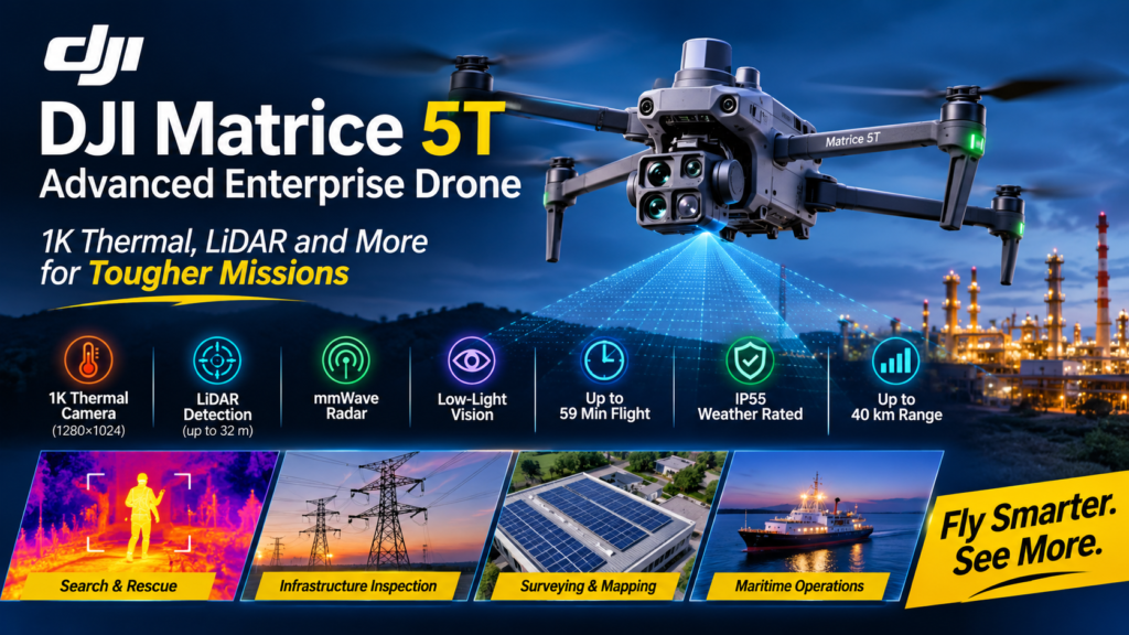
The DJI Matrice 5T is DJI’s newest compact enterprise drone, announced on November 5, 2026, and it is built to keep inspection, emergency response, and surveying missions running at night and in bad weather. It combines a native 1280×1024 thermal camera with LiDAR, mmWave radar, and an omnidirectional vision system, all in an IP55-rated airframe that DJI says can fly for up to 59 minutes.
If you have flown a thermal mission after sunset, you know the problem. The heat signature is on screen, but you can’t tell what it is, and you can’t see the wire hanging in front of the aircraft. Night operations are where a drone program either proves its value or loses the trust of the team that depends on it. This aircraft is aimed squarely at that gap.
This guide explains what the DJI Matrice 5T is, how its cameras and sensors work, how it compares with the Matrice 4T, who it suits, and what is still unknown about pricing outside China. Every section stands on its own, so jump to whatever you need.
Source note: Specifications come from DJI’s launch announcement. DJI states that all figures were measured on a production model in a controlled environment, so real-world results will vary with weather, payload, and mission profile.
What Is the DJI Matrice 5T?
Definition: The DJI Matrice 5T is a compact enterprise flagship drone that integrates thermal imaging, enhanced night vision, LiDAR, mmWave radar, and onboard AI in a single aircraft.
Expansion: DJI positions the aircraft for emergency response, infrastructure inspection, and surveying in difficult conditions. It carries an IP55 rating for dust and rain, operates in temperatures from -20°C to 50°C, and offers up to 59 minutes of flight time. It is meant to be the drone a team can launch when the weather turns, the light disappears, or the airspace is cluttered with wires and towers.
What makes it notable is the combination rather than any single feature. DJI says this is the first time it has put LiDAR, mmWave radar, and an omnidirectional vision system into a compact enterprise drone. Thermal, night vision, long zoom, and AI detection were already part of the enterprise toolkit. The new part is a sensing stack that protects the aircraft while those payloads do their work.
Quick Facts at a Glance
- Announced: November 5, 2026
- Flight time: up to 59 minutes
- Protection and climate: IP55; operates from -20°C to 50°C
- Thermal camera: native 1280×1024; 2560×2048 with UHR Infrared Image enabled
- Wide camera: 1/0.98-inch sensor, f/1.8 aperture, ISO up to 1,600,000, color imagery down to 0.01 lux
- Zoom: 3x medium telephoto (50 MP) and an 11x optical / 176x hybrid telephoto
- Obstacle sensing: LiDAR (thin obstacles up to 32 m at night), mmWave radar, low-light fisheye vision (down to 0.5 lux)
- AI: detects over 20 target types, with support for third-party models
- Transmission: up to 40 km with O4 Enterprise
- China list price: ¥57,488 (no US or European price in the launch announcement)
How Good Is the DJI Matrice 5T Thermal Camera?
Short answer: It is a major step up in thermal detail. The camera captures a native 1280×1024 image, which DJI says quadruples the pixel count of the standard 640×512 thermal sensors common in this class.
What “Native” Resolution Means
Native resolution is the number of physical pixels on the thermal sensor itself. Software can upscale a smaller image, but it can’t recover detail the sensor never captured. A native 1K sensor records four times as many temperature measurements across the same scene, which gives the operator more real data to work with.
This matters because the Matrice 4T lists thermal output of up to 1280×1024 through infrared super-resolution. That is a different method from the 5T’s native sensor. When comparing spec sheets, always check whether a thermal number is native or processed. heliguy
Ultra-High-Resolution Mode
With UHR Infrared Image enabled, output rises to 2560×2048. DJI says this keeps heat anomalies clearly defined even against complex backgrounds, such as a hot component sitting in a cluttered substation or a person in dense vegetation. The practical benefit is flexibility: you can fly in standard mode for broad searches and switch to the higher-resolution mode when you need to document a finding.
Why More Thermal Pixels Matter in the Field
Higher thermal resolution tends to help in three situations:
- Search and rescue: a small heat source can be recognized from a greater distance, so you can cover more ground per pass.
- Solar and grid inspection: a faulty cell or overheating connector is easier to isolate and measure.
- Public safety: operators can distinguish between a person, an animal, and a warm object with more confidence.
As with any enterprise thermal drone, atmospheric conditions and target emissivity still affect what the camera reports, so verify critical findings before acting on them.
How Does the DJI Matrice 5T Fly Safely in the Dark?
Short answer: It fuses LiDAR, mmWave radar, and full-color low-light vision, so each sensor covers the weaknesses of the others. This drone LiDAR and mmWave radar combination is the biggest change from earlier compact enterprise aircraft.
LiDAR for Thin Obstacles
Power lines, guy wires, and cables are the classic night-flight hazard because cameras often fail to see them. The top-mounted LiDAR can detect thin obstacles like power lines up to 32 meters away in darkness. That gives the aircraft and the pilot time to react, and it underpins the automated power-line features described later.
mmWave Radar for Fog, Rain, and Dust
Optical sensors struggle when the air is full of particles. The mmWave radar is designed to keep reading the environment through fog, rain, and dust, which are exactly the conditions where emergency responders and utility crews still need to fly. Radar does not replace vision, but it keeps a distance-sensing layer working when imagery degrades.
Low-Light Fisheye Vision
The omnidirectional vision system uses full-color fisheye sensors that maintain visual positioning in conditions as dark as 0.5 lux. Vision Assist now provides full-color imagery as well, which improves situational awareness compared with a grainy monochrome feed. For a pilot flying a building perimeter at night, that difference is easy to appreciate.
Weak-GNSS Environments
Canyons and high-rise districts can degrade satellite positioning. In those settings, the aircraft fuses visual and radar data to build an environmental map in real time, which supports stable flight when GNSS is weak. DJI notes this capability as measured under controlled conditions, so treat it as a strong aid rather than a guarantee.
Night Vision and Zoom: What Can the Cameras See?
Short answer: The payload covers close inspection, mid-range detail, and long-distance identification, with night performance built in at each focal length.
Wide Camera
The wide camera uses a large 1/0.98-inch sensor with a fast f/1.8 aperture. With ISO sensitivity up to 1,600,000 and AI low-light enhancement, DJI says it produces full-color imagery in conditions as dark as 0.01 lux. Full-color night footage is valuable because it preserves context such as clothing color, vehicle color, and signage that thermal alone cannot show.
Medium Telephoto
The medium telephoto camera has a 50 MP sensor and 3x optical zoom. DJI highlights it for power line and bridge inspections, where it can capture detail from about 10 meters away. That standoff distance helps keep the aircraft clear of energized equipment and structures.
Telephoto
The telephoto camera offers monochrome night vision, 11x optical zoom, and 176x hybrid zoom. DJI says it can read license plate numbers from up to 400 meters away. For law enforcement, perimeter security, and incident documentation, that reach lets the drone observe without getting close or disturbing the scene.
What Can the Onboard AI on the DJI Matrice 5T Do?
Short answer: It detects more than 20 target types, such as vehicles and vessels, by analyzing the thermal and visible feeds in parallel, and it can run custom models.
Built-In Detection
Running two feeds at once matters. A thermal-only detector can confuse a warm engine block with a person, while a visible-only detector fails in the dark. Cross-checking both streams is the logic behind this onboard AI drone inspection workflow.
Search by Prompt
Once the aircraft is connected to DJI FlightHub 2, operators can use text and image prompts to search for targets inside DJI Pilot 2. They can also outline an area on a map and generate a patrol route with custom actions such as hovering, capturing photos and video, or broadcasting audio. This reduces the manual flying needed for repetitive patrols.
Open Edge Computing
Open onboard computing supports third-party models, so organizations can deploy their own algorithms. A utility could train a model for a specific insulator defect, or a conservation group could train one for a particular species. DJI Pilot custom plugins also let developers add their own capabilities to DJI Pilot 2 as floating windows.
How Far Can It Transmit? O4 Enterprise and Relay Modes
Short answer: Up to 40 km, up from 25 km on the previous generation, according to DJI.
On the DJI Matrice 5T, the O4 Enterprise Enhanced Video Transmission System uses adaptive multi-band switching to resist urban interference. Dual built-in DJI Cellular Dongle 2 modules help maintain a stable link when physical obstructions block the direct path, by switching automatically to the best available network.
Smart Relay and multiple relay topologies address blocked signals caused by terrain, in both single-drone and multi-drone operations. Remember that regulations, not just radio range, limit how far you may fly. Beyond-visual-line-of-sight rules vary by country, and a 40 km link does not authorize a 40 km flight.
Surveying and Mapping Without Ground Control Points
Short answer: Paired with DJI Terra, DJI says the aircraft delivers centimeter-level surveying accuracy without ground control points.
Mapping is a secondary role for many thermal drones, but the DJI Matrice 5T treats it as a core use. DJI Terra can stitch thermal images into 2D thermal maps, read temperatures, and mark anomalies directly, which speeds up large solar-farm and grid inspections.
On-site speed is another selling point. During a flight, the remote controller receives images in real time and can process 200 photos in 8 minutes to generate local point clouds or 2.5D models. It can also build a rough 3D model from a single flight and use it to plan precise routes that follow a structure’s surface.
Specialized Missions: Power Lines, Vessels, and Custom Plugins
Short answer: Several features target specific industries rather than general flying.
- Power line inspection: The LiDAR can detect and lock onto power and ground wires, enabling lateral flight along the line to help spot broken strands or foreign objects hanging on it.
- Maritime operations: The aircraft supports takeoff from moving vessels and can recognize a landing-point pattern on a deck.
- Telephoto clarity: A built-in AI foreground segmentation model separates the subject from the background to reduce visual clutter and keep key details sharp.
- Quiet flight: The Chinese outlet IT Home reports that the standard silent propellers hold flight noise to 80 dB(A), which suits urban patrols and wildlife observation. 163
DJI Matrice 5T vs. Matrice 4T: What Changed?
Short answer: The newer aircraft adds LiDAR and mmWave radar, native 1K thermal, a weather rating, longer transmission range, and longer flight time.
The Matrice 4T launched in January 2025 as DJI’s compact thermal enterprise aircraft. Teams already flying the 4T will want to know whether the upgrade justifies the cost. The table compares the two on the points DJI emphasized at launch.
| Feature | DJI Matrice 5T | Matrice 4T |
|---|---|---|
| Launch | November 5, 2026 | January 2025 |
| Thermal imaging | Native 1280×1024; 2560×2048 with UHR mode | Up to 1280×1024 via super-resolution |
| Obstacle sensing | LiDAR + mmWave radar + low-light fisheye vision | Vision-based sensing with NIR auxiliary light |
| Weather rating | IP55 | Not highlighted in sources reviewed |
| Video transmission | Up to 40 km (O4 Enterprise) | Up to 25 km (per DJI’s comparison) |
| Flight time | Up to 59 minutes | Up to about 49 minutes |
| Onboard AI | 20+ target types; open to third-party models | AI detection of people, vehicles, and boats |
The 4T’s flight time comes from DJI’s earlier published specifications. Confirm the 4T figures against DJI’s current product page before publishing.
If your missions rarely happen in the dark or in poor weather, the 4T may remain sufficient. If you regularly fly near wires at night, operate in fog or dust, or need to resolve small heat sources from altitude, the newer aircraft addresses real limitations.
Who Should Consider the DJI Matrice 5T?
The aircraft fits teams whose missions are time-critical and environment-dependent:
- Public safety and search and rescue: native 1K thermal, full-color night imagery, and AI target detection speed up locating people and vehicles.
- Utilities and energy: LiDAR wire detection and thermal mapping support power-line, substation, and solar inspection.
- Infrastructure and surveying firms: centimeter-level mapping without GCPs and on-controller processing shorten turnaround.
- Maritime and coastal operators: moving-vessel takeoff and deck-pattern landing recognition support offshore work.
- Wildlife and conservation teams: the quieter propellers and night imaging suit sensitive observation.
Smaller operators who only need daytime photography will not use most of what this drone offers, and a simpler platform will cost less.
Data Security and Compliance
Security is a purchasing criterion for many agencies, and DJI addresses it directly in the DJI Matrice 5T launch. Users must opt in to share photos and videos with DJI, and US-based users no longer have the option to sync flight logs with DJI servers. DJI says FlightHub 2 holds ISO 27001 and ISO 27701 certifications from the British Standards Institution, and that account registration data is protected with AES-256 encryption.
The aircraft also includes DJI’s Flight Termination System, a key technical requirement for C6 compliance. It can be triggered manually to stop the propellers, or automatically if the drone breaches a geofence boundary. Procurement teams should still verify their own jurisdiction’s rules, since approval for government or critical-infrastructure use depends on local policy and not on a manufacturer’s statements.
DJI Matrice 5T Price and Availability
DJI says the aircraft is available now through authorized DJI Enterprise dealers. In mainland China, the official price is 57,488 yuan. The launch announcement gave no US or European pricing, so contact a dealer in your region for a quote and delivery timing. 163
Protection plans are available as well. DJI Care Enterprise Plus includes one battery replacement per year and Flyaway Coverage Service, and DJI’s Official Extended Warranty Service adds one year of warranty coverage. Availability and import rules differ by country, so confirm that your region can purchase and legally operate the aircraft before budgeting.
Frequently Asked Questions
Is the DJI Matrice 5T waterproof?
It is IP55-rated, which DJI describes as protection against dust and rain. That is not the same as waterproof, so avoid submersion and heavy downpours outside the rating.
How long can the DJI Matrice 5T fly?
DJI lists up to 59 minutes of flight time, measured in a controlled environment. Expect less with heavy payload use, cold temperatures, strong wind, and aggressive maneuvering.
Does it have true 1K thermal?
Yes. The thermal camera is native 1280×1024, and UHR Infrared Image mode raises output to 2560×2048.
Can it run custom AI models?
Yes. DJI says open onboard computing supports third-party models, and custom plugins can extend DJI Pilot 2.
How far can it transmit video?
Up to 40 km with O4 Enterprise, subject to terrain, interference, and local flight regulations.
Final Verdict: Is the DJI Matrice 5T Worth Considering?
For teams whose work happens after dark, near wires, or in poor weather, the DJI Matrice 5T looks like a meaningful upgrade. Native 1K thermal, LiDAR plus mmWave radar, an IP55 rating, and a 40 km link address practical limits that earlier compact aircraft left to pilot skill and luck.
The main open questions are cost and access outside China, plus independent testing of the controlled-environment figures DJI published. Before committing, request a demo from an authorized dealer, check your local regulations, and test the drone against your own mission profile. If your flights are mostly daytime and simple, a lower-cost platform may serve you better. If darkness and obstacles define your work, the DJI Matrice 5T deserves a place on your shortlist.
DJI Matrice 5T: DJI ର 1K ଥର୍ମାଲ୍ (ତାପୀୟ) କ୍ୟାମେରା ଏବଂ LiDAR ଯୁକ୍ତ ଏଣ୍ଟରପ୍ରାଇଜ୍ ଡ୍ରୋନ୍ ବିଷୟରେ ସମ୍ପୂର୍ଣ୍ଣ ଗାଇଡ୍
DJI Matrice 5T ହେଉଛି DJI ର ସର୍ବଶେଷ କମ୍ପାକ୍ଟ (ଛୋଟ ଆକାରର) ଏଣ୍ଟରପ୍ରାଇଜ୍ ଡ୍ରୋନ୍, ଯାହା ୫ ନଭେମ୍ବର, ୨୦୨୬ ରେ ଘୋଷଣା କରାଯାଇଥିଲା। ଏହାକୁ ବିଶେଷ ଭାବରେ ରାତି ସମୟରେ ଏବଂ ଖରାପ ପାଗରେ ନିରୀକ୍ଷଣ (inspection), ଜରୁରୀକାଳୀନ ସହାୟତା (emergency response) ଏବଂ ସର୍ଭେ କାର୍ଯ୍ୟ ସୁରୁଖୁରୁରେ ଚଳାଇବା ପାଇଁ ତିଆରି କରାଯାଇଛି। ଏଥିରେ ଏକ 1280×1024 ଥର୍ମାଲ୍ କ୍ୟାମେରା ସହିତ LiDAR, mmWave ରାଡାର୍ ଏବଂ ଚାରିଆଡ଼କୁ ଦେଖିପାରୁଥିବା (omnidirectional) ଭିଜନ୍ ସିଷ୍ଟମ୍ ରହିଛି। ଏହାର ଢାଞ୍ଚା IP55 ମାନକ ବିଶିଷ୍ଟ ଏବଂ DJI ଅନୁଯାୟୀ, ଏହା ଗୋଟିଏ ଥର ଚାର୍ଜରେ ୫୯ ମିନିଟ୍ ପର୍ଯ୍ୟନ୍ତ ଉଡ଼ିପାରିବ।
ଯଦି ଆପଣ ସୂର୍ଯ୍ୟାସ୍ତ ପରେ କେବେ ଥର୍ମାଲ୍ କ୍ୟାମେରା ସାହାଯ୍ୟରେ କୌଣସି ଅଭିଯାନ କରିଥାନ୍ତି, ତେବେ ଆପଣ ଏଥିରେ ଥିବା ସମସ୍ୟା ବିଷୟରେ ଜାଣିଥିବେ। ସ୍କ୍ରିନରେ ତାପମାତ୍ରା ଜନିତ ଚିହ୍ନ (heat signature) ଦେଖାଯାଏ, କିନ୍ତୁ ତାହା ପ୍ରକୃତରେ କ’ଣ ତାହା ବୁଝିବା କଷ୍ଟକର ହୋଇପଡ଼େ; ଏପରିକି ଡ୍ରୋନ୍ ସାମ୍ନାରେ ଝୁଲୁଥିବା ତାର ମଧ୍ୟ ଦେଖାଯାଏ ନାହିଁ। ରାତି ସମୟର କାର୍ଯ୍ୟକଳାପ ହିଁ ସ୍ଥିର କରେ ଯେ ଏକ ଡ୍ରୋନ୍ କାର୍ଯ୍ୟକ୍ରମ ପ୍ରକୃତରେ କେତେ ଉପଯୋଗୀ କିମ୍ବା ଏହା ଉପରେ ନିର୍ଭର କରୁଥିବା ଟିମ୍ର ବିଶ୍ୱାସ ବଜାୟ ରହିବ କି ନାହିଁ। ଏହି ଡ୍ରୋନ୍ଟି ଠିକ୍ ସେହି ଅଭାବ କିମ୍ବା ସମସ୍ୟାକୁ ଦୂର କରିବା ପାଇଁ ତିଆରି କରାଯାଇଛି।
ଏହି ଗାଇଡ୍ରେ DJI Matrice 5T କ’ଣ, ଏହାର କ୍ୟାମେରା ଏବଂ ସେନ୍ସରଗୁଡ଼ିକ କିପରି କାମ କରନ୍ତି, Matrice 4T ସହିତ ଏହାର ତୁଳନା, ଏହା କାହା ପାଇଁ ଉପଯୁକ୍ତ ଏବଂ ଚୀନ୍ ବାହାରେ ଏହାର ମୂଲ୍ୟ କେତେ ହେବ (ଯାହା ବର୍ତ୍ତମାନ ସୁଦ୍ଧା ଜଣାପଡ଼ିନାହିଁ) ସେ ବିଷୟରେ ବର୍ଣ୍ଣନା କରାଯାଇଛି। ପ୍ରତ୍ୟେକ ବିଭାଗ ସ୍ୱତନ୍ତ୍ର ଭାବରେ ଉପସ୍ଥାପିତ ହୋଇଛି, ତେଣୁ ଆପଣ ନିଜ ଆବଶ୍ୟକତା ଅନୁଯାୟୀ ଯେକୌଣସି ଅଂଶକୁ ପଢ଼ିପାରିବେ।
ଉତ୍ସ ସମ୍ବନ୍ଧୀୟ ସୂଚନା: ଏଠାରେ ଦିଆଯାଇଥିବା ବୈଷୟିକ ବିବରଣୀ (specifications) DJI ର ଲଞ୍ଚ ଘୋ ଏହା ଏପରି ଏକ ଡ୍ରୋନ୍ ଯାହାକୁ ଏକ ଟିମ୍ ସେତେବେଳେ ବ୍ୟବହାର କରିପାରିବେ ଯେତେବେଳେ ପାଗ ଖରାପ ହୋଇଯାଏ, ଆଲୋକ କମିଯାଏ, କିମ୍ବା ଆକାଶମାର୍ଗରେ ତାର ଓ ଟାୱାର ଭଳି ବାଧାବିଘ୍ନ ଭର୍ତ୍ତି ହୋଇଯାଏ।
ଏହାର ବିଶେଷତ୍ୱ କୌଣସି ଗୋଟିଏ ଫିଚର୍ (feature) ରେ ନୁହେଁ, ବରଂ ବିଭିନ୍ନ ବୈଶିଷ୍ଟ୍ୟର ମିଶ୍ରଣରେ ରହିଛି। DJI ଅନୁଯାୟୀ, ଏହା ପ୍ରଥମ ଥର ପାଇଁ ଏକ କମ୍ପାକ୍ଟ (ଛୋଟ ଆକାରର) ଏଣ୍ଟରପ୍ରାଇଜ୍ ଡ୍ରୋନ୍ରେ LiDAR, mmWave ରାଡାର୍ ଏବଂ ସର୍ବଦିଗୀୟ ଭିଜନ୍ ସିଷ୍ଟମ୍ (omnidirectional vision system) ଯୋଡ଼ା ଯାଇଛି। ଥର୍ମାଲ୍ (ତାପମାତ୍ରା ଆଧାରିତ), ନାଇଟ୍ ଭିଜନ୍ (ରାତିରେ ଦେଖିବା କ୍ଷମତା), ଲଙ୍ଗ୍ ଜୁମ୍ (ଦୂରର ଦୃଶ୍ୟକୁ ନିକଟରେ ଦେଖିବା) ଏବଂ AI ଆଧାରିତ ଚିହ୍ନଟ ପ୍ରଣାଳୀ ପୂର୍ବରୁ ହିଁ ଏହି ଧରଣର ଡ୍ରୋନ୍ଗୁଡ଼ିକରେ ଉପଲବ୍ଧ ଥିଲା। ଏଥିରେ ନୂଆ କଥା ହେଉଛି ଏହାର ଏକ ସ୍ୱତନ୍ତ୍ର ‘ସେନ୍ସିଂ ଷ୍ଟାକ୍’ (sensing stack), ଯାହା ଡ୍ରୋନ୍ରେ ଲାଗିଥିବା ବିଭିନ୍ନ ଯନ୍ତ୍ରାଂଶ (payloads) କାମ କରୁଥିବା ସମୟରେ ଡ୍ରୋନ୍କୁ ସୁରକ୍ଷିତ ରଖିଥାଏ।
ଏକ ନଜରରେ ମୁଖ୍ୟ ତଥ୍ୟ:
ଘୋଷଣା ତାରିଖ: ନଭେମ୍ବର ୫, ୨୦୨୬
ଉଡ଼ାଣ ସମୟ: ୫୯ ମିନିଟ୍ ପର୍ଯ୍ୟନ୍ତ
ସୁରକ୍ଷା ଏବଂ ପାଗ ଅନୁକୂଳତା: IP55; -୨୦°C ରୁ ୫୦°C ତାପମାତ୍ରା ମଧ୍ୟରେ କାର୍ଯ୍ୟକ୍ଷମ
ଥର୍ମାଲ୍ କ୍ୟାମେରା: ନେଟିଭ୍ (ମୂଳ) ରିଜୋଲ୍ୟୁସନ୍ 1280×1024; UHR ଇନଫ୍ରାରେଡ୍ ଇମେଜ୍ ସୁବିଧା ସହ 2560×2048
ୱାଇଡ୍ କ୍ୟାମେରା: 1/0.98-ଇଞ୍ଚ ସେନ୍ସର, f/1.8 ଆପର୍ଚର୍, ISO 1,600,000 ପର୍ଯ୍ୟନ୍ତ, 0.01 lux (ଅତ୍ୟନ୍ତ କମ୍ ଆଲୋକ) ସ୍ତରରେ ମଧ୍ୟ ରଙ୍ଗୀନ ଛବି ନେବାର କ୍ଷମତା
ଜୁମ୍: 3x ମିଡିୟମ୍ ଟେଲିଫୋଟୋ (50 MP) ଏବଂ 11x ଅପ୍ଟିକାଲ୍ / 176x ହାଇବ୍ରିଡ୍ ଟେଲିଫୋଟୋ
ବାଧାବିଘ୍ନ ଚିହ୍ନଟ (Obstacle sensing): LiDAR (ରାତିରେ ୩୨ ମିଟର ଦୂରତା ପର୍ଯ୍ୟନ୍ତ ପତଳା ବାଧାବିଘ୍ନ ଚିହ୍ନଟ କରିପାରେ), mmWave ରାଡାର୍, କମ୍ ଆଲୋକରେ କାମ କରୁଥିବା ଫିସ୍-ଆଇ (fisheye) ଭିଜନ୍ (0.5 lux ପର୍ଯ୍ୟନ୍ତ)
AI: ୨୦ରୁ ଅଧିକ ପ୍ରକାରର ଲକ୍ଷ୍ୟବସ୍ତୁକୁ ଚ “ନେଟିଭ୍” (Native) ରିଜୋଲ୍ୟୁସନ୍ର ଅର୍ଥ କ’ଣ?
‘ନେଟିଭ୍ ରିଜୋଲ୍ୟୁସନ୍’ (Native resolution) କହିଲେ ଥର୍ମାଲ୍ ସେନ୍ସରରେ ଥିବା ପ୍ରକୃତ (ଭୌତିକ) ପିକ୍ସେଲ୍ଗୁଡ଼ିକର ସଂଖ୍ୟାକୁ ବୁଝାଏ। ସଫ୍ଟୱେର୍ ମାଧ୍ୟମରେ ଏକ ଛୋଟ ଛବିକୁ ବଡ଼ (upscale) କରାଯାଇପାରିବ, କିନ୍ତୁ ଏହା ସେହି ସୂକ୍ଷ୍ମ ବିବରଣୀଗୁଡ଼ିକୁ ଫେରାଇ ଆଣିପାରିବ ନାହିଁ ଯାହାକୁ ସେନ୍ସର ପ୍ରାରମ୍ଭରେ ରେକର୍ଡ କରିନଥିଲା। ଏକ ‘ନେଟିଭ୍ 1K’ ସେନ୍ସର ସମାନ ଦୃଶ୍ୟ ମଧ୍ୟରେ ଚାରି ଗୁଣ ଅଧିକ ତାପମାତ୍ରା ମାପ (temperature measurements) ରେକର୍ଡ କରିଥାଏ, ଯାହା ଅପରେଟରଙ୍କୁ କାମ କରିବା ପାଇଁ ଅଧିକ ପ୍ରକୃତ ତଥ୍ୟ (real data) ପ୍ରଦାନ କରେ।
ଏହା ଗୁରୁତ୍ୱପୂର୍ଣ୍ଣ କାରଣ ‘Matrice 4T’ ଇନଫ୍ରାରେଡ୍ ସୁପର-ରିଜୋଲ୍ୟୁସନ୍ (infrared super-resolution) ମାଧ୍ୟମରେ 1280×1024 ପର୍ଯ୍ୟନ୍ତ ଥର୍ମାଲ୍ ଆଉଟପୁଟ୍ ପ୍ରଦାନ କରିଥାଏ। ଏହି ପଦ୍ଧତି ‘5T’ ର ନେଟିଭ୍ ସେନ୍ସର ଠାରୁ ଭିନ୍ନ ଅଟେ। ତେଣୁ, ଯେତେବେଳେ ଆପଣ ବିଭିନ୍ନ ଡ୍ରୋନ୍ର ବୈଷୟିକ ବିବରଣୀ (spec sheets) ତୁଳନା କରନ୍ତି, ସେତେବେଳେ ଥର୍ମାଲ୍ ରିଜୋଲ୍ୟୁସନ୍ ସଂଖ୍ୟାଟି ‘ନେଟିଭ୍’ ଅଟେ ନା ‘ପ୍ରୋସେସ୍ଡ୍’ (ସଫ୍ଟୱେର୍ ଦ୍ୱାରା ପ୍ରକ୍ରିୟାକୃତ), ତାହା ନିଶ୍ଚିତ ଭାବରେ ଯାଞ୍ଚ କରନ୍ତୁ।
ଅଲ୍ଟ୍ରା-ହାଇ-ରିଜୋଲ୍ୟୁସନ୍ (Ultra-High-Resolution) ମୋଡ୍
‘UHR ଇନଫ୍ରାରେଡ୍ ଇମେଜ୍’ (UHR Infrared Image) ସକ୍ରିୟ ଥିଲେ, ଆଉଟପୁଟ୍ 2560×2048 ପର୍ଯ୍ୟନ୍ତ ବୃଦ୍ଧି ପାଇଥାଏ। DJI ଅନୁଯାୟୀ, ଏହା ଜଟିଳ ପୃଷ୍ଠଭୂମିରେ ମଧ୍ୟ ତାପମାତ୍ରାଗତ ପାର୍ଥକ୍ୟ (heat anomalies) କୁ ସ୍ପଷ୍ଟ ଭାବରେ ଦେଖାଇଥାଏ; ଉଦାହରଣ ସ୍ୱରୂପ, ଏକ ଭିଡ଼ଭାଡ଼ ଥିବା ସବ୍ଷ୍ଟେସନ୍ ମଧ୍ୟରେ ଥିବା ଅତ୍ୟଧିକ ଗରମ ହୋଇଯାଇଥିବା ଯନ୍ତ୍ରାଂଶ କିମ୍ବା ଘନ ବନସ୍ତ ମଧ୍ୟରେ ଥିବା କୌଣସି ବ୍ୟକ୍ତିଙ୍କୁ ଏହା ସ୍ପଷ୍ଟ ଭାବରେ ଚିହ୍ନଟ କରିପାରେ। ଏହାର ବ୍ୟାବହାରିକ ଲାଭ ହେଉଛି ନମନୀୟତା (flexibility): ଆପଣ ବ୍ୟାପକ ଅଞ୍ଚଳ ଖୋଜିବା ପାଇଁ ‘ଷ୍ଟାଣ୍ଡାର୍ଡ ମୋଡ୍’ (standard mode) ରେ ଡ୍ରୋନ୍ ଉଡ଼ାଇପାରିବେ ଏବଂ ଯେତେବେଳେ କୌଣସି ନିର୍ଦ୍ଦିଷ୍ଟ ବିଷୟକୁ ରେକର୍ଡ କରିବାକୁ ଚାହିଁବେ, ସେତେବେଳେ ‘ହାଇ-ରିଜୋଲ୍ୟୁସନ୍ ମୋଡ୍’
ଅନ୍ଧକାରରେ ସୁରକ୍ଷିତ ଭାବରେ ଉଡ଼ିପାରିବ କି?
ସଂକ୍ଷିପ୍ତ ଉତ୍ତର: ଏଥିରେ LiDAR, mmWave ରାଡାର୍ (mmWave radar) ଏବଂ କମ୍ ଆଲୋକରେ କାମ କରୁଥିବା ଫୁଲ୍-କଲର୍ (full-color) ଭିଜନ୍ ସିଷ୍ଟମର ସମନ୍ୱୟ ଘଟାଯାଇଛି, ଯାହା ଫଳରେ ଗୋଟିଏ ସେନସର ଅନ୍ୟ ସେନସରର ଦୁର୍ବଳତାକୁ ପୂରଣ କରିଥାଏ। ପୂର୍ବର କମ୍ପାକ୍ଟ ଏଣ୍ଟରପ୍ରାଇଜ୍ (ବ୍ୟବସାୟିକ) ଡ୍ରୋନ୍ଗୁଡ଼ିକ ତୁଳନାରେ, ଏହି ଡ୍ରୋନ୍ରେ LiDAR ଏବଂ mmWave ରାଡାର୍ର ମିଶ୍ରଣ ଏକ ବଡ଼ ପରିବର୍ତ୍ତନ ଅଟେ।
ସୂକ୍ଷ୍ମ ବାଧାବିଘ୍ନ ଚିହ୍ନଟ ପାଇଁ LiDAR
ବିଦ୍ୟୁତ୍ ତାର, ସପୋର୍ଟ ତାର (guy wires) ଏବଂ ଅନ୍ୟାନ୍ୟ କେବୁଲ୍ଗୁଡ଼ିକ ରାତିରେ ଉଡ଼ାଣ ସମୟରେ ବିପଦ ସୃଷ୍ଟି କରିଥାଏ, କାରଣ କ୍ୟାମେରାଗୁଡ଼ିକ ପ୍ରାୟତଃ ଏଗୁଡ଼ିକୁ ଦେଖିପାରନ୍ତି ନାହିଁ। ଡ୍ରୋନ୍ର ଉପର ଭାଗରେ ଲାଗିଥିବା LiDAR, ଅନ୍ଧକାରରେ ୩୨ ମିଟର ଦୂରତା ପର୍ଯ୍ୟନ୍ତ ବିଦ୍ୟୁତ୍ ତାର ଭଳି ସୂକ୍ଷ୍ମ ବାଧାବିଘ୍ନକୁ ଚିହ୍ନଟ କରିପାରେ। ଏହା ଡ୍ରୋନ୍ ଏବଂ ପାଇଲଟ୍ଙ୍କୁ ପ୍ରତିକ୍ରିୟା ଦେବା ପାଇଁ ସମୟ ଯୋଗାଇଥାଏ ଏବଂ ପରବର୍ତ୍ତୀ ସମୟରେ ବର୍ଣ୍ଣନା କରାଯାଇଥିବା ‘ସ୍ୱୟଂଚାଳିତ ପାୱାର-ଲାଇନ୍ ଫିଚର୍’ (power-line features) ପାଇଁ ଆଧାର ପ୍ରଦାନ କରେ।
କୁହୁଡ଼ି, ବର୍ଷା ଏବଂ ଧୂଳି ପରିସ୍ଥିତି ପାଇଁ mmWave ରାଡାର୍
ଯେତେବେଳେ ବାୟୁମଣ୍ଡଳରେ ବିଭିନ୍ନ କଣିକା (ଯେପରି ଧୂଳି) ଭର୍ତ୍ତି ହୋଇ ରହିଥାଏ, ସେତେବେଳେ ଅପ୍ଟିକାଲ୍ ସେନସରଗୁଡ଼ିକ ଠିକ୍ ଭାବରେ କାମ କରିପାରନ୍ତି ନାହିଁ। mmWave ରାଡାର୍କୁ ଏପରି ଭାବରେ ଡିଜାଇନ୍ କରାଯାଇଛି ଯେ ଏହା କୁହୁଡ଼ି, ବର୍ଷା ଏବଂ ଧୂଳି ମଧ୍ୟରେ ମଧ୍ୟ ପରିବେଶକୁ ଚିହ୍ନଟ କରିପାରିବ। ଏହି ପରିସ୍ଥିତିଗୁଡ଼ିକରେ ହିଁ ଜରୁରୀକାଳୀନ ସେବା ପ୍ରଦାନକାରୀ ଏବଂ ଉପଯୋଗିତା ସେବା (utility services) କର୍ମଚାରୀମାନଙ୍କୁ ଡ୍ରୋନ୍ ଉଡ଼ାଇବାର ଆବଶ୍ୟକତା ପଡ଼ିଥାଏ। ରାଡାର୍ ଦୃଶ୍ୟମାନ ପ୍ରଣାଳୀ (vision system) ର ସମ୍ପୂର୍ଣ୍ଣ ବିକଳ୍ପ ନୁହେଁ, କିନ୍ତୁ ଯେତେବେଳେ ଭିଜୁଆଲ୍ ଇମେଜ୍ (ଦୃଶ୍ୟ) ଅସ୍ପଷ୍ଟ ହୋଇଯାଏ, ସେତେବେଳେ ଏହା ଦୂରତା ମାପିବାରେ ସାହାଯ୍ୟ କରେ।
କମ୍ ଆଲୋକରେ କାମ କରୁଥିବା ‘ଫିସ୍-ଆଇ’ (Fisheye) ଭିଜନ୍ ସିଷ୍ଟମ୍
ଏହାର ‘ଓ ୧,୬୦୦,୦୦୦ ପର୍ଯ୍ୟନ୍ତ ISO ସମ୍ବେଦନଶୀଳତା (sensitivity) ଏବଂ AI-ଆଧାରିତ ‘ଲୋ-ଲାଇଟ୍ ଏନହାନ୍ସମେଣ୍ଟ’ (କମ୍ ଆଲୋକରେ ଦୃଶ୍ୟ ସ୍ପଷ୍ଟ କରିବା କ୍ଷମତା) ସହିତ, DJI ଅନୁଯାୟୀ ଏହା ୦.୦୧ ଲକ୍ସ (lux) ପରି ଅତ୍ୟନ୍ତ ଅନ୍ଧକାର ପରିସ୍ଥିତିରେ ମଧ୍ୟ ପୂର୍ଣ୍ଣ-ରଙ୍ଗୀନ (full-color) ଚିତ୍ର ପ୍ରଦାନ କରିପାରେ। ରାତି ସମୟର ଏହି ରଙ୍ଗୀନ ଦୃଶ୍ୟଗୁଡ଼ିକ ଅତ୍ୟନ୍ତ ଉପଯୋଗୀ, କାରଣ ଏଗୁଡ଼ିକ ପୋଷାକର ରଙ୍ଗ, ଗାଡ଼ିର ରଙ୍ଗ ଏବଂ ବିଭିନ୍ନ ସଙ୍କେତ ବା ଲେଖା (signage) ଭଳି ଗୁରୁତ୍ୱପୂର୍ଣ୍ଣ ବିବରଣୀକୁ ସୁରକ୍ଷିତ ରଖିଥାଏ, ଯାହା କେବଳ ଥର୍ମାଲ୍ (thermal) କ୍ୟାମେରାରେ ଦେଖାଯାଇପାରିବ ନାହିଁ।
ମିଡିୟମ୍ ଟେଲିଫୋଟୋ (Medium Telephoto)
ଏହି ମିଡିୟମ୍ ଟେଲିଫୋଟୋ କ୍ୟାମେରାରେ ୫୦ MP ସେନ୍ସର ଏବଂ ୩ ଗୁଣ (3x) ଅପ୍ଟିକାଲ୍ ଜୁମ୍ ରହିଛି। DJI ଏହାକୁ ବିଦ୍ୟୁତ୍ ଲାଇନ୍ ଏବଂ ସେତୁ ଯାଞ୍ଚ ପାଇଁ ବିଶେଷ ଉପଯୋଗୀ ବୋଲି ଦର୍ଶାଇଛି, ଯେଉଁଠାରେ ଏହା ପ୍ରାୟ ୧୦ ମିଟର ଦୂରରୁ ମଧ୍ୟ ସୂକ୍ଷ୍ମ ବିବରଣୀ ସଂଗ୍ରହ କରିପାରେ। ଏହି ଦୂରତା ଡ୍ରୋନ୍କୁ ବିଦ୍ୟୁତ୍ ପ୍ରବାହିତ ଯନ୍ତ୍ରପାତି ଏବଂ ବିଭିନ୍ନ ଗଠନମୂଳକ ଢାଞ୍ଚାଠାରୁ ସୁରକ୍ଷିତ ଦୂରତାରେ ରଖିବାରେ ସାହାଯ୍ୟ କରେ।
ଟେଲିଫୋଟୋ (Telephoto)
ଏହି ଟେଲିଫୋଟୋ କ୍ୟାମେରାରେ ମୋନୋକ୍ରୋମ୍ (କଳା-ଧଳା) ନାଇଟ୍ ଭିଜନ୍, ୧୧ ଗୁଣ (11x) ଅପ୍ଟିକାଲ୍ ଜୁମ୍ ଏବଂ ୧୭୬ ଗୁଣ (176x) ହାଇବ୍ରିଡ୍ ଜୁମ୍ ସୁବିଧା ରହିଛି। DJI ଅନୁଯାୟୀ, ଏହା ୪୦୦ ମିଟର ଦୂରରୁ ମଧ୍ୟ ଗାଡ଼ିର ଲାଇସେନ୍ସ ପ୍ଲେଟ୍ ନମ୍ବର ପଢ଼ିପାରେ। ଆଇନ ପ୍ରଣୟନକାରୀ ସଂସ୍ଥା, ସୀମା ସୁରକ୍ଷା ଏବଂ ଘଟଣାସ୍ଥଳର ତଥ୍ୟ ସଂଗ୍ରହ କ୍ଷେତ୍ରରେ, ଏହି କ୍ଷମତା ଡ୍ରୋନ୍କୁ ଘଟଣାସ୍ଥଳର ନିକଟତର ନ ହୋଇ କିମ୍ବା ସେଠାକାର ପରିସ୍ଥିତିରେ ବ୍ୟାଘାତ ନ ସୃଷ୍ଟି କରି ନିରୀକ୍ଷଣ କରିବାର ସୁଯୋଗ ଦେଇଥାଏ।
DJI Matrice 5T ରେ ଥିବା AI (ଆର୍ଟିଫିସିଆଲ୍ ଇଣ୍ଟେଲିଜେନ୍ସ) କ’ଣ କରିପାରେ?
ସଂକ୍ଷେପରେ କହିଲେ: ଏହା ଥର୍ମାଲ୍ (ତାପମାତ୍ରା-ଆଧାରିତ) ଏବଂ ସାଧାରଣ ଦୃଶ୍ୟ (visible feeds) ଉଭୟକୁ ଏକାସାଙ୍ଗରେ ବିଶ୍ଳେଷଣ କରି ଗାଡ଼ି ଓ ଜାହାଜ ଭଳି ୨୦ର DJI ପାଇଲଟ୍ କଷ୍ଟମ୍ ପ୍ଲଗଇନ୍ ଡେଭଲପରମାନଙ୍କୁ ଭାସମାନ ୱିଣ୍ଡୋ ଭାବରେ DJI ପାଇଲଟ୍ 2 ରେ ସେମାନଙ୍କର ନିଜସ୍ୱ କ୍ଷମତା ଯୋଡିବାକୁ ମଧ୍ୟ ଅନୁମତି ଦିଏ।
ଏହା କେତେ ଦୂର ପ୍ରସାରିତ ହୋଇପାରିବ? O4 ଏଣ୍ଟରପ୍ରାଇଜ୍ ଏବଂ ରିଲେ ମୋଡ୍
ସଂକ୍ଷିପ୍ତ ଉତ୍ତର: DJI ଅନୁଯାୟୀ, ପୂର୍ବ ପିଢ଼ିର 25 କିଲୋମିଟରରୁ 40 କିଲୋମିଟର ପର୍ଯ୍ୟନ୍ତ।
DJI ମାଟ୍ରିସ୍ 5T ରେ, O4 ଏଣ୍ଟରପ୍ରାଇଜ୍ ଉନ୍ନତ ଭିଡିଓ ଟ୍ରାନ୍ସମିସନ୍ ସିଷ୍ଟମ୍ ସହରାଞ୍ଚଳ ହସ୍ତକ୍ଷେପକୁ ପ୍ରତିରୋଧ କରିବା ପାଇଁ ଅନୁକୂଳ ମଲ୍ଟି-ବ୍ୟାଣ୍ଡ ସ୍ୱିଚିଂ ବ୍ୟବହାର କରେ। ଡୁଆଲ୍ ବିଲ୍ଟ-ଇନ୍ DJI ସେଲୁଲାର୍ ଡଙ୍ଗଲ୍ 2 ମଡ୍ୟୁଲ୍ସ ଏକ ସ୍ଥିର ଲିଙ୍କ୍ ବଜାୟ ରଖିବାରେ ସାହାଯ୍ୟ କରେ ଯେତେବେଳେ ଭୌତିକ ବାଧା ସିଧାସଳଖ ପଥକୁ ଅବରୋଧ କରେ, ସ୍ୱୟଂଚାଳିତ ଭାବରେ ସର୍ବୋତ୍ତମ ଉପଲବ୍ଧ ନେଟୱାର୍କକୁ ସ୍ୱିଚ୍ କରି।
ସ୍ମାର୍ଟ ରିଲେ ଏବଂ ମଲ୍ଟିପଲ୍ ରିଲେ ଟୋପୋଲୋଜି ଏକକ-ଡ୍ରୋନ୍ ଏବଂ ମଲ୍ଟି-ଡ୍ରୋନ୍ କାର୍ଯ୍ୟରେ, ଭୂଖଣ୍ଡ ଦ୍ୱାରା ସୃଷ୍ଟ ଅବରୋଧିତ ସଙ୍କେତଗୁଡ଼ିକୁ ଠିକଣା ଭାବରେ ସମାଧାନ କରେ। ମନେରଖନ୍ତୁ ଯେ ନିୟମାବଳୀ, କେବଳ ରେଡିଓ ପରିସର ନୁହେଁ, ଆପଣ କେତେ ଦୂର ଉଡ଼ିପାରିବେ ତାହା ସୀମିତ କରେ। ଦୃଶ୍ୟ-ରେଖା-ଅଫ-ସାଇଟ୍ ନିୟମ ଦେଶ ଅନୁସାରେ ଭିନ୍ନ ହୁଏ, ଏବଂ ଏକ 40 କିଲୋମିଟର ଲିଙ୍କ୍ 40 କିଲୋମିଟର ଉଡ଼ାଣକୁ ଅନୁମୋଦନ କରେ ନାହିଁ।
ଭୂମି ସହ ସର୍ଭେ ଏବଂ ମ୍ୟାପିଂ ବିନା ଭୂମି ସହଭାଗୀତା
ଗ୍ରାଉଣ୍ଡ କଣ୍ଟ୍ରୋଲ ପଏଣ୍ଟ (Ground Control Points)
ସଂକ୍ଷିପତ୍ତ ଉତ୍ତର: DJI Terra ସହିତ ବ୍ୟବହାର କଲେ, ଏହି ଡ୍ରୋନ୍ (aircraft) ଗ୍ରାଉଣ୍ଡ କଣ୍ଟ୍ରୋଲ ପଏଣ୍ଟ ବିନା ସେଣ୍ଟିମିଟର-ସ୍ତରୀୟ ସର୍ଭେକ୍ଷଣ ସଠିକତା ପ୍ରଦାନ କରେ ବୋଲି DJI ଦାବି କରେ।
ଅନେକ ଥର୍ମାଲ୍ (ତାପମାତ୍ରା ଆଧାରିତ) ଡ୍ରୋନ୍ ପାଇଁ ମ୍ୟାପିଂ କିମ୍ବା ନକ୍ସା ପ୍ରସ୍ତୁତି ଏକ ଗୌଣ କାର୍ଯ୍ୟ ହୋଇଥାଏ, କିନ୍ତୁ DJI Matrice 5T ପାଇଁ ଏହା ଏକ ମୁଖ୍ୟ ଉପଯୋଗିତା। DJI Terra ସାହାଯ୍ୟରେ ଥର୍ମାଲ୍ ଛବିଗୁଡ଼ିକୁ ଯୋଡ଼ି 2D ଥର୍ମାଲ୍ ମ୍ୟାପ୍ ପ୍ରସ୍ତୁତ କରାଯାଇପାରିବ, ତାପମାତ୍ରା ମପାଯାଇପାରିବ ଏବଂ ଅସ୍ୱାଭାବିକତାଗୁଡ଼ିକୁ ଚିହ୍ନଟ କରାଯାଇପାରିବ। ଏହା ବୃହତ ସୌର ଶକ୍ତି କ୍ଷେତ୍ର (solar farms) ଏବଂ ବିଦ୍ୟୁତ୍ ଗ୍ରିଡ୍ ଯାଞ୍ଚ ପ୍ରକ୍ରିୟାକୁ ଦ୍ରୁତ କରିଥାଏ।
କାର୍ଯ୍ୟସ୍ଥଳରେ କାର୍ଯ୍ୟ ସମ୍ପାଦନର ଗତି ଏହାର ଅନ୍ୟ ଏକ ବିଶେଷତା। ଉଡ଼ାଣ ସମୟରେ, ରିମୋଟ୍ କଣ୍ଟ୍ରୋଲରକୁ ରିଅଲ୍-ଟାଇମ୍ରେ (ତୁରନ୍ତ) ଛବିଗୁଡ଼ିକ ମିଳିଥାଏ। ଏହା ୮ ମିନିଟ୍ ମଧ୍ୟରେ ୨୦୦ଟି ଫଟୋ ପ୍ରକ୍ରିୟାକରଣ କରି ‘ପଏଣ୍ଟ କ୍ଲାଉଡ୍’ (point clouds) କିମ୍ବା 2.5D ମଡେଲ୍ ପ୍ରସ୍ତୁତ କରିପାରେ। ଏହା ବ୍ୟତୀତ, କେବଳ ଗୋଟିଏ ଉଡ଼ାଣରୁ ଏକ ମୋଟାମୋଟି 3D ମଡେଲ୍ ପ୍ରସ୍ତୁତ କରାଯାଇପାରିବ, ଯାହାକୁ ବ୍ୟବହାର କରି କୌଣସି ସଂରଚନାର ପୃଷ୍ଠଭାଗ ଅନୁସାରେ ସଠିକ୍ ଉଡ଼ାଣ ପଥ (routes) ନିର୍ଦ୍ଧାରଣ କରାଯାଇପାରିବ।
ବିଶେଷ ଉଦ୍ଦେଶ୍ୟମୂଳକ କାର୍ଯ୍ୟ: ବିଦ୍ୟୁତ୍ ଲାଇନ୍, ଜାହାଜ ଏବଂ କଷ୍ଟମ୍ ପ୍ଲଗ୍-ଇନ୍
ସଂକ୍ଷିପତ୍ତ ଉତ୍ତର: ଏଥିରେ ଥିବା ଅନେକ ବୈଶିଷ୍ଟ୍ୟ ସାଧାରଣ ଉଡ଼ାଣ ଅପେକ୍ଷା ନିର୍ଦ୍ଦିଷ୍ଟ ଶିଳ୍ପ କ୍ଷେତ୍ରଗୁଡ଼ିକ ପାଇଁ ଉଦ୍ଦିଷ୍ଟ।
ବିଦ୍ୟୁତ୍ ଲାଇନ୍ ଯାଞ୍ଚ: ଏଥିରେ ଥିବା LiDAR ପ୍ରଯୁକ୍ତି ବିଦ୍ୟୁତ୍ ତାର ଏବଂ ଭୂମି ସଂଯୁକ୍ତ ତାରଗୁଡ଼ିକୁ ଚିହ୍ନଟ କରି ସେଗୁଡ଼ିକ ଉପରେ ନଜର ରଖିପାରେ (lock on)। ଏହା ଫଳରେ ଡ୍ରୋନ୍ଟି ତାର ସହିତ ସମାନ୍ତରାଳ ଭାବେ ଉଡ଼ିପାରେ, ଯାହା ତାର ଛିଣ୍ଡିବା କିମ୍ବା ସେଥିରେ ଅନ୍ୟ କୌଣସି ବସ୍ତୁ ଲାଗି ରହିବା ଭଳି ସମସ୍ୟାକୁ ଖୋଜି ବାହାର କରିବାରେ ସାହାଯ୍ୟ କରେ।
ସାମୁଦ୍ରିକ କାର୍ଯ୍ୟ ବୈଶିଷ୍ଟ୍ୟ DJI Matrice 5T Matrice 4T
ଉନ୍ମୋଚନ ନଭେମ୍ବର ୫, ୨୦୨୬ ଜାନୁଆରୀ ୨୦୨୫
ଥର୍ମାଲ୍ ଇମେଜିଂ (ତାପଜ ଚିତ୍ରଣ) ମୂଳ (Native) 1280×1024; UHR ମୋଡ୍ ସହିତ 2560×2048 ସୁପର-ରିଜୋଲ୍ୟୁସନ୍ ମାଧ୍ୟମରେ 1280×1024 ପର୍ଯ୍ୟନ୍ତ
ବାଧାବିଘ୍ନ ଚିହ୍ନଟ (Obstacle sensing) LiDAR + mmWave ରାଡାର + କମ୍ ଆଲୋକରେ କାମ କରୁଥିବା ଫିସ୍-ଆଇ (fisheye) ଭିଜନ୍ NIR (ନିକଟ-ଅବଲୋହିତ) ସହାୟକ ଆଲୋକ ସହିତ ଭିଜନ୍-ଆଧାରିତ ସେନ୍ସିଂ
ପାଣିପାଗ ସୁରକ୍ଷା ମାନକ (Weather rating) IP55 ସମୀକ୍ଷା କରାଯାଇଥିବା ଉତ୍ସଗୁଡ଼ିକରେ ଉଲ୍ଲେଖ କରାଯାଇ ନାହିଁ
ଭିଡିଓ ପ୍ରସାରଣ ୪୦ କିମି ପର୍ଯ୍ୟନ୍ତ (O4 Enterprise) ୨୫ କିମି ପର୍ଯ୍ୟନ୍ତ (DJI ର ତୁଳନାତ୍ମକ ତଥ୍ୟ ଅନୁଯାୟୀ)
ଉଡ଼ାଣ ସମୟ (Flight time) ୫୯ ମିନିଟ୍ ପର୍ଯ୍ୟନ୍ତ ପ୍ରାୟ ୪୯ ମିନିଟ୍ ପର୍ଯ୍ୟନ୍ତ
ଅନ୍-ବୋର୍ଡ AI ୨୦ରୁ ଅଧିକ ପ୍ରକାରର ଲକ୍ଷ୍ୟ (target); ତୃତୀୟ ପକ୍ଷ ମଡେଲ୍ ବ୍ୟବହାର କରିବାର ସୁବିଧା AI ମାଧ୍ୟମରେ ବ୍ୟକ୍ତି, ଯାନବାହାନ ଏବଂ ଡଙ୍ଗା ଚିହ୍ନଟ
4T ର ଉଡ଼ାଣ ସମୟ ସମ୍ବନ୍ଧୀୟ ତଥ୍ୟ DJI ଦ୍ୱାରା ପୂର୍ବରୁ ପ୍ରକାଶିତ ନିର୍ଦ୍ଦିଷ୍ଟ ବିବରଣୀ (specifications) ଉପରେ ଆଧାରିତ। ପ୍ରକାଶ କରିବା ପୂର୍ବରୁ, DJI ର ବର୍ତ୍ତମାନର ଉତ୍ପାଦ ପୃଷ୍ଠାରେ (product page) 4T ର ଏହି ତଥ୍ୟଗୁଡ଼ିକୁ ଯାଞ୍ଚ କରି ନିଶ୍ଚିତ ହୋଇନିଅନ୍ତୁ।
ଯଦି ଆପଣଙ୍କର କାର୍ଯ୍ୟଗୁଡ଼ିକ କ୍ୱଚିତ୍ ଅନ୍ଧକାରରେ କିମ୍ବା ଖରାପ ପାଣିପାଗରେ ହୁଏ, ତେବେ 4T ଯଥେଷ୍ଟ ହୋଇପାରେ। କିନ୍ତୁ ଯଦି ଆପଣ ନିୟମିତ ଭାବରେ ରାତିରେ ବିଦ୍ୟୁତ୍ ତାର ନିକଟରେ ଉଡ଼ାଣ କରନ୍ତି, କୁହୁଡ଼ି କିମ୍ବା ଧୂଳି ମଧ୍ୟରେ କାମ କରନ୍ତି, କିମ୍ବା ଅଧିକ ଉଚ୍ଚତାରୁ ଛୋଟ ତାପଜ ଉତ୍ସଗୁଡ଼ିକୁ (heat sources) ଚିହ୍ନଟ କରିବା ଆବଶ୍ୟକ କରନ୍ତି, ତେବେ ନୂତନ ଡ୍ରୋନ୍ଟି (Matrice 5T) ପୂର୍ବର ସୀମାବଦ୍ଧତାଗୁଡ଼ିକୁ ଦୂର କରିବାରେ ସକ୍ଷମ।
DJI Matrice 5T କାହା ପାଇଁ ଉପଯୁକ୍ତ?
ଏହି ଡ୍ରୋନ୍ଟି ସେହି ଦଳଗୁଡ଼ିକ ପାଇଁ ଉପଯୁକ୍ତ ଯେଉଁମାନଙ୍କ କାର୍ଯ୍ୟ ସମୟ-ସମ୍ବେଦନଶୀଳ ଏବଂ ପରିବେଶ ଉପରେ ନିର୍ଭରଶୀଳ:
ସାର୍ବଜନୀନ ସୁର ତଥ୍ୟ ସୁରକ୍ଷା ଏବଂ ନିୟମ ପାଳନ (Data Security and Compliance)
ଅନେକ ସଂସ୍ଥା ପାଇଁ ‘ସୁରକ୍ଷା’ ଏକ ଗୁରୁତ୍ୱପୂର୍ଣ୍ଣ ମାନଦଣ୍ଡ ଅଟେ ଏବଂ DJI Matrice 5T ର ଉନ୍ମୋଚନ ସମୟରେ DJI ଏହି ବିଷୟ ଉପରେ ସିଧାସଳଖ ଧ୍ୟାନ ଦେଇଛି। ବ୍ୟବହାରକାରୀମାନେ ନିଜର ଫଟୋ ଏବଂ ଭିଡିଓ DJI ସହିତ ସେୟାର କରିବା ପାଇଁ ସ୍ୱେଚ୍ଛାକୃତ ଭାବେ ସମ୍ମତି (opt-in) ଦେବା ଆବଶ୍ୟକ। ଏହା ବ୍ୟତୀତ, ଆମେରିକାରେ ଥିବା ବ୍ୟବହାରକାରୀଙ୍କ ପାଇଁ ‘ଫ୍ଲାଇଟ୍ ଲଗ୍’ (flight logs) କୁ DJI ସର୍ଭର ସହିତ ସିଙ୍କ୍ (sync) କରିବାର ବିକଳ୍ପ ଆଉ ଉପଲବ୍ଧ ନାହିଁ। DJI ଅନୁଯାୟୀ, FlightHub 2 ‘ବ୍ରିଟିଶ୍ ଷ୍ଟାଣ୍ଡାର୍ଡସ୍ ଇନଷ୍ଟିଚ୍ୟୁସନ୍’ (British Standards Institution) ଠାରୁ ISO 27001 ଏବଂ ISO 27701 ପ୍ରମାଣପତ୍ର ହାସଲ କରିଛି ଏବଂ ଏଥିରେ ଥିବା ଆକାଉଣ୍ଟ ପଞ୍ଜୀକରଣ ତଥ୍ୟ AES-256 ଏନକ୍ରିପସନ୍ (encryption) ମାଧ୍ୟମରେ ସୁରକ୍ଷିତ ରଖାଯାଇଛି।
ଏହି ଡ୍ରୋନ୍ରେ DJI ର ‘ଫ୍ଲାଇଟ୍ ଟର୍ମିନେସନ୍ ସିଷ୍ଟମ୍’ (Flight Termination System) ମଧ୍ୟ ରହିଛି, ଯାହା C6 ନିୟମାବଳୀ ପାଳନ କରିବା ପାଇଁ ଏକ ପ୍ରମୁଖ ବୈଷୟିକ ଆବଶ୍ୟକତା ଅଟେ। ଏହାକୁ ହାତରେ (manually) ଚାଲୁ କରି ପ୍ରପେଲରଗୁଡ଼ିକୁ ବନ୍ଦ କରାଯାଇପାରିବ, କିମ୍ବା ଯଦି ଡ୍ରୋନ୍ ନିର୍ଦ୍ଧାରିତ ସୀମା (geofence boundary) ଅତିକ୍ରମ କରେ, ତେବେ ଏହା ସ୍ୱୟଂଚାଳିତ ଭାବେ ସକ୍ରିୟ ହୋଇଯିବ। ସରକାରୀ କାର୍ଯ୍ୟ କିମ୍ବା ଗୁରୁତ୍ୱପୂର୍ଣ୍ଣ ଭିତ୍ତିଭୂମି କ୍ଷେତ୍ରରେ ଏହାର ବ୍ୟବହାର ପାଇଁ ଅନୁମତି ସ୍ଥାନୀୟ ନୀତି ଉପରେ ନିର୍ଭର କରେ, ନିର୍ମାତାଙ୍କ ଦାବି ଉପରେ ନୁହେଁ; ତେଣୁ କ୍ରୟକାରୀ ଦଳଗୁଡ଼ିକ ନିଜ ଅଞ୍ଚଳର ନିୟମାବଳୀ ଯାଞ୍ଚ କରିନେବା ଉଚିତ୍।
DJI Matrice 5T ର ମୂଲ୍ୟ ଏବଂ ଉପଲବ୍ଧତା
DJI ଅନୁଯାୟୀ, ଏହି ଡ୍ରୋନ୍ ବର୍ତ୍ତମାନ ଅନୁମୋଦିତ ‘DJI ଏଣ୍ଟରପ୍ରାଇଜ୍ ଡିଲର’ (DJI Enterprise dealers) ମାନଙ୍କ ନିକଟରେ ଉପଲବ୍ଧ ଅଛି। ମୁଖ୍ୟ ଚୀନ୍ (Mainland China) ରେ ଏହାର ସରକାରୀ ମୂଲ୍ୟ ୫୭,୪୮୮ ୟୁଆନ୍ (yuan) ରହିଛି। ଉନ୍ମୋଚନ ଘୋଷଣାରେ ଆମେରିକା କିମ୍ବା ୟୁରୋପ ପାଇଁ କୌଣସି ମୂଲ୍ୟ ଉଲ୍ଲେଖ କରାଯାଇ ନାହିଁ, ତେଣୁ ମୂଲ୍ୟ ଏବଂ ଡେଲିଭରି ସମୟ ସମ୍ବନ୍ଧୀୟ ସୂଚନା ପାଇଁ ଆପଣ ନିଜ ଅଞ୍ଚଳର ଡିଲରଙ୍କ ସହ ଯୋଗାଯୋ
ଅନ୍ୟାନ୍ୟ ବିକଳ୍ପ ମଧ୍ୟ ଉପଲବ୍ଧ ଅଛି। ‘DJI Care Enterprise Plus’ ରେ ବର୍ଷକୁ ଥରେ ବ୍ୟାଟେରୀ ବଦଳାଇବାର ସୁବିଧା ଏବଂ ‘Flyaway Coverage Service’ (ଡ୍ରୋନ୍ ହଜିଯିବା କ୍ଷେତ୍ରରେ ସୁରକ୍ଷା) ଅନ୍ତର୍ଭୁକ୍ତ। ଏହା ବ୍ୟତୀତ, DJI ର ଅଫିସିଆଲ୍ ‘Extended Warranty Service’ (ବର୍ଦ୍ଧିତ ୱାରେଣ୍ଟି ସେବା) ମାଧ୍ୟମରେ ଆପଣ ଆଉ ଏକ ବର୍ଷର ୱାରେଣ୍ଟି ପାଇପାରିବେ। ବିଭିନ୍ନ ଦେଶରେ ଉପଲବ୍ଧତା ଏବଂ ଆମଦାନୀ ନିୟମ ଅଲଗା ଅଲଗା ହୋଇଥାଏ, ତେଣୁ କୌଣସି ବଜେଟ୍ ପ୍ରସ୍ତୁତ କରିବା ପୂର୍ବରୁ ନିଶ୍ଚିତ ହୁଅନ୍ତୁ ଯେ ଆପଣଙ୍କ ଅଞ୍ଚଳରେ ଏହି ଡ୍ରୋନ୍ କିଣିବା ଏବଂ ଆଇନଗତ ଭାବରେ ଚଳାଇବା ଅନୁମତିପ୍ରାପ୍ତ କି ନୁହେଁ।
ସାଧାରଣତଃ ପଚରାଯାଉଥିବା ପ୍ରଶ୍ନଗୁଡ଼ିକ (FAQs)
DJI Matrice 5T କ’ଣ ‘ୱାଟରପ୍ରୁଫ୍’ (ଜଳରୋଧୀ) ଅଟେ?
ଏହା IP55-ରେଟେଡ୍ (IP55 ମାନ୍ୟତା ପ୍ରାପ୍ତ), ଯାହାର ଅର୍ଥ ହେଉଛି ଏହା ଧୂଳି ଏବଂ ବର୍ଷା ଠାରୁ ସୁରକ୍ଷା ପ୍ରଦାନ କରେ। ଏହା ସମ୍ପୂର୍ଣ୍ଣ ‘ୱାଟରପ୍ରୁଫ୍’ ନୁହେଁ, ତେଣୁ ଏହାକୁ ପାଣିରେ ବୁଡ଼ାନ୍ତୁ ନାହିଁ କିମ୍ବା ନିର୍ଦ୍ଧାରିତ ସୀମା ବାହାରେ ପ୍ରବଳ ବର୍ଷାରେ ବ୍ୟବହାର କରନ୍ତୁ ନାହିଁ।
DJI Matrice 5T କେତେ ସମୟ ପର୍ଯ୍ୟନ୍ତ ଉଡ଼ିପାରିବ?
ନିୟନ୍ତ୍ରିତ ପରିବେଶରେ ପରୀକ୍ଷା କରାଯାଇଥିବା ତଥ୍ୟ ଅନୁଯାୟୀ, DJI Matrice 5T ସର୍ବାଧିକ ୫୯ ମିନିଟ୍ ପର୍ଯ୍ୟନ୍ତ ଉଡ଼ିପାରିବ। ତେବେ, ଯଦି ଡ୍ରୋନ୍ରେ ଅଧିକ ଓଜନର ସାମଗ୍ରୀ (payload) ଥାଏ, ତାପମାତ୍ରା କମ୍ ଥାଏ, ଜୋରରେ ପବନ ବହୁଥାଏ କିମ୍ବା ଡ୍ରୋନ୍କୁ ବହୁତ ଜଟିଳ ଭାବରେ ଚଳାଯାଏ, ତେବେ ଏହାର ଉଡ଼ାଣ ସମୟ କମ୍ ହୋଇପାରେ।
ଏଥିରେ କ’ଣ ପ୍ରକୃତ 1K ଥର୍ମାଲ୍ (thermal) କ୍ଷମତା ଅଛି?
ହଁ। ଏହାର ଥର୍ମାଲ୍ କ୍ୟାମେରା ମୂଳତଃ 1280×1024 ରିଜୋଲ୍ୟୁସନ୍ ବିଶିଷ୍ଟ ଏବଂ ‘UHR Infrared Image’ ମୋଡ୍ ବ୍ୟବହାର କରି ଏହାକୁ 2560×2048 ରିଜୋଲ୍ୟୁସନ୍କୁ ବୃଦ୍ଧି କରାଯାଇପାରିବ।
ଏଥିରେ କ’ଣ କଷ୍ଟମ୍ AI (କୃତ୍ରିମ ବୁଦ୍ଧିମତ୍ତା) ମଡେଲ୍ ଚଳାଯାଇପାରିବ?
ହଁ। DJI ଅନୁଯାୟୀ, ଏହାର ‘open onboard computing’ (ଖୋଲା ଅନ୍ବୋର୍ଡ କମ୍ପ୍ୟୁଟିଂ) ବ୍ୟବସ୍ଥା ତୃତୀୟ ପକ୍ଷ (third-party) ମଡେଲଗୁଡ଼ିକୁ ସମର୍ଥନ କରେ ଏ ଯଦି ଅନ୍ଧକାର ଏବଂ ବାଧାବିଘ୍ନ ଆପଣଙ୍କ କାର୍ଯ୍ୟର ମୁଖ୍ୟ ବିଷୟ ହୋଇଥାଏ, ତେବେ DJI Matrice 5T ଆପଣଙ୍କ ମନୋନୀତ ତାଲିକାରେ ସ୍ଥାନ ପାଇବା ଯୋଗ୍ୟ।
ଅନ୍ତିମ ନିଷ୍ପତ୍ତି: DJI Matrice 5T ବିଚାର କରିବା ଯୋଗ୍ୟ କି?
ଯେଉଁ ଦଳଗୁଡ଼ିକର କାମ ଅନ୍ଧାର ପରେ, ତାର ପାଖରେ କିମ୍ବା ଖରାପ ପାଗରେ ହୁଏ, ସେମାନଙ୍କ ପାଇଁ DJI Matrice 5T ଏକ ଅର୍ଥପୂର୍ଣ୍ଣ ଅପଗ୍ରେଡ୍ ପରି ଦେଖାଯାଉଛି। ଦେଶୀୟ 1K ଥର୍ମାଲ୍, LiDAR ଏବଂ mmWave ରାଡାର, ଏକ IP55 ରେଟିଂ, ଏବଂ ଏକ 40 କିଲୋମିଟର ଲିଙ୍କ୍ ଠିକଣା ବ୍ୟବହାରିକ ସୀମା ଯାହା ପୂର୍ବରୁ କମ୍ପାକ୍ଟ ବିମାନ ପାଇଲଟ୍ ଦକ୍ଷତା ଏବଂ ଭାଗ୍ୟ ପାଇଁ ଛାଡିଥିଲା।
ମୁଖ୍ୟ ଖୋଲା ପ୍ରଶ୍ନ ହେଉଛି ଚୀନ୍ ବାହାରେ ମୂଲ୍ୟ ଏବଂ ପ୍ରବେଶ, ଏବଂ DJI ପ୍ରକାଶିତ ନିୟନ୍ତ୍ରିତ-ପରିବେଶ ସଂଖ୍ୟାର ସ୍ୱାଧୀନ ପରୀକ୍ଷଣ। ପ୍ରତିଶ୍ରୁତି ଦେବା ପୂର୍ବରୁ, ଜଣେ ଅଧିକୃତ ଡିଲରଙ୍କଠାରୁ ଏକ ଡେମୋ ଅନୁରୋଧ କରନ୍ତୁ, ଆପଣଙ୍କର ସ୍ଥାନୀୟ ନିୟମାବଳୀ ଯାଞ୍ଚ କରନ୍ତୁ, ଏବଂ ଆପଣଙ୍କର ନିଜସ୍ୱ ମିଶନ ପ୍ରୋଫାଇଲ୍ ବିରୁଦ୍ଧରେ ଡ୍ରୋନ୍ ପରୀକ୍ଷା କରନ୍ତୁ। ଯଦି ଆପଣଙ୍କର ଉଡ଼ାଣ ପ୍ରାୟତଃ ଦିନର ଏବଂ ସରଳ, ଏକ କମ ମୂଲ୍ୟର ପ୍ଲାଟଫର୍ମ ଆପଣଙ୍କୁ ଭଲ ଭାବରେ ସେବା ଦେଇପାରେ। ଯଦି ଅନ୍ଧାର ଏବଂ ବାଧା ଆପଣଙ୍କ କାମକୁ ପରିଭାଷିତ କରେ, ତେବେ DJI Matrice 5T ଆପଣଙ୍କ ସଂକ୍ଷିପ୍ତ ତାଲିକାରେ ସ୍ଥାନ ପାଇବାକୁ ଯୋଗ୍ୟ।