ଡ୍ରୋନ୍ ପାଇଁ GPS ସ୍ପୁଫିଂ (GPS Spoofing) ଚିହ୍ନଟ: AI କିପରି ଭୁଲ୍ ଅବସ୍ଥାନ ସଙ୍କେତକୁ ଧରିପାରେ
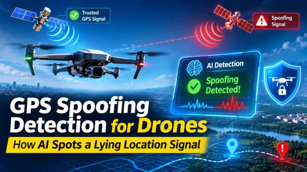
A drone that trusts a false position will fly confidently in the wrong direction. New research suggests that AI-based GPS spoofing detection can catch many of those lies by checking whether a drone’s reported location matches how the aircraft actually moves. In the East Texas A&M University study, a model called Chronos scored 97.5% when given just 10 consecutive readings, on a measure that balances how many abnormal sequences it catches against how often its alerts are correct. ntxe-news
This guide explains what spoofing is, how the ETAMU team ran its test, and why models with prior training came out ahead. It also compares the approach with older defenses and covers what drone operators can do right now. Each section stands on its own, so you can jump to the part you need.
Quick answer: ETAMU researchers fed drone flight records to eight AI models and asked them to sort short stretches of flight into normal or abnormal. The models used motion information rather than GPS signal properties. Models with prior training performed best. The test used recorded flights, so live, in-flight detection is still a next step. ntxe-news
What Is GPS Spoofing Detection?
GPS spoofing detection is the practice of recognizing when a receiver’s reported position, speed or time comes from counterfeit signals instead of genuine satellite signals.
Spoofing itself is the transmission of false signals that can trick a receiver into reporting the wrong location. The weakness is built into the system. Civilian GPS signals are not encrypted, which lets malicious users broadcast counterfeit signals. ntxe-newsnsf
Researchers have proposed several families of defenses. These include analysis of the navigation signals, authentication of navigation messages, inertial-sensor cross-checks, and mobile-network-based positioning that uses cellular networks to relocate the aircraft. Machine learning is now one of the techniques proposed for this job. It is attractive because it can learn what “normal” looks like directly from data. arxivnsf
GPS Spoofing vs. GPS Jamming: What Is the Difference?
What separates spoofing from jamming? Jamming interferes with reception and can leave a drone without usable location information, while spoofing feeds the receiver false signals that produce a wrong location. ntxe-news
That distinction shapes the whole defense problem. A jammed drone knows it is blind and can trigger a fallback such as holding position or returning home. A spoofed drone gets no such warning, because the data it receives looks valid. Effective GPS spoofing detection therefore has to work without an obvious error message, and it has to work fast enough to matter.
Why Drone GPS Spoofing Is a Safety Problem, Not Just a Security Problem
Drone GPS spoofing turns a data problem into a physical one. The ETAMU researchers describe a range of consequences: ntxe-news
- Search and rescue: A drone sweeping a ridge for a missing hiker believes it is somewhere else, adjusts course and flies into the next valley. Ground teams lose time searching the wrong place.
- Conflict zones: Someone steers an opposing drone away from the area it was sent to monitor.
- Restricted airspace: A civilian drone is pushed into airspace it should avoid.
- Unsafe landings: A spoofed drone lands somewhere hazardous.
- Collisions and crashes: A drone sent off course can miss a threat it was sent to spot, endanger other aircraft or crash near people.
Small drones face particular exposure. A 2025 Frontiers in Computer Science paper notes that earlier studies found small drones are more likely to be targeted, and that many spoofing-identification techniques need extra hardware that tiny, resource-constrained drones may not be able to carry. That makes lightweight GPS spoofing detection that reuses data a drone already collects especially valuable. frontiersin
How ETAMU Tested AI for Drone GPS Spoofing
Who Did the Work and Where It Appears
The study was accepted for presentation at WATCH 2026, a peer-reviewed workshop held alongside the Association for Computing Machinery’s Conference on Computer and Communications Security in The Hague, Netherlands. It was funded by National Science Foundation Award No. 2502117. The project is led by Dr. Jinoh Kim, a professor in ETAMU’s Department of Computer Science and Information Systems. ntxe-news
The Core Idea: Dead Reckoning for Machines
Dead reckoning is the practice of tracking movement from a known starting point using speed, direction and elapsed time. Kim likened the team’s approach to it, and noted that a drone’s onboard motion sensors provide the information researchers use to look for inconsistencies in how the aircraft appears to move. ntxe-news
The team deliberately set GPS-related attributes aside. Instead of reading GPS values, the models look at how fast the drone moves, in what direction and over how much time. In plain terms, the models stop asking “does this signal look fake?” and ask “does this motion story add up?” Because it avoids GPS-related attributes, this framing keeps GPS spoofing detection separate from the signal being attacked. It also gives AI drone security work a useful new angle. ntxe-news
The Dataset: 96 Real Flights
The researchers used a public dataset of 96 actual drone flights: ntxe-news
- 42 normal flights with no interference.
- 54 flights under controlled spoofing attacks.
- Two attack styles: some fed the drone a single false location, while others fed it false coordinates that changed over time.
- 22 entire flights held out for testing, so the models were scored on flights they had not seen during training.
Why hold out whole flights? Because it tests generalization instead of memorization. If neighboring slices of the same flight appeared in both training and testing, the scores could look better than the real-world performance deserves.
Eight Models, One Surprising Result
The team compared eight AI models, some trained from scratch on flight records and some that came with prior training. A separate part of the system was trained to sort short stretches of flight data into normal or abnormal. The best performers had already learned to recognize patterns in numerical data collected over time. ntxe-news
Kim summed up the finding: “But surprisingly, pretrained models are working better.” ntxe-news
Why Pretrained Time-Series Models Improve GPS Spoofing Detection
Why would a pretrained model beat one trained from scratch? The study reports that the best performers had already learned patterns in numerical data recorded over time, and that their advantage showed up even when they had only a brief stretch of flight data. ntxe-news
One plausible explanation is data scarcity, though the study summary does not state it as the cause. Ninety-six flights is a modest training set. A model that arrives with general knowledge of time-ordered numbers has less to learn from scratch. That is the logic behind pretrained time-series models, and it is why they are becoming a serious option for GPS spoofing detection.
Transfer learning is gaining ground elsewhere in drone security too. The Frontiers study applied transfer learning and deep learning to detect spoofing in small drones. frontiersin
What “10 Consecutive Readings” Means in Practice
Short windows matter because drones make decisions in real time. Given 10 consecutive readings, Chronos scored 97.5% on a measure that balances catches against the correctness of its alerts. A detector that needs only a short stretch of data could, in principle, raise an alarm quickly. The caveat is important: the study evaluated recorded flights, and running the checks during flight is a next step. ntxe-newsntxe-news
Can the Model Run on the Drone Itself?
That is an open question. Smaller models have run onboard before: a Purdue thesis implemented a three-class machine learning model on a UAV with a Raspberry Pi processor to classify two kinds of spoofing. Whether pretrained time-series models like those in the ETAMU study can match that footprint is something the in-flight work will have to show. purdue
How Does AI Compare With Other GPS Spoofing Detection Methods?
Different defenses check different things. The table below summarizes the approaches that appear in the research referenced in this article.
| Approach | What it checks | Example from the research | Trade-off to weigh |
|---|---|---|---|
| Signal analysis and message authentication | Properties of the GPS signals and the authenticity of navigation messages | Surveyed as established method families | Many techniques need extra hardware |
| Inertial cross-checks | Whether accelerometer readings agree with acceleration computed from GPS output | Lee et al. compared accelerometer output with GPS-derived acceleration | Depends on onboard sensor quality |
| Cellular-assisted positioning | Path-loss statistics from cellular networks, scored by deep learning | A cellular-network-assisted system that detects spoofed positions with an MLP model | Needs cellular coverage along the route |
| Deep learning on simulated flights | Temporal flight patterns using a BiLSTM-Attention-CNN model | Built on a modified JMAVSim simulation and reported to beat traditional machine learning and other deep learning approaches | Trained on simulated attacks, so real-world transfer must be proven |
| Pretrained models on motion data (ETAMU) | Speed, direction and elapsed time, with no GPS attributes | Chronos reached 97.5% on 10 consecutive readings, tested on 22 held-out flights | Evaluated on recorded flights; live detection is next Deep Learning for GPS Spoofing Detection in Cellular Enabled Unmanned Aerial Vehicle Systems +6 |
The trade-off column is my own summary, not a finding of any single study.
Which GPS Spoofing Detection Method Is Best?
No single GPS spoofing detection method wins in every situation. Signal-level checks guard the source of the problem. Motion-based checks like ETAMU’s guard the outcome. Cellular or sensor cross-checks add independent witnesses. Because each method watches a different thing, layering two or three makes it much harder for one false signal to fool everything at once.
Practical Takeaways for AI Drone Security
Whether you build drones, fly them commercially or manage a fleet, GPS spoofing detection starts with one mindset shift: treat the reported location as a claim to verify, not a fact.
- Cross-check position against motion. Compare where the drone says it is with what speed, direction and time say it should be.
- Think in short windows. The ETAMU results suggest useful signals can emerge from brief stretches of data.
- Keep flight records. Models learn from logged flights, so clean, labeled logs are the raw material for any GPS spoofing detection system you train.
- Test on unseen flights. Hold out entire flights, not slices of the same one.
- Separate spoofing from jamming in your playbooks. The two failures look different and need different responses.
- Plan a fallback. The broader ETAMU project also explores how a drone might estimate its location when reliable information is unavailable. Every fleet needs a plan for what happens after an alert. ntxe-news
- Layer your defenses. Pair motion-based checks with at least one independent method.
Frequently Asked Questions
Can AI really perform GPS spoofing detection on drones?
In research settings, yes. ETAMU’s models labeled short stretches of recorded flight data as normal or abnormal, with the strongest results from pretrained models. Live, in-flight performance has not yet been shown. ntxe-news
What is GPS spoofing detection in simple terms?
It is a way of noticing that the location a drone is being told does not fit reality. The check can use signal properties, onboard sensors, cellular data or, in the ETAMU study, patterns in how the drone moves.
Does the ETAMU method need GPS data?
Not GPS-related attributes. The researchers look at how fast the drone moves, in what direction and over how much time. ntxe-news
How is this different from GPS jamming defenses?
Jamming can leave a drone with no usable location, while spoofing supplies a false one. A spoofed drone gets no obvious warning, which is why detection matters. ntxe-news
Is the research peer reviewed and funded?
It was accepted for the peer-reviewed WATCH 2026 workshop and funded by National Science Foundation Award No. 2502117. ntxe-news
Is it ready to deploy?
Not yet. The study evaluated recorded flights, and running checks during flight is a next step. ntxe-news
The People Behind the Research
Iyanuoluwa Alegbeleye, an undergraduate computer science student and research assistant, is the paper’s first author. Co-authors include Shinhwan Kim of ETAMU, Sang-Yoon Chang of the University of Colorado Colorado Springs, and Jinoh Kim. Prajeena Maharjan, a 2026 ETAMU master’s graduate, built a process for preparing flight records for model training and ran, monitored and documented experiments. The current team includes two undergraduate and two graduate research assistants working toward drone location integrity and awareness. That student-led structure is a reminder that useful AI drone security work is accessible to small teams with real flight data. Researchers test AI to detect GPS spoofing in drones +2
Limitations and What to Watch Next
- Offline evaluation. Results come from recorded flights, not live ones. ntxe-news
- Modest dataset. Ninety-six flights, with spoofing that was controlled, may not represent every real-world attack.
- Unknown onboard cost. Whether the best pretrained models can run on small drones is untested in this study.
- Fallback navigation. Estimating location when reliable information is unavailable is part of the broader project. ntxe-news
The ETAMU work on GPS spoofing detection is best read as a strong early signal, not a finished product.
Conclusion: Trust, but Verify the Location
A drone can no longer assume its location is honest. The ETAMU study shows that GPS spoofing detection can lean on something the attacker cannot easily fake: the drone’s own motion. By looking at speed, direction and time, and by using pretrained time-series models, the researchers reached 97.5% on a short 10-reading window. The next test is whether that holds up in the air.
For operators and developers, the lesson is practical. Verify the position, keep flight logs, test on unseen flights and layer your defenses. Investing in GPS spoofing detection now is a direct investment in drone location integrity, and in the safety of everything the drone is flying over.
ଡ୍ରୋନ୍ ପାଇଁ GPS ସ୍ପୁଫିଂ (GPS Spoofing) ଚିହ୍ନଟ: AI କିପରି ଭୁଲ୍ ଅବସ୍ଥାନ ସଙ୍କେତକୁ ଧରିପାରେ
ଯଦି ଏକ ଡ୍ରୋନ୍ ଏକ ଭୁଲ୍ ଅବସ୍ଥାନକୁ ସତ ବୋଲି ବିଶ୍ୱାସ କରେ, ତେବେ ଏହା ଆତ୍ମବିଶ୍ୱାସର ସହ ଭୁଲ୍ ଦିଗରେ ଉଡ଼ିବା ଆରମ୍ଭ କରିବ। ନୂତନ ଗବେଷଣାରୁ ଜଣାପଡ଼ିଛି ଯେ, AI-ଆଧାରିତ GPS ସ୍ପୁଫିଂ ଚିହ୍ନଟ ପ୍ରଣାଳୀ ମାଧ୍ୟମରେ ଏଭଳି ଭୁଲ୍ ସୂଚନାକୁ ଧରାଯାଇପାରିବ। ଏଥିପାଇଁ ଡ୍ରୋନ୍ ଦ୍ୱାରା ଦର୍ଶାଯାଇଥିବା ଅବସ୍ଥାନ ଏବଂ ଏହାର ପ୍ରକୃତ ଗତିବିଧି ମଧ୍ୟରେ ସାମଞ୍ଜସ୍ୟ ଅଛି କି ନାହିଁ, ତାହା ଯାଞ୍ଚ କରାଯାଏ। ‘ଇଷ୍ଟ ଟେକ୍ସାସ୍ A&M ୟୁନିଭରସିଟି’ (East Texas A&M University) ର ଏକ ଅଧ୍ୟୟନ ଅନୁଯାୟୀ, ‘Chronos’ ନାମକ ଏକ ମଡେଲ୍କୁ କ୍ରମାଗତ ଭାବେ ମାତ୍ର ୧୦ଟି ରିଡିଂ (readings) ଦିଆଯିବା ପରେ, ଏହା ୯୭.୫% ସଫଳତା ହାସଲ କରିଥିଲା। ଏହି ମୂଲ୍ୟାଙ୍କନରେ ଦୁଇଟି ବିଷୟକୁ ଧ୍ୟାନରେ ରଖାଯାଇଥିଲା: କେତେଗୁଡ଼ିଏ ଅସ୍ୱାଭାବିକ ଘଟଣାକୁ ଏହା ସଠିକ୍ ଭାବେ ଚିହ୍ନଟ କଲା ଏବଂ ଏହାର ସତର୍କ ସୂଚନା (alerts) କେତେ ଥର ସଠିକ୍ ଥିଲା।
ଏହି ଗାଇଡ୍ରେ ବର୍ଣ୍ଣନା କରାଯାଇଛି ଯେ ‘ସ୍ପୁଫିଂ’ (spoofing) କ’ଣ, ETAMU ଦଳ କିପରି ପରୀକ୍ଷଣ କଲେ ଏବଂ କାହିଁକି ପୂର୍ବରୁ ପ୍ରଶିକ୍ଷିତ (trained) ମଡେଲଗୁଡ଼ିକ ଅଧିକ ଭଲ ପ୍ରଦର୍ଶନ କଲେ। ଏଥିରେ ପୁରୁଣା ସୁରକ୍ଷା ବ୍ୟବସ୍ଥା ସହିତ ଏହି ନୂତନ ପଦ୍ଧତିର ତୁଳନା କରାଯାଇଛି ଏବଂ ଡ୍ରୋନ୍ ଅପରେଟରମାନେ ବର୍ତ୍ତମାନ କ’ଣ ପଦକ୍ଷେପ ନେଇପାରିବେ, ସେ ବିଷୟରେ ମଧ୍ୟ ଆଲୋଚନା କରାଯାଇଛି। ପ୍ରତ୍ୟେକ ବିଭାଗ ସ୍ୱତନ୍ତ୍ର, ତେଣୁ ଆପଣ ନିଜ ଆବଶ୍ୟକତା ଅନୁଯାୟୀ ଯେକୌଣସି ଅଂଶକୁ ସିଧାସଳଖ ପଢ଼ିପାରିବେ।
ସଂକ୍ଷିପ୍ତ ଉତ୍ତର: ETAMU ଗବେଷକମାନେ ଆଠଟି AI ମଡେଲ୍କୁ ଡ୍ରୋନ୍ ଉଡ଼ାଣର ତଥ୍ୟ (flight records) ପ୍ରଦାନ କରିଥିଲେ ଏବଂ ସେଗୁଡ଼ିକୁ ଉଡ଼ାଣର ବିଭିନ୍ନ ଅଂଶ ‘ସ୍ୱାଭାବିକ’ କି ‘ଅସ୍ୱାଭାବିକ’ ତାହା ବର୍ଗୀକରଣ କରିବାକୁ କହିଥିଲେ। ଏହି ମଡେଲଗୁଡ଼ିକ GPS ସଙ୍କେତର ଗୁଣ ବଦଳରେ ଡ୍ରୋନ୍ର ‘ଗତିବିଧି ସମ୍ବନ୍ଧୀୟ ତଥ୍ୟ’ (motion information) ବ୍ୟବହାର କରିଥିଲେ। ଯେଉଁ ମଡେଲଗୁଡ଼ିକ ପୂର୍ବରୁ ପ୍ରଶିକ୍ଷିତ ଥିଲେ, ସେଗୁଡ଼ିକ ସର୍ବୋତ୍ GPS ସ୍ପୁଫିଂ (Spoofing) ଏବଂ GPS ଜାମିଂ (Jamming): ଏହା ମଧ୍ୟରେ ପାର୍ଥକ୍ୟ କ’ଣ?
ସ୍ପୁଫିଂ ଏବଂ ଜାମିଂ ମଧ୍ୟରେ ପାର୍ଥକ୍ୟ କ’ଣ? ଜାମିଂ ସିଗନାଲ୍ ଗ୍ରହଣ ପ୍ରକ୍ରିୟାରେ ବାଧା ସୃଷ୍ଟି କରେ, ଯାହା ଫଳରେ ଏକ ଡ୍ରୋନ୍ ନିଜର ସଠିକ୍ ଅବସ୍ଥିତି (location) ଜାଣିପାରେ ନାହିଁ। ଅନ୍ୟ ପକ୍ଷରେ, ସ୍ପୁଫିଂ ମାଧ୍ୟମରେ ଡ୍ରୋନ୍କୁ ଭୁଲ୍ ସିଗନାଲ୍ ପଠାଯାଏ, ଯାହା ଫଳରେ ଡ୍ରୋନ୍ଟି ନିଜକୁ ଭୁଲ୍ ସ୍ଥାନରେ ଥିବା ଭଳି ଭାବିଥାଏ।
ଏହି ପାର୍ଥକ୍ୟ ସୁରକ୍ଷା ବ୍ୟବସ୍ଥା (defense) ସମ୍ବନ୍ଧୀୟ ଆହ୍ୱାନକୁ ସମ୍ପୂର୍ଣ୍ଣ ଭାବେ ପ୍ରଭାବିତ କରେ। ଯେତେବେଳେ ଏକ ଡ୍ରୋନ୍ ଜାମିଂର ଶିକାର ହୁଏ, ସେତେବେଳେ ଏହା ଜାଣିପାରେ ଯେ ଏହା କିଛି ଦେଖିପାରୁନାହିଁ (ଅର୍ଥାତ୍ ଏହା ଅନ୍ଧ ହୋଇଯାଇଛି); ଏପରି ସ୍ଥିତିରେ ଡ୍ରୋନ୍ଟି ନିଜକୁ ସେହି ସ୍ଥାନରେ ସ୍ଥିର ରଖିବା କିମ୍ବା ନିଜର ମୂଳ ସ୍ଥାନକୁ ଫେରିଯିବା ଭଳି ସୁରକ୍ଷା ପଦକ୍ଷେପ ନେଇପାରେ। କିନ୍ତୁ ସ୍ପୁଫିଂର ଶିକାର ହୋଇଥିବା ଡ୍ରୋନ୍କୁ ଏଭଳି କୌଣସି ଚେତାବନୀ ମିଳେ ନାହିଁ, କାରଣ ଏହା ଗ୍ରହଣ କରୁଥିବା ତଥ୍ୟ (data) ସମ୍ପୂର୍ଣ୍ଣ ସଠିକ୍ ବୋଲି ମନେହୁଏ। ତେଣୁ, GPS ସ୍ପୁଫିଂକୁ ଚିହ୍ନଟ କରିବା ପାଇଁ ଏପରି ଏକ ବ୍ୟବସ୍ଥା ଆବଶ୍ୟକ ଯାହା କୌଣସି ସ୍ପଷ୍ଟ ତ୍ରୁଟି ସୂଚନା (error message) ବିନା କାମ କରିପାରିବ ଏବଂ ଯଥେଷ୍ଟ ଦ୍ରୁତ ଗତିରେ କାର୍ଯ୍ୟ କରିବ।
ଡ୍ରୋନ୍ GPS ସ୍ପୁଫିଂ କେବଳ ଏକ ସୁରକ୍ଷା (security) ସମସ୍ୟା ନୁହେଁ, ବରଂ ଏହା ନିରାପତ୍ତା (safety) ସମ୍ବନ୍ଧୀୟ ଏକ ଗମ୍ଭୀର ସମସ୍ୟା।
ଡ୍ରୋନ୍ GPS ସ୍ପୁଫିଂ ଏକ ତଥ୍ୟଗତ ସମସ୍ୟାକୁ ଏକ ବାସ୍ତବିକ (physical) ସମସ୍ୟାରେ ପରିଣତ କରିଦିଏ। ETAMU ଗବେଷକମାନେ ଏହାର ବିଭିନ୍ନ ପରିଣାମ ବିଷୟରେ ବର୍ଣ୍ଣନା କରିଛନ୍ତି:
ଖୋଜାଖୋଜି ଏବଂ ଉଦ୍ଧାର କାର୍ଯ୍ୟ: ଯଦି ଏକ ଡ୍ରୋନ୍ କୌଣସି ନିଖୋଜ ବ୍ୟକ୍ତିଙ୍କୁ ଖୋଜିବା ପାଇଁ ଏକ ପାହାଡ଼ିଆ ଅଞ୍ଚଳରେ ଉଡ଼ୁଥାଏ, ତେବେ ସ୍ପୁଫିଂ ଯୋଗୁଁ ଏହା ଭାବିପାରେ ଯେ ଏହା ଅନ୍ୟ କେଉଁ ସ୍ଥାନରେ ଅଛି। ଫଳସ୍ୱରୂପ, ଡ୍ରୋନ୍ଟି ନିଜର ଗତିପଥ ବଦଳାଇ ଅନ୍ୟ ଏକ ଉପତ୍ୟକା ଆଡ଼କୁ ଚାଲିଯାଏ। ଏହା ଫଳରେ ତଳେ ଥିବା ଉଦ୍ଧାରକାରୀ ଦଳ ଭୁଲ୍ ସ୍ଥାନରେ ଖୋଜ frontiersin
ETAMU କିପରି ଡ୍ରୋନ୍ର GPS ସ୍ପୁଫିଂ (GPS ଠକେଇ) ପାଇଁ AI ର ପରୀକ୍ଷା କଲା
ଏହି କାର୍ଯ୍ୟ କିଏ କଲେ ଏବଂ ଏହା କେଉଁଠାରେ ପ୍ରକାଶ ପାଇଲା
ଏହି ଅଧ୍ୟୟନଟି ‘WATCH 2026’ ରେ ଉପସ୍ଥାପନ ପାଇଁ ଗୃହୀତ ହୋଇଥିଲା। ଏହା ଏକ ‘ପିଅର୍-ରିଭ୍ୟୁଡ୍’ (ବିଶେଷଜ୍ଞଙ୍କ ଦ୍ୱାରା ସମୀକ୍ଷିତ) କର୍ମଶାଳା, ଯାହା ନେଦରଲ୍ୟାଣ୍ଡର ହେଗ୍ (The Hague) ସହରରେ ‘ଆସୋସିଏସନ୍ ଫର୍ କମ୍ପ୍ୟୁଟିଂ ମେସିନାରୀ’ (ACM) ର ‘କମ୍ପ୍ୟୁଟର ଏବଂ ଯୋଗାଯୋଗ ସୁରକ୍ଷା ସମ୍ମିଳନୀ’ ସହିତ ଆୟୋଜିତ ହୋଇଥିଲା। ଏଥିପାଇଁ ‘ନ୍ୟାସନାଲ୍ ସାଇନ୍ସ ଫାଉଣ୍ଡେସନ୍’ (National Science Foundation) ପକ୍ଷରୁ ‘ଆୱାର୍ଡ ନଂ ୨୫୦୨୧୧୭’ (Award No. 2502117) ମାଧ୍ୟମରେ ଆର୍ଥିକ ସହାୟତା ପ୍ରଦାନ କରାଯାଇଥିଲା। ଏହି ପ୍ରକଳ୍ପର ନେତୃତ୍ୱ ନେଉଛନ୍ତି ETAMU ର କମ୍ପ୍ୟୁଟର ବିଜ୍ଞାନ ଏବଂ ସୂଚନା ପ୍ରଣାଳୀ ବିଭାଗର ପ୍ରଫେସର ଡ. ଜିନୋ କିମ୍ (Dr. Jinoh Kim)।
ntxe-news
ମୂଳ ଧାରଣା: ମେସିନ୍ ପାଇଁ ‘ଡେଡ୍ ରେକନିଂ’ (Dead Reckoning)
‘ଡେଡ୍ ରେକନିଂ’ (Dead Reckoning) ହେଉଛି ଏକ ପଦ୍ଧତି, ଯେଉଁଥିରେ ଗତି, ଦିଶା ଏବଂ ବିତିଯାଇଥିବା ସମୟକୁ ବ୍ୟବହାର କରି ଏକ ଜଣାଶୁଣା ଆରମ୍ଭ ବିନ୍ଦୁରୁ ଗତିପଥକୁ ଅନୁସରଣ କରାଯାଏ। କିମ୍ ଏହି ଦଳର କାର୍ଯ୍ୟଶୈଳୀକୁ ଏହି ପଦ୍ଧତି ସହିତ ତୁଳନା କରିଛନ୍ତି। ସେ କହିଛନ୍ତି ଯେ, ଡ୍ରୋନ୍ରେ ଲାଗିଥିବା ‘ମୋଶନ୍ ସେନ୍ସର’ (ଗତି ସୂଚକ ଯନ୍ତ୍ର) ଗୁଡ଼ିକ ଏପରି ତଥ୍ୟ ପ୍ରଦାନ କରନ୍ତି, ଯାହା ସାହାଯ୍ୟରେ ଗବେଷକମାନେ ଡ୍ରୋନ୍ର ଗତିବିଧିରେ କୌଣସି ଅସ୍ୱାଭାବିକତା କିମ୍ବା ଅସଙ୍ଗତି ରହିଛି କି ନାହିଁ, ତାହା ଯାଞ୍ଚ କରିପାରନ୍ତି।
ntxe-news
ଏହି ଦଳ ଜାଣିଶୁଣି GPS ସମ୍ବନ୍ଧୀୟ ତଥ୍ୟଗୁଡ଼ିକୁ ବିଚାରକୁ ନେଇନଥିଲେ। GPS ମୂଲ୍ୟ (values) ଉପରେ ନିର୍ଭର କରିବା ପରିବର୍ତ୍ତେ, ସେମାନଙ୍କର ମଡେଲଗୁଡ଼ିକ ଡ୍ରୋନ୍ କେତେ ବେଗରେ ଗତି କରୁଛି, କେଉଁ ଦିଗରେ ଯାଉଛି ଏବଂ କେତେ ସମୟ ଧରି ଗତି କରୁଛି, ତାହା ଉପରେ ଧ୍ୟାନ ଦେଇଥାନ୍ତି। ସରଳ ଭାଷାରେ କହିଲେ, ଏହି ମଡେଲ୍ଗୁଡ଼ିକ…els “ଏହି ସିଗନାଲଟି କ’ଣ ନକଲି ଦେଖାଯାଉଛି?” ପଚାରିବା ବନ୍ଦ କରି “ଏହି ଗତି କାହାଣୀ ଯୋଡି ହେଉଛି କି?” ପଚାରନ୍ତି କାରଣ ଏହା GPS-ସମ୍ବନ୍ଧୀୟ ଗୁଣଗୁଡ଼ିକୁ ଏଡାଏ, ଏହି ଫ୍ରେମିଂ GPS ସ୍ପୁଫିଂ ଚିହ୍ନଟକୁ ଆକ୍ରମଣ ହେଉଥିବା ସିଗନାଲଠାରୁ ପୃଥକ ରଖିଥାଏ। ଏହା AI ଡ୍ରୋନ୍ ସୁରକ୍ଷା କାର୍ଯ୍ୟକୁ ଏକ ଉପଯୋଗୀ ନୂତନ ଦୃଷ୍ଟିକୋଣ ମଧ୍ୟ ଦେଇଥାଏ।
ntxe-news
ଡାଟାସେଟ୍: 96 ପ୍ରକୃତ ଉଡ଼ାଣ
ଗବେଷକମାନେ 96 ପ୍ରକୃତ ଡ୍ରୋନ୍ ଉଡ଼ାଣର ଏକ ସାର୍ବଜନୀନ ଡାଟାସେଟ୍ ବ୍ୟବହାର କରିଥିଲେ:
ntxe-news
କୌଣସି ହସ୍ତକ୍ଷେପ ବିନା 42 ସାଧାରଣ ଉଡ଼ାଣ।
ନିୟନ୍ତ୍ରିତ ସ୍ପୁଫିଂ ଆକ୍ରମଣ ଅଧୀନରେ 54 ଉଡ଼ାଣ।
ଦୁଇଟି ଆକ୍ରମଣ ଶୈଳୀ: କେତେକ ଡ୍ରୋନକୁ ଗୋଟିଏ ଭୁଲ ସ୍ଥାନ ଦେଇଥିଲେ, ଯେତେବେଳେ ଅନ୍ୟମାନେ ଏହାକୁ ଭୁଲ ସ୍ଥାନ ପ୍ରଦାନ କରିଥିଲେ ଯାହା ସମୟ ସହିତ ପରିବର୍ତ୍ତନ ହୋଇଥିଲା।
22 ସମ୍ପୂର୍ଣ୍ଣ ଉଡ଼ାଣ ପରୀକ୍ଷା ପାଇଁ ଅଟକି ରହିଥିଲା, ତେଣୁ ମଡେଲଗୁଡ଼ିକୁ ତାଲିମ ସମୟରେ ସେମାନେ ଦେଖି ନଥିବା ଉଡ଼ାଣରେ ସ୍କୋର କରାଯାଇଥିଲା।
କାହିଁକି ସମ୍ପୂର୍ଣ୍ଣ ଉଡ଼ାଣ ସ୍ଥଗିତ ରଖାଗଲା? କାରଣ ଏହା ମନେ ରଖିବା ପରିବର୍ତ୍ତେ ସାଧାରଣୀକରଣ ପରୀକ୍ଷା କରେ। ଯଦି ସମାନ ଉଡ଼ାଣର ପଡ଼ୋଶୀ ସ୍ଲାଇସ୍ ତାଲିମ ଏବଂ ପରୀକ୍ଷଣ ଉଭୟରେ ଦେଖାଯାଏ, ତେବେ ସ୍କୋରଗୁଡ଼ିକ ବାସ୍ତବ-ବିଶ୍ୱ କାର୍ଯ୍ୟଦକ୍ଷତା ଯୋଗ୍ୟ ଅପେକ୍ଷା ଭଲ ଦେଖାଯାଇପାରିବ।
ଆଠଟି ମଡେଲ, ଗୋଟିଏ ଆଶ୍ଚର୍ଯ୍ୟଜନକ ଫଳାଫଳ
ଦଳ ଆଠଟି AI ମଡେଲ ତୁଳନା କରିଥିଲେ, କିଛି ଉଡ଼ାଣ ରେକର୍ଡରେ ଆରମ୍ଭରୁ ତାଲିମପ୍ରାପ୍ତ ଏବଂ କିଛି ପୂର୍ବ ତାଲିମ ସହିତ ଆସିଥିଲା। ସିଷ୍ଟମର ଏକ ପୃଥକ ଅଂଶ ଉଡ଼ାଣ ତଥ୍ୟର ଛୋଟ ଅଂଶକୁ ସାଧାରଣ କିମ୍ବା ଅସ୍ୱାଭାବିକ ଭାବରେ ସଜାଡ଼ିବା ପାଇଁ ତାଲିମ ଦିଆଯାଇଥିଲା। ଶ୍ରେଷ୍ଠ ପ୍ରଦର୍ଶନକାରୀମାନେ ସମୟ ସହିତ ସଂଗୃହୀତ ସାଂଖ୍ୟିକ ତଥ୍ୟରେ ପ୍ୟାଟର୍ଣ୍ଣଗୁଡ଼ିକୁ ଚିହ୍ନଟ କରିବା ପୂର୍ବରୁ ଶିଖି ସାରିଥିଲେ।
ntxe-news
କିମ୍ ଏହି ନିଷ୍କର୍ଷକୁ ସଂକ୍ଷେପ କରି କହିଥିଲେ: “କିନ୍ତୁ ଆଶ୍ଚର୍ଯ୍ୟଜନକ ଭାବରେ, ପୂର୍ବ ପ୍ରଶିକ୍ଷିତ ମଡେଲଗୁଡ଼ିକ ଭଲ ଭାବରେ କାମ କରୁଛନ୍ତି।”
ntxe-news
କାହିଁକି ପୂର୍ବ ପ୍ରଶିକ୍ଷିତ ସମୟ-ସିରିଜ୍ ମଡେଲଗୁଡ଼ିକ GPS ସ୍ପୁଫିଂ ଚିହ୍ନଟକୁ ଉନ୍ନତ କରନ୍ତି
ଏକ ପୂର୍ବ ପ୍ରଶିକ୍ଷିତ ମଡେଲ ଆରମ୍ଭରୁ ତାଲିମପ୍ରାପ୍ତ ଜଣଙ୍କୁ କାହିଁକି ପରାସ୍ତ କରିବ? ଅଧ୍ୟୟନ ରିପୋର୍ଟ କରେ ଯେ ସର୍ବୋତ୍ତମ ପ୍ରଦର୍ଶନକାରୀମାନେ ସମୟ ସହିତ ରେକର୍ଡ ହୋଇଥିବା ସାଂଖ୍ୟିକ ତଥ୍ୟରେ ପ୍ୟାଟର୍ଣ୍ଣଗୁଡ଼ିକ ପୂର୍ବରୁ ଶିଖି ସାରିଥିଲେ, ଏବଂ ସେମାନଙ୍କର ସୁବିଧା କେବଳ ଏକ ସଂକ୍ଷିପ୍ତ ବିମାନ ତଥ୍ୟ ଥିଲେ ମଧ୍ୟ ଦେଖାଯାଇଥିଲା।
ntxe-news
ଏକ ଯୁକ୍ତିଯୁକ୍ତ ବ୍ୟାଖ୍ୟା ହେଉଛି ତଥ୍ୟ ଅଭାବ, ଯଦିଓ ଅଧ୍ୟୟନ ସାରାଂଶ ଏହାକୁ କାରଣ ଭାବରେ ଦର୍ଶାଏ ନାହିଁ। ଛୟାନବେ ଉଡ଼ାଣ ଏକ ସାଧାରଣ ତାଲିମ ସେଟ୍। ଏକ ମଡେଲ ଯାହା ସମୟ-କ୍ରମିତ ସଂଖ୍ୟାର ସାଧାରଣ ଜ୍ଞାନ ସହିତ ଆସେ, ସେଗୁଡ଼ିକୁ ଆରମ୍ଭରୁ ଶିଖିବାକୁ କମ୍ ଅଛି। ଏହା ହେଉଛି ପୂର୍ବ-ପ୍ରଶିକ୍ଷିତ ସମୟ-କ୍ରମ ମଡେଲଗୁଡ଼ିକ ପଛରେ ଯୁକ୍ତି, ଏବଂ ଏହି କାରଣରୁ ସେମାନେ GPS ସ୍ପୁଫିଂ ଚିହ୍ନଟ ପାଇଁ ଏକ ଗମ୍ଭୀର ବିକଳ୍ପ ହୋଇଯାଉଛନ୍ତି।
ଡ୍ରୋନ୍ ସୁରକ୍ଷାରେ ମଧ୍ୟ ସ୍ଥାନାନ୍ତର ଶିକ୍ଷା ଅନ୍ୟତ୍ର ସ୍ଥାନ ପାଇଛି। ଫ୍ରଣ୍ଟିୟର୍ସ ଛୋଟ ଡ୍ରୋନରେ ସ୍ପୁଫିଂ ଚିହ୍ନଟ କରିବା ପାଇଁ ପ୍ରୟୋଗିତ ସ୍ଥାନାନ୍ତର ଶିକ୍ଷା ଏବଂ ଗଭୀର ଶିକ୍ଷା ଅଧ୍ୟୟନ କରିଛନ୍ତି।
frontiers
ଅଭ୍ୟାସରେ “10 ଲଗାତାର ପାଠ” କ’ଣ ବୁଝାଏ
ସର୍ଟ ୱିଣ୍ଡୋଜ୍ ଗୁରୁତ୍ୱପୂର୍ଣ୍ଣ କାରଣ ଡ୍ରୋନ୍ ପ୍ରକୃତ ସମୟରେ ନିଷ୍ପତ୍ତି ନିଅନ୍ତି। 10 କ୍ରମାଗତ ପାଠ୍ୟକରଣ ଦିଆଯାଇଥିବାରୁ, କ୍ରୋନୋସ୍ ଏକ ମାପରେ 97.5% ସ୍କୋର କରିଛି ଯାହା ଏହାର ସତର୍କତାର ସଠିକତା ବିରୁଦ୍ଧରେ କ୍ୟାଚ୍ ସନ୍ତୁଳନ କରେ। ଏକ ଡିଟେକ୍ଟର ଯାହାକୁ କେବଳ ଏକ ଛୋଟ ଡାଟା ଆବଶ୍ୟକ, ନୀତିଗତ ଭାବରେ, ଶୀଘ୍ର ଏକ ଆଲାର୍ମ ବଜାୟ ରଖିପାରେ। ସତର୍କତା ଗୁରୁତ୍ୱପୂର୍ଣ୍ଣ: ଅଧ୍ୟୟନ ରେକର୍ଡ ହୋଇଥିବା ବିମାନଗୁଡ଼ିକର ମୂଲ୍ୟାଙ୍କନ କରିଥିଲା, ଏବଂ ଉଡ଼ାଣ ସମୟରେ ଯାଞ୍ଚ ଚଳାଇବା ଏକ ପରବର୍ତ୍ତୀ ପଦକ୍ଷେପ।
ntxe-news
ntxe-news
କ’ଣ ମଡେଲ୍ ଡ୍ରୋନ୍ ଉପରେ ନିଜେ ଚାଲିପାରିବ?
ଏହା ଏକ ଖୋଲା ପ୍ରଶ୍ନ। ଛୋଟ ମଡେଲଗୁଡ଼ିକ ପୂର୍ବରୁ ଅନବୋର୍ଡରେ ଚାଲିସାରିଛି: ଏକ ପର୍ଡୁ ଥିସିସ୍ ଦୁଇ ପ୍ରକାରର ସ୍ପୁଫିଂକୁ ବର୍ଗୀକୃତ କରିବା ପାଇଁ ଏକ ରାସ୍ପେରି ପାଇ ପ୍ରୋସେସର ସହିତ ଏକ UAV ଉପରେ ଏକ ତିନି-ଶ୍ରେଣୀ ମେସିନ୍ ଲର୍ଣ୍ଣିଂ ମଡେଲ୍ କାର୍ଯ୍ୟକାରୀ କରିଛି। ETAMU ଅଧ୍ୟୟନରେ ଥିବା ପରି ପୂର୍ବ-ପ୍ରଶିକ୍ଷିତ ସମୟ-କ୍ରମ ମଡେଲଗୁଡ଼ିକ ସେହି ପାଦଚିହ୍ନ ସହିତ ମେଳ ଖାଇପାରିବ କି ଯାହା ଫ୍ଲାଇଟ୍ କାର୍ଯ୍ୟ ଦେଖାଇବାକୁ ପଡ଼ିବ।
ପର୍ଡୁ
ଅନ୍ୟାନ୍ୟ GPS ସ୍ପୁଫିଂ ଚିହ୍ନଟ ପଦ୍ଧତି ସହିତ AI କିପରି ତୁଳନା କରେ?
ବିଭିନ୍ନ ପ୍ରତିରକ୍ଷା ବିଭିନ୍ନ ଜିନିଷଗୁଡ଼ିକୁ ଯାଞ୍ଚ କରେ। ନିମ୍ନରେ ଥିବା ସାରଣୀ ଏହି ପ୍ରବନ୍ଧରେ ଉଲ୍ଲେଖ କରାଯାଇଥିବା ଗବେଷଣାରେ ଦେଖାଯାଉଥିବା ପଦ୍ଧତିଗୁଡ଼ିକୁ ସାରାଂଶିତ କରେ।
ଏହା କ’ଣ ଯାଞ୍ଚ କରେ ଗବେଷଣାରୁ ଉଦାହରଣ ଓଜନ କରିବା ପାଇଁ ବାଣିଜ୍ୟ-ଅଫ୍
ସିଗନାଲ ବିଶ୍ଳେଷଣ ଏବଂ ବାର୍ତ୍ତା ପ୍ରମାଣୀକରଣ
GPS ସିଗନାଲଗୁଡ଼ିକର ଗୁଣଧର୍ମ ଏବଂ ନାଭିଗେସନ୍ ବାର୍ତ୍ତାଗୁଡ଼ିକର ପ୍ରାମାଣିକତା
ପ୍ରତିଷ୍ଠିତ ପଦ୍ଧତି ପରିବାର ଭାବରେ ସର୍ବେକ୍ଷଣ କରାଯାଇଥିବା
ଅନର୍ସିଆଲ୍ କ୍ରସ୍-ଚେକ୍
ଆକ୍ସିଲେରୋମିଟର ରିଡିଂଗୁଡ଼ିକ GPS ଆଉଟପୁଟ୍ ରୁ ଗଣନା କରାଯାଇଥିବା ତ୍ୱରଣ ସହିତ ସହମତ କି ନାହିଁ
ଲି ଏଟ୍ ଅଲ୍। GPS-ଉତ୍ପନ୍ନ ତ୍ୱରଣ ସହିତ ତୁଳନା କରାଯାଇଥିବା ତ୍ୱରାନ୍ୱିତ ତ୍ୱରାନ୍ୱିତ ଆଉଟପୁଟ୍ ଅନ୍ବୋର୍ଡ ସେନ୍ସର ଗୁଣବତ୍ତା ଉପରେ ନିର୍ଭର କରେ
ସେଲୁଲାର-ସହାୟିତ ସ୍ଥିତି ସେଲୁଲାର ନେଟୱାର୍କରୁ ପଥ-କ୍ଷୟ ପରିସଂଖ୍ୟାନ, ଗଭୀର ଶିକ୍ଷା ଦ୍ୱାରା ସ୍କୋର୍ କରାଯାଇଥିବା ଏକ ସେଲୁଲାର-ନେଟୱାର୍କ-ସହାୟିତ ସିଷ୍ଟମ୍ ଯାହା ଏକ MLP ମଡେଲ୍ ସହିତ ସ୍ପୁଫଡ୍ ସ୍ଥିତି ଚିହ୍ନଟ କରେ ମାର୍ଗରେ ସେଲୁଲାର କଭରେଜ୍ ଆବଶ୍ୟକ କରେ
ସିମୁଲେଟେଡ୍ ଫ୍ଲାଇଟ୍ଗୁଡ଼ିକରେ ଗଭୀର ଶିକ୍ଷା ଏକ BiLSTM-Attention-CNN ମଡେଲ୍ ବ୍ୟବହାର କରି ଟେମ୍ପୋରାଲ୍ ଫ୍ଲାଇଟ୍ ପ୍ୟାଟର୍ନ ଏକ ପରିବର୍ତ୍ତିତ JMAVSim ସିମୁଲେସନ୍ ଉପରେ ନିର୍ମିତ ଏବଂ ପାରମ୍ପରିକ ମେସିନ୍ ଲର୍ଣ୍ଣିଂ ଏବଂ ଅନ୍ୟାନ୍ୟ ଡିପ୍ ଲର୍ଣ୍ଣିଂ ପଦ୍ଧତିକୁ ପରାସ୍ତ କରିବାକୁ ରିପୋର୍ଟ କରାଯାଇଛି ସିମୁଲେଟେଡ୍ ଆକ୍ରମଣ ଉପରେ ତାଲିମପ୍ରାପ୍ତ, ତେଣୁ ବାସ୍ତବ-ବିଶ୍ୱ ସ୍ଥାନାନ୍ତର ପ୍ରମାଣିତ ହେବା ଆବଶ୍ୟକ
ମୋସନ୍ ଡାଟା (ETAMU) ଉପରେ ପୂର୍ବ ପ୍ରଶିକ୍ଷିତ ମଡେଲ୍ଗୁଡ଼ିକ ଗତି, ଦିଗ ଏବଂ ବିତିଯାଇଥିବା ସମୟ, କୌଣସି GPS ଗୁଣ ବିନା Chronos 10 କ୍ରମାଗତ ପାଠ୍ୟକ୍ରମରେ 97.5% ରେ ପହଞ୍ଚିଛି, 22 ଅଟକିଥିବା ଫ୍ଲାଇଟ୍ରେ ପରୀକ୍ଷିତ ହୋଇଛି ରେକର୍ଡ କରାଯାଇଥିବା ଫ୍ଲାଇଟ୍ରେ ମୂଲ୍ୟାଙ୍କିତ ହୋଇଛି; ଲାଇଭ୍ ଚିହ୍ନଟ ପରବର୍ତ୍ତୀ
ସେଲୁଲାର ସକ୍ଷମ ମାନବହୀନ ବାୟୁବାହୀ ଯାନ ସିଷ୍ଟମ୍ରେ GPS ସ୍ପୁଫିଂ ଚିହ୍ନଟ ପାଇଁ ଗଭୀର ଶିକ୍ଷା
+6
ଟ୍ରେଡ-ଅଫ୍ ସ୍ତମ୍ଭଟି ମୋର ନିଜସ୍ୱ ସାରାଂଶ, କୌଣସି ଏକ ଅଧ୍ୟୟନର ନିର୍ଣ୍ଣୟ ନୁହେଁ।
କେଉଁ GPS ସ୍ପୁଫିଂ ଚିହ୍ନଟ ପଦ୍ଧତି ସର୍ବୋତ୍ତମ?
ପ୍ରତ୍ୟେକ ପରିସ୍ଥିତିରେ କୌଣସି ଗୋଟିଏ GPS ସ୍ପୁଫିଂ ଚିହ୍ନଟ ପଦ୍ଧତି ଜିତିପାରେ ନାହିଁ। ସିଗନାଲ-ସ୍ତର ଯାଞ୍ଚ ସମସ୍ୟାର ଉତ୍ସକୁ ସୁରକ୍ଷା ଦିଏ। ETAMU ଭଳି ଗତି-ଆଧାରିତ ଯାଞ୍ଚ ବାହାରକୁ ସୁରକ୍ଷା ଦିଏ।ସେଲୁଲାର୍ (ମୋବାଇଲ୍ ନେଟୱାର୍କ) କିମ୍ବା ସେନ୍ସର ମାଧ୍ୟମରେ କରାଯାଉଥିବା ଯାଞ୍ଚ, ସ୍ୱାଧୀନ ପ୍ରମାଣ ଯୋଗାଇଥାଏ। ଯେହେତୁ ପ୍ରତ୍ୟେକ ପଦ୍ଧତି ଭିନ୍ନ ଭିନ୍ନ ବିଷୟ ଉପରେ ନଜର ରଖେ, ତେଣୁ ଦୁଇ କିମ୍ବା ତିନୋଟି ପଦ୍ଧତିକୁ ଏକାଠି ବ୍ୟବହାର କରିବା ଦ୍ୱାରା କୌଣସି ଏକ ଭୁଲ୍ ସଙ୍କେତ (false signal) ଦ୍ୱାରା ସମଗ୍ର ବ୍ୟବସ୍ଥାକୁ ପ୍ରତାରିତ କରିବା ଅତ୍ୟନ୍ତ କଷ୍ଟକର ହୋଇପଡ଼େ।
AI ଡ୍ରୋନ୍ ସୁରକ୍ଷା ପାଇଁ ବ୍ୟାବହାରିକ ପରାମର୍ଶ
ଆପଣ ଡ୍ରୋନ୍ ନିର୍ମାଣ କରନ୍ତୁ, ବ୍ୟବସାୟିକ ଉଦ୍ଦେଶ୍ୟରେ ଡ୍ରୋନ୍ ଚଳାନ୍ତୁ କିମ୍ବା ଡ୍ରୋନ୍ ଗୁଡ଼ିକର ପରିଚାଳନା କରନ୍ତୁ – GPS ସ୍ପୁଫିଂ (GPS spoofing – GPS ସଙ୍କେତରେ ଜାଲିଆତି) ଚିହ୍ନଟ କରିବା ପାଇଁ ପ୍ରଥମେ ନିଜର ଦୃଷ୍ଟିକୋଣ ବଦଳାଇବାକୁ ପଡ଼ିବ: ଡ୍ରୋନ୍ ଦ୍ୱାରା ଦର୍ଶାଯାଉଥିବା ସ୍ଥାନକୁ ଏକ ‘ତଥ୍ୟ’ ବୋଲି ନ ମାନି, ଏହାକୁ ଏକ ‘ଦାବି’ ବୋଲି ବିଚାର କରନ୍ତୁ ଯାହାକୁ ଯାଞ୍ଚ କରିବା ଆବଶ୍ୟକ।
ଡ୍ରୋନ୍ର ଅବସ୍ଥିତି (position) ଏବଂ ଏହାର ଗତିବିଧି (motion) ମଧ୍ୟରେ ତୁଳନାତ୍ମକ ଯାଞ୍ଚ କରନ୍ତୁ। ଡ୍ରୋନ୍ ନିଜକୁ ଯେଉଁ ସ୍ଥାନରେ ଥିବା ଦର୍ଶାଉଛି, ତାହା ସହିତ ଏହାର ଗତି, ଦିଗ ଏବଂ ସମୟର ତଥ୍ୟ ମେଳ ଖାଉଛି କି ନାହିଁ, ତାହା ଯାଞ୍ଚ କରନ୍ତୁ।
ଅଳ୍ପ ସମୟର ତଥ୍ୟ (short windows) ଉପରେ ଧ୍ୟାନ ଦିଅନ୍ତୁ। ETAMU ଗବେଷଣାର ଫଳାଫଳ ସୂଚିତ କରେ ଯେ, ତଥ୍ୟର ଛୋଟ ଛୋଟ ଅଂଶରୁ ମଧ୍ୟ ଉପଯୋଗୀ ସଙ୍କେତ ମିଳିପାରିବ।
ଉଡ଼ାଣର ରେକର୍ଡ (flight records) ସାଇତି ରଖନ୍ତୁ। AI ମଡେଲଗୁଡ଼ିକ ପୂର୍ବରୁ ରେକର୍ଡ କରାଯାଇଥିବା ଉଡ଼ାଣ ତଥ୍ୟରୁ ଶିଖିଥାନ୍ତି; ତେଣୁ GPS ସ୍ପୁଫିଂ ଚିହ୍ନଟ ପ୍ରଣାଳୀକୁ ପ୍ରଶିକ୍ଷିତ କରିବା ପାଇଁ ସ୍ପଷ୍ଟ ଏବଂ ସଠିକ୍ ଭାବେ ଚିହ୍ନିତ (labeled) ତଥ୍ୟ ଆବଶ୍ୟକ।
ପୂର୍ବରୁ ଦେଖାଯାଇନଥିବା ଉଡ଼ାଣ ତଥ୍ୟ (unseen flights) ଉପରେ ପରୀକ୍ଷା କରନ୍ତୁ। ଏଥିପାଇଁ ସମ୍ପୂର୍ଣ୍ଣ ଉଡ଼ାଣ ତଥ୍ୟକୁ ବ୍ୟବହାର କରନ୍ତୁ, କେବଳ କିଛି ଅଂଶକୁ ନୁହେଁ।
ଆପଣଙ୍କ କାର୍ଯ୍ୟ ଯୋଜନାରେ ‘ସ୍ପୁଫିଂ’ (spoofing) ଏବଂ ‘ଜାମିଂ’ (jamming) କୁ ପୃଥକ ଭାବେ ବିଚାର କରନ୍ତୁ। ଏହି ଦୁଇଟି ସମସ୍ୟା ଭିନ୍ନ ଭିନ୍ନ ଅଟେ ଏବଂ ଏଗୁଡ଼ିକର ମୁକାବିଲା ପାଇଁ ଭି ntxe-news
ଏହା GPS ‘ଜାମିଂ’ (jamming) ବିରୋଧୀ ସୁରକ୍ଷା ବ୍ୟବସ୍ଥାଠାରୁ କିପରି ଭିନ୍ନ?
‘ଜାମିଂ’ ଦ୍ୱାରା ଡ୍ରୋନ୍ଟି ନିଜର ସଠିକ୍ ଅବସ୍ଥିତି (location) ଜାଣିପାରେ ନାହିଁ, କିନ୍ତୁ ‘ସ୍ପୁଫିଂ’ (spoofing) ମାଧ୍ୟମରେ ଏହାକୁ ଏକ ଭୁଲ୍ ଅବସ୍ଥିତି ପ୍ରଦାନ କରାଯାଏ। ‘ସ୍ପୁଫିଂ’ର ଶିକାର ହୋଇଥିବା ଡ୍ରୋନ୍କୁ କୌଣସି ସ୍ପଷ୍ଟ ଚେତାବନୀ ମିଳେ ନାହିଁ, ତେଣୁ ଏହାକୁ ଚିହ୍ନଟ କରିବା ଅତ୍ୟନ୍ତ ଗୁରୁତ୍ୱପୂର୍ଣ୍ଣ।
ntxe-news
ଏହି ଗବେଷଣା କ’ଣ ସମୀକ୍ଷିତ (peer-reviewed) ଏବଂ ଆର୍ଥିକ ସହାୟତା ପ୍ରାପ୍ତ?
ଏହି ଗବେଷଣାପତ୍ରଟି ‘WATCH 2026’ କର୍ମଶାଳା (ଯେଉଁଠାରେ ବିଶେଷଜ୍ଞଙ୍କ ଦ୍ୱାରା ସମୀକ୍ଷା କରାଯାଏ) ପାଇଁ ଗୃହୀତ ହୋଇଛି ଏବଂ ଏହାକୁ ‘ନ୍ୟାସନାଲ୍ ସାଇନ୍ସ ଫାଉଣ୍ଡେସନ୍’ (National Science Foundation) ପକ୍ଷରୁ ଆର୍ଥିକ ସହାୟତା (Award No. 2502117) ପ୍ରଦାନ କରାଯାଇଛି।
ntxe-news
ଏହା କ’ଣ ବ୍ୟବହାର ପାଇଁ ପ୍ରସ୍ତୁତ?
ବର୍ତ୍ତମାନ ପାଇଁ ନୁହେଁ। ଏହି ଅଧ୍ୟୟନରେ ପୂର୍ବରୁ ରେକର୍ଡ କରାଯାଇଥିବା ଉଡ଼ାଣ (flights) ଉପରେ ବିଶ୍ଳେଷଣ କରାଯାଇଛି; ଉଡ଼ାଣ ସମୟରେ ଯାଞ୍ଚ କରିବା ହେଉଛି ପରବର୍ତ୍ତୀ ପଦକ୍ଷେପ।
ntxe-news
ଏହି ଗବେଷଣା ପଛରେ ଥିବା ବ୍ୟକ୍ତିବିଶେଷ
କମ୍ପ୍ୟୁଟର ସାଇନ୍ସର ସ୍ନାତକ ଛାତ୍ର ତଥା ଗବେଷଣା ସହଯୋଗୀ ଇୟାନୁଓଲୁୱା ଆଲେଗବେଲେୟେ (Iyanuoluwa Alegbeleye) ହେଉଛନ୍ତି ଏହି ଗବେଷଣାପତ୍ରର ମୁଖ୍ୟ ଲେଖକ। ଅନ୍ୟ ସହ-ଲେଖକମାନଙ୍କ ମଧ୍ୟରେ ଅଛନ୍ତି ETAMU ର ଶିନ୍ହୱାନ୍ କିମ୍ (Shinhwan Kim), ୟୁନିଭରସିଟି ଅଫ୍ କଲୋରାଡୋ କଲୋରାଡୋ ସ୍ପ୍ରିଙ୍ଗ୍ସର ସାଙ୍ଗ-ୟୁନ୍ ଚାଙ୍ଗ୍ (Sang-Yoon Chang) ଏବଂ ଜିନୋହ କିମ୍ (Jinoh Kim)। ETAMU ରୁ ୨୦୨୬ ମସିହାରେ ସ୍ନାତକୋତ୍ତର ଡିଗ୍ରୀ ହାସଲ କରିଥିବା ପ୍ରଜିନା ମହାରଜନ (Prajeena Maharjan) ମଡେଲ୍ ପ୍ରଶିକ୍ଷଣ ପାଇଁ ଉଡ଼ାଣ ତଥ୍ୟ (flight records) ପ୍ରସ୍ତୁତ କରିବାର ଏକ ପ୍ରକ୍ରିୟା ବିକଶିତ କରିଥିଲେ ଏବଂ ପରୀକ୍ଷଣଗୁଡ଼ିକୁ ପରିଚାଳନା, ନିରୀକ୍ଷଣ ଓ ଲିପିବଦ୍ଧ କରିଥିଲେ।
ବର୍ତ୍ତମାନର ଦଳରେ ଦୁଇଜଣ ସ୍ନାତକ ଏବଂ ଦୁଇଜଣ ସ୍ନାତକୋତ୍ତର ଗବେଷଣା ସହଯୋଗୀ ଅଛନ୍ତି, ଯେଉଁମାନେ ଡ୍ରୋନ୍ର ଅବସ୍ଥିତି ସମ୍ବନ୍ଧୀୟ ସଠିକତା ଓ ସଚେତନତା ଉପରେ କାର୍ଯ୍ୟ କରୁ ETAMU ଅଧ୍ୟୟନ ଦର୍ଶାଉଛି ଯେ GPS ସ୍ପୁଫିଂ ଚିହ୍ନଟକରଣ ଏପରି କିଛି ଉପରେ ନିର୍ଭର କରିପାରେ ଯାହା ଆକ୍ରମଣକାରୀ ସହଜରେ ନକଲି କରିପାରିବ ନାହିଁ: ଡ୍ରୋନର ନିଜସ୍ୱ ଗତି। ଗତି, ଦିଗ ଏବଂ ସମୟକୁ ଦେଖି ଏବଂ ପୂର୍ବ ପ୍ରଶିକ୍ଷିତ ସମୟ-କ୍ରମ ମଡେଲଗୁଡ଼ିକୁ ବ୍ୟବହାର କରି, ଗବେଷକମାନେ ଏକ ଛୋଟ 10-ପଠନ ୱିଣ୍ଡୋରେ 97.5% ରେ ପହଞ୍ଚିଛନ୍ତି। ପରବର୍ତ୍ତୀ ପରୀକ୍ଷା ହେଉଛି ଏହା ବାୟୁରେ ସ୍ଥିର ଅଛି କି ନାହିଁ।
ଅପରେଟର ଏବଂ ଡେଭଲପରମାନଙ୍କ ପାଇଁ, ପାଠ ବ୍ୟବହାରିକ। ସ୍ଥିତି ଯାଞ୍ଚ କରନ୍ତୁ, ଫ୍ଲାଇଟ୍ ଲଗ୍ ରଖନ୍ତୁ, ଅଦୃଶ୍ୟ ଫ୍ଲାଇଟ୍ ଉପରେ ପରୀକ୍ଷା କରନ୍ତୁ ଏବଂ ଆପଣଙ୍କର ପ୍ରତିରକ୍ଷା ସ୍ତର କରନ୍ତୁ। GPS ସ୍ପୁଫିଂ ଚିହ୍ନଟକରଣରେ ବର୍ତ୍ତମାନ ବିନିଯୋଗ କରିବା ହେଉଛି ଡ୍ରୋନ୍ ସ୍ଥାନ ଅଖଣ୍ଡତାରେ ଏବଂ ଡ୍ରୋନ୍ ଉଡ଼ୁଥିବା ପ୍ରତ୍ୟେକ ଜିନିଷର ସୁରକ୍ଷାରେ ଏକ ସିଧାସଳଖ ନିବେଶ।