ଡ୍ରୋନ୍ ପାଇଁ ସାଟେଲାଇଟ୍ (ଉପଗ୍ରହ) ସଂଯୋଗ: ବ୍ୟବସାୟିକ ଅପରେଟରମାନେ କିପରି ଦୃଶ୍ୟମାନ ସୀମା ବାହାରେ (BVLOS) କାର୍ଯ୍ୟ ପରିସର ବୃଦ୍ଧି କରନ୍ତି
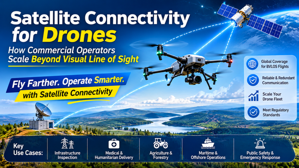
Satellite connectivity for drones gives an uncrewed aircraft a command-and-control link that works anywhere with a view of the sky. Operators can fly beyond visual line of sight (BVLOS) without relying on cell towers or a pilot’s eyeline. For commercial teams, that is the difference between a handful of supervised flights and a real, repeatable fleet operation.
For most of the short history of commercial drones, the limiting factor was never the battery or the camera. It was the radio link. A drone that cannot be reliably reached cannot be trusted with a long pipeline survey, a medical delivery, or a flight through shared airspace. In 2026, that constraint is loosening fast, and this guide explains how, where it pays off, what it costs, and how to build a setup that regulators and finance teams will both accept.
Key Takeaways
- Satellite connectivity for drones removes the coverage gaps of cellular and the range limits of direct radio, making BVLOS drone operations practical in remote and mixed-use airspace.
- The best architectures are multi-link: satellite, cellular, and radio working together with automatic failover.
- Small, low-power drone satcom terminals have made satellite links viable for aircraft that once could not carry them.
- Regulators care about link reliability and redundancy, so link design is a compliance decision, not just a technical one.
- Commercial drone fleet scaling depends on managed services, such as support, integration, and monitoring, as much as on hardware.
What Is Satellite Connectivity for Drones?
Definition
Satellite connectivity for drones is the use of satellite communications (satcom) networks to carry command and control (C2) traffic, telemetry, and sometimes video or payload data between a drone and its operators. The satellite acts as a relay in the sky. Instead of a signal travelling directly from a handheld controller to the aircraft, it travels from a ground station up to a satellite and back down to a small terminal on the drone.
This matters because the old model has hard physical limits. Direct radio links need an unbroken line of sight and lose range with terrain, buildings, and distance. Cellular links depend on tower coverage, which thins out quickly over farmland, forests, mountains, and open water. A satellite link is tied to the sky rather than the ground, so its coverage follows the aircraft.
How the Link Works
A typical satellite C2 chain has four parts:
- An onboard terminal. A compact antenna and modem integrated with the drone’s autopilot. Modern drone satcom terminals are designed to be small and power-efficient.
- A satellite network. Geostationary, medium, or low Earth orbit constellations relay the signal.
- A ground gateway. The network hands the data to a ground station and then to the internet or a private network.
- An operations platform. Flight-control and fleet-management software where pilots monitor and command the aircraft.
Because the data path is managed end to end, operators can add monitoring, cybersecurity, and compliance reporting on top of the link, which is increasingly what commercial customers buy.
Why Not Just Use Cellular?
Cellular is excellent where it exists, and it remains the cheapest link for urban and suburban flights. The problem is that “where it exists” is not where many high-value drone missions happen. Power-line corridors, pipelines, offshore assets, wildfire zones, and disaster areas often have weak or no coverage at flight altitude. Cellular networks were also designed for phones on the ground, not aircraft moving through the air, so handoffs and signal quality at altitude can be unpredictable. Satellite fills those gaps rather than replacing cellular.
Why Does Commercial Scale Change the Equation?
Why does satellite connectivity for drones matter for commercial scale? Because scale means flying where the work is, not where the network happens to be, and doing it with fewer pilots per aircraft. A single remote pilot supervising several drones needs a link that stays up across long distances and varied terrain. Satellite links provide that consistency, and consistency is what lets a company move from pilot projects to repeatable operations.
Three pressures drive this shift:
- Economics. A fleet that needs a visual observer at every launch site does not scale. BVLOS drone operations reduce labor per flight hour.
- Safety cases. Regulators approving BVLOS flights look for proof that the control link will not silently fail. A link with built-in redundancy supports that proof.
- Airspace integration. As drones share low-altitude airspace with other traffic, they need to stay reachable and visible. Persistent connectivity underpins that.
Satellite connectivity for drones is therefore not a niche add-on. It is increasingly part of the baseline for any operator that wants to run beyond line of sight at volume.
How Do the Main Drone Links Compare?
No single link wins on every dimension. The table below summarizes the practical trade-offs for command and control.
| Factor | Direct Radio (RF) | Cellular (4G/5G) | Satellite (Satcom) |
|---|---|---|---|
| Typical range | Line of sight only | Wherever towers reach | Wide-area, tied to satellite coverage |
| Coverage in remote areas | Limited by terrain | Often poor or absent | Strong, follows the aircraft |
| Latency | Very low | Low to moderate | Moderate, depends on orbit and network |
| Bandwidth | Moderate | High | Often lower, optimized for C2 and telemetry |
| Hardware weight and power | Low | Low | Historically heavy, now shrinking |
| Ongoing cost | Low | Low to moderate | Moderate to higher |
| Best for | Short-range, visual flights | Urban and suburban BVLOS | Remote, long-range, safety-critical BVLOS |
| Failure mode | Terrain and distance dropouts | Coverage gaps and handoffs | Antenna orientation, sky visibility |
The lesson is not that satellite beats everything. It is that each link fails in a different way, which is exactly why combining them works.
What Does the 2026 Market Tell Us?
Three developments this year show satellite connectivity for drones moving from pilot projects to purchasable products.
Managed distribution is arriving. In March 2026, DRONELIFE reported that Galaxy 1 Communications and Viasat partnered around a Distribution Partner-as-a-Service (DPaaS) model, which adds a managed operational layer to Viasat’s existing UAV satellite connectivity. The signal here is that buyers increasingly want service, support, and reporting wrapped around the link, not just a terminal in a box. dronelife
Multi-link demos are proving the safety case. An April 2026 demonstration involving Thales, Viasat, and partners was summarized by industry coverage as evidence that resilient, multi-link connectivity can meet the safety standards required for large-scale BVLOS operations. Analysts framed the broader trend as hybrid architectures that dynamically switch between satellite, cellular, and dedicated radio links. pulse
Terminals are getting small enough for small aircraft. Gotonomi, a developer of miniaturized satcom and cellular solutions, announced integrations through early 2026 with autopilot ecosystems such as Embention’s Veronte and with multicopter makers such as Xer Technologies, to enable reliable command and control for long-distance and remote operations. Earlier guidance from Elsight in 2021 noted that existing satellite solutions were heavy and power-hungry, making them unviable for most commercial UAVs. That barrier is exactly what newer terminals are attacking. unmannedsystemstechnologyelsight
Behind these headlines sits the Velaris service, which began at Inmarsat and now sits under Viasat following its May 2023 acquisition of Inmarsat. Velaris was positioned from launch as a way for a single pilot to remotely operate multiple UAVs at scale. aviationweek
Where Does Satellite Connectivity for Drones Deliver the Most Value?
Satellite links pay off most where terrestrial coverage is weak and the cost of a lost link is high. The strongest use cases include:
- Linear infrastructure inspection. Power lines, pipelines, and railways stretch across areas with patchy coverage. Trials using satellite terminals have reported reliable C2 with LTE-to-satellite failover and workable low-bandwidth video during BVLOS power-line inspections.
- Medical and humanitarian delivery. Remote communities and disaster zones often lack networks. A satellite-linked aircraft can keep reporting in when the ground infrastructure is down.
- Maritime and offshore operations. Over open water there are no towers at all.
- Agriculture and forestry. Large rural holdings and wildfire monitoring benefit from continuous contact far from any road.
- Advanced Air Mobility (AAM). Larger uncrewed and optionally piloted aircraft need certified, avionics-grade links to operate in controlled airspace.
- Public safety and emergency response. Response teams need dependable links in exactly the places where networks fail.
What Does a Multi-Link Architecture Look Like?
The strongest designs treat satellite connectivity for drones as one layer in a stack rather than the whole stack. A practical multi-link architecture usually includes:
- A primary link chosen for the environment. Cellular in covered areas, direct radio near the operator.
- A satellite link as the safety net. It activates when the primary degrades, keeping C2 alive.
- Automatic failover logic. Software that monitors signal quality and switches links without pilot intervention.
- Bandwidth prioritization. C2 and telemetry always take precedence over video. Satellite bandwidth is limited, so non-essential data waits or is compressed.
- Security and monitoring. Encrypted links, cybersecurity controls, and audit-ready logs.
What is link failover? Link failover is the automatic switch from a degraded communication path to a backup path. In a drone context, it means the aircraft stays under control even when cellular coverage disappears mid-flight.
This pattern also explains why low-bandwidth satcom can still be enough. C2 messages are small. A link that cannot stream high-definition video can still carry the commands and telemetry that keep an aircraft safe, with imagery downloaded after landing or sent in compressed form.
How Does Satellite Connectivity Support BVLOS Regulation?
Regulators approve BVLOS drone operations on the strength of a safety case. A central question in that case is simple: what happens when the control link fails? Operators who can show redundant links, defined lost-link behavior, and continuous monitoring have a stronger argument than those relying on a single path.
This is where satellite connectivity for drones becomes a compliance asset. A satellite link provides:
- Independent redundancy. It does not share the same failure modes as cellular or line-of-sight radio.
- Predictable coverage. Operators can model where the link will and will not work.
- Auditability. Managed networks can produce the reporting that authorities expect.
Rules differ by country, and they are changing, so operators should confirm requirements with their aviation authority before designing around any single assumption. The direction of travel, however, favors operators who can document reliable, redundant links.
Related work on electronic conspicuity, meaning the ability of aircraft to be seen and identified electronically, points the same way. A 2026 industry statement on the topic argues that integrating millions of low-altitude aircraft will require persistent connectivity and hybrid designs that combine terrestrial networks with satellite resilience.
What Are the Trade-Offs of Satellite Connectivity for Drones?
Satellite links solve real problems, and they bring real costs. Being honest about both helps teams decide well.
Is Satellite Connectivity for Drones Expensive?
Is satellite connectivity for drones expensive? Usually it costs more than cellular, both for hardware and for airtime, so most operators use satellite selectively rather than on every flight. The right question is cost per mission. If a lost aircraft, an aborted long-range flight, or a denied BVLOS approval costs more than the link, satellite pays for itself. For short flights in well-covered areas, it often does not.
Other Limitations to Plan For
- Latency. Satellite links add delay compared with direct radio. Pilots and autopilots must be configured for it.
- Bandwidth. Expect limited throughput, so design around C2 first and payload data second.
- Antenna and sky view. Terminal placement and aircraft attitude affect signal quality.
- Size, weight, and power (SWaP). Terminals have shrunk, but every gram still affects endurance on small aircraft.
- Integration effort. The terminal must work with your autopilot and ground software. Verified integrations save months.
How Do You Choose a Satellite Provider for Drones?
Choosing a provider for satellite connectivity for drones is less about brand and more about fit. Use this checklist:
- Coverage. Does the network cover your operating regions, including altitude and latitude?
- Terminal SWaP. Can your airframe carry it without crippling endurance?
- Autopilot and software compatibility. Look for documented integrations with your flight stack.
- Latency and bandwidth. Match published performance to your C2 and payload needs.
- Certification path. If you fly in controlled airspace or AAM, ask about avionics-grade certification.
- Managed services. Evaluate support, cybersecurity, monitoring, and compliance reporting.
- Pricing model. Compare airtime plans, such as per-megabyte, per-flight-hour, or subscription, against your actual usage.
- Roadmap and partners. A healthy ecosystem of integrators and resellers reduces risk.
What Is a Practical Rollout Roadmap?
Teams that succeed usually move in stages rather than retrofitting an entire fleet at once.
- Define the mission. Identify the routes and regions where link reliability is the limiting factor.
- Model the link. Map coverage and expected latency for those routes.
- Pilot on a small fleet. Start with one or two aircraft and a defined set of missions.
- Test failover deliberately. Simulate cellular loss and confirm lost-link behavior.
- Document the safety case. Capture test results for your regulator.
- Scale with managed support. Add monitoring, reporting, and more aircraft once the process is repeatable.
Start your rollout of satellite connectivity for drones with the missions where the value is clearest, then expand. That sequence builds evidence for regulators and for your own finance team at the same time.
Frequently Asked Questions
Can small drones use satellite connectivity?
Yes. Compact, low-power terminals now exist for small multicopters and fixed-wing aircraft, including integrations with popular open-source and commercial autopilots. Payload and endurance trade-offs still apply, so check terminal weight and power draw against your airframe.
Does satellite replace cellular for drone control?
No. Satellite complements cellular. Cellular is cheaper and faster where it works, while satellite covers the gaps and provides redundancy. Hybrid designs that switch between them are the emerging standard for large-scale BVLOS.
Can satellite links carry video?
Sometimes. Many satellite links are tuned for C2 and telemetry, with limited video capability. Operators often compress video, send low-bitrate streams, or retrieve full-quality footage after landing.
What is the biggest mistake teams make with satellite connectivity for drones?
Treating it as a hardware purchase instead of a system. A terminal alone does not create a safe operation. You also need integration with the autopilot, failover logic, monitoring, and a documented safety case.
How does satellite connectivity relate to Advanced Air Mobility?
Larger uncrewed and emerging aircraft need certified, avionics-grade links to operate in managed airspace. Industry announcements in 2026 describe satellite connectivity being integrated into certified avionics architectures for this reason.
Is satellite connectivity for drones only for defense?
No. Defense users were early adopters, but commercial inspection, delivery, agriculture, and public safety are now driving demand, and civil regulators are shaping requirements around reliable links.
The Future of Satellite Connectivity for Drones
The direction is clear even if the details are still moving. Terminals will keep shrinking. Direct-to-device satellite services and 5G non-terrestrial networks will blur the line between cellular and satellite. Managed service layers will make connectivity something operators subscribe to rather than assemble. And regulators will keep asking the same question: how do you know the link will hold?
Operators who answer that with layered links, tested failover, and documented results will move faster than those who do not. Satellite connectivity for drones is no longer a curiosity reserved for specialized aircraft. It is becoming core infrastructure for anyone serious about commercial drone fleet scaling, and the time to plan for it is before your first BVLOS application, not after.
ଡ୍ରୋନ୍ ପାଇଁ ସାଟେଲାଇଟ୍ (ଉପଗ୍ରହ) ସଂଯୋଗ: ବ୍ୟବସାୟିକ ଅପରେଟରମାନେ କିପରି ଦୃଶ୍ୟମାନ ସୀମା ବାହାରେ (BVLOS) କାର୍ଯ୍ୟ ପରିସର ବୃଦ୍ଧି କରନ୍ତି
ଡ୍ରୋନ୍ ପାଇଁ ସାଟେଲାଇଟ୍ ସଂଯୋଗ, ଏକ ଚାଳକବିହୀନ ବିମାନକୁ ଏପରି ଏକ ‘ନିର୍ଦ୍ଦେଶ ଓ ନିୟନ୍ତ୍ରଣ’ (command-and-control) ଲିଙ୍କ୍ ପ୍ରଦାନ କରେ, ଯାହା ଆକାଶ ଦେଖାଯାଉଥିବା ଯେକୌଣସି ସ୍ଥାନରେ କାମ କରିଥାଏ। ଅପରେଟରମାନେ ସେଲ୍ୟୁଲାର୍ ଟାୱାର୍ କିମ୍ବା ପାଇଲଟଙ୍କ ଦୃଷ୍ଟିସୀମା ଉପରେ ନିର୍ଭର ନକରି, ଦୃଶ୍ୟମାନ ସୀମା ବାହାରେ (Beyond Visual Line of Sight – BVLOS) ଡ୍ରୋନ୍ ଉଡ଼ାଇ ପାରିବେ। ବ୍ୟବସାୟିକ ଦଳଗୁଡ଼ିକ ପାଇଁ, ଏହା କେବଳ କିଛି ସୀମିତ ତଦାରଖଯୁକ୍ତ ଉଡ଼ାଣ ଏବଂ ଏକ ପ୍ରକୃତ, ବାରମ୍ବାର କରାଯାଇପାରୁଥିବା ବ୍ୟାପକ ପରିଚାଳନା ମଧ୍ୟରେ ଥିବା ପାର୍ଥକ୍ୟକୁ ବୁଝାଏ।
ବ୍ୟବସାୟିକ ଡ୍ରୋନ୍ର ସଂକ୍ଷିପ୍ତ ଇତିହାସରେ, ଅଧିକାଂଶ ସମୟରେ ବ୍ୟାଟେରୀ କିମ୍ବା କ୍ୟାମେରା କେବେବି ମୁଖ୍ୟ ବାଧା ସୃଷ୍ଟି କରିନଥିଲା; ବରଂ ‘ରେଡିଓ ଲିଙ୍କ୍’ ହିଁ ମୁଖ୍ୟ ସମସ୍ୟା ଥିଲା। ଯେଉଁ ଡ୍ରୋନ୍ ସହିତ ନିର୍ଭରଯୋଗ୍ୟ ଭାବରେ ଯୋଗାଯୋଗ କରାଯାଇପାରିବ ନାହିଁ, ତାହା ଉପରେ ଦୀର୍ଘ ପାଇପଲାଇନ ସର୍ଭେ, ଔଷଧ ପରିବହନ କିମ୍ବା ଅନ୍ୟ ବିମାନ ଚଳାଚଳ କରୁଥିବା ଆକାଶମାର୍ଗରେ ଉଡ଼ାଣ ଭରିବା ପାଇଁ ଭରସା କରାଯାଇପାରିବ ନାହିଁ। ୨୦୨୬ ମସିହା ବେଳକୁ, ଏହି ବାଧା ଦ୍ରୁତ ଗତିରେ ଦୂର ହେଉଛି। ଏହି ଗାଇଡ୍ ବ୍ୟାଖ୍ୟା କରେ ଯେ ଏହା କିପରି କାମ କରେ, କେଉଁଠାରେ ଏହା ଲାଭଦାୟକ ହୁଏ, ଏଥିପାଇଁ କେତେ ଖର୍ଚ୍ଚ ହୁଏ ଏବଂ କିପରି ଏପରି ଏକ ବ୍ୟବସ୍ଥା (setup) ପ୍ରସ୍ତୁତ କରାଯାଇପାରିବ ଯାହାକୁ ନିୟାମକ ସଂସ୍ଥା (regulators) ଏବଂ ଆର୍ଥିକ ଦଳ ଉଭୟେ ଗ୍ରହଣ କରିବେ।
ମୁଖ୍ୟ ବିଷୟଗୁଡ଼ିକ
ଡ୍ରୋନ୍ ପାଇଁ ସାଟେଲାଇଟ୍ ସଂଯୋଗ, ସେଲ୍ୟୁଲାର୍ ନେଟୱାର୍କର କଭରେଜ୍ ଅଭାବ ଏବଂ ପ୍ରତ୍ୟକ୍ଷ ରେଡିଓ ଯୋଗାଯୋଗର ସୀମିତ ପରିସରକୁ ଦୂର କରିଥାଏ। ଏହା ଦୁର୍ଗମ ଅଞ୍ଚଳ ଏବଂ ମିଶ୍ରିତ ବ୍ୟବହାର ଥିବା ଆକାଶମାର୍ଗରେ BVLOS ଡ୍ରୋନ୍ ପରିଚାଳନାକୁ ବ୍ୟାବହାରିକ କରିଥାଏ।
ସର୍ବୋତ୍ତମ ବ୍ୟବସ୍ଥାଗୁଡ଼ିକ ହେଉଛି ‘ମଲ୍ଟି-ଲିଙ୍କ୍’ (multi-link) ବା ଏକାଧିକ ସ ସିଧାସଳଖ ରେଡିଓ ସଂଯୋଗ (Direct radio links) ପାଇଁ ମଝିରେ କୌଣସି ବାଧା ନଥାଇ ସିଧା ଦୃଷ୍ଟିପଥ (line of sight) ରହିବା ଆବଶ୍ୟକ; ଭୂ-ପ୍ରକୃତି, କୋଠାବାଡ଼ି ଏବଂ ଦୂରତା କାରଣରୁ ଏହାର କାର୍ଯ୍ୟକ୍ଷମ ପରିସର କମିଯାଏ। ସେଲ୍ୟୁଲାର୍ (ମୋବାଇଲ୍ ନେଟୱାର୍କ) ସଂଯୋଗଗୁଡ଼ିକ ଟାୱାର କଭରେଜ୍ ଉପରେ ନିର୍ଭର କରନ୍ତି, କିନ୍ତୁ କୃଷିକ୍ଷେତ୍ର, ଜଙ୍ଗଲ, ପର୍ବତ ଏବଂ ଜଳରାଶି ଉପରେ ଏହି କଭରେଜ୍ ବହୁତ ଦୁର୍ବଳ ହୋଇଯାଏ। ଅନ୍ୟ ପକ୍ଷରେ, ସାଟେଲାଇଟ୍ (ଉପଗ୍ରହ) ସଂଯୋଗ ଭୂମି ବଦଳରେ ଆକାଶ ସହ ଜଡ଼ିତ ଥାଏ, ତେଣୁ ଏହାର କଭରେଜ୍ ବିମାନ (ଡ୍ରୋନ୍) ସହିତ ଗତି କରେ।
ସଂଯୋଗ କିପରି କାମ କରେ
ଏକ ସାଧାରଣ ସାଟେଲାଇଟ୍ C2 (କମାଣ୍ଡ ଏବଂ କଣ୍ଟ୍ରୋଲ୍) ବ୍ୟବସ୍ଥାରେ ଚାରୋଟି ମୁଖ୍ୟ ଅଂଶ ଥାଏ:
ଡ୍ରୋନ୍ରେ ଲାଗିଥିବା ଟର୍ମିନାଲ୍ (Onboard terminal): ଏଥିରେ ଏକ ଛୋଟ ଆଣ୍ଟେନା ଏବଂ ମଡେମ୍ ଥାଏ, ଯାହା ଡ୍ରୋନ୍ର ଅଟୋ-ପାଇଲଟ୍ ସିଷ୍ଟମ୍ ସହିତ ସଂଯୁକ୍ତ ଥାଏ। ଆଧୁନିକ ଡ୍ରୋନ୍ ସାଟେଲାଇଟ୍ କମ୍ୟୁନିକେଶନ୍ ଟର୍ମିନାଲଗୁଡ଼ିକ ଆକାରରେ ଛୋଟ ଏବଂ କମ୍ ବିଦ୍ୟୁତ୍ ଶକ୍ତି ବ୍ୟବହାର କରୁଥିବା ଭଳି ଡିଜାଇନ୍ କରାଯାଇଥାଏ।
ସାଟେଲାଇଟ୍ ନେଟୱାର୍କ: ଭୂ-ସ୍ଥିର (Geostationary), ମଧ୍ୟମ କିମ୍ବା ନିମ୍ନ ଭୂ-କକ୍ଷପଥରେ (Low Earth Orbit) ଥିବା ଉପଗ୍ରହଗୁଡ଼ିକ ସିଗନାଲ୍କୁ ପରିବହନ (relay) କରିଥାନ୍ତି।
ଗ୍ରାଉଣ୍ଡ ଗେଟୱେ (Ground gateway): ନେଟୱାର୍କ ତଥ୍ୟ (data) କୁ ଏକ ଭୂ-ସ୍ଥିତ ଷ୍ଟେସନ୍କୁ ପଠାଏ, ଯେଉଁଠାରୁ ଏହା ଇଣ୍ଟରନେଟ୍ କିମ୍ବା କୌଣସି ଘରୋଇ ନେଟୱାର୍କକୁ ଯାଇଥାଏ।
ଅପରେସନ୍ସ ପ୍ଲାଟଫର୍ମ (Operations platform): ଏହା ଏକ ସଫ୍ଟୱେର୍ ଯାହା ମାଧ୍ୟମରେ ପାଇଲଟମାନେ ବିମାନକୁ ନିୟନ୍ତ୍ରଣ କରନ୍ତି ଏବଂ ପରିଚାଳନା କରନ୍ତି।
ଯେହେତୁ ତଥ୍ୟ ପ୍ରବାହର ସମ୍ପୂର୍ଣ୍ଣ ପଥ (end-to-end) ପରିଚାଳିତ ହୁଏ, ତେଣୁ ଅପରେଟରମାନେ ଏହି ସଂଯୋଗ ସହିତ ମନିଟରିଂ (ନିରୀକ୍ଷଣ), ସାଇବର ସୁରକ୍ଷା ଏବଂ ନିୟମ ପାଳନ ସମ୍ବନ୍ଧୀୟ ରିପୋର୍ଟିଂ ଭଳି ସୁବିଧା ଯୋଡ଼ିପାରନ୍ତି। ବର୍ତ୍ତମାନ ବ୍ୟବସାୟିକ ଗ୍ରାହକମାନେ ମୁଖ୍ୟତଃ ଏହି ସୁବିଧାଗୁଡ଼ିକ ପାଇଁ ହିଁ ଅଧିକ ଆଗ୍ରହ ଦେଖାଉଛନ୍ତି।
କେବଳ ସେଲ୍ୟୁଲ ପ୍ରତ୍ୟେକ ଲଞ୍ଚ ସ୍ଥାନରେ ଏକ ଦୃଶ୍ୟ ପର୍ଯ୍ୟବେକ୍ଷକ ଆବଶ୍ୟକ କରୁଥିବା ଏକ ନୌବାହିନୀ ସ୍କେଲ୍ କରେ ନାହିଁ। BVLOS ଡ୍ରୋନ୍ କାର୍ଯ୍ୟ ପ୍ରତି ଉଡ଼ାଣ ଘଣ୍ଟାରେ ଶ୍ରମ ହ୍ରାସ କରେ।
ସୁରକ୍ଷା ମାମଲା। BVLOS ବିମାନଗୁଡ଼ିକୁ ଅନୁମୋଦନ କରୁଥିବା ନିୟାମକମାନେ ପ୍ରମାଣ ଖୋଜନ୍ତି ଯେ ନିୟନ୍ତ୍ରଣ ଲିଙ୍କ୍ ନୀରବରେ ବିଫଳ ହେବ ନାହିଁ। ବିଲ୍ଟ-ଇନ୍ ରିଡାଣ୍ଡାନ୍ସି ସହିତ ଏକ ଲିଙ୍କ୍ ସେହି ପ୍ରମାଣକୁ ସମର୍ଥନ କରେ।
ବାୟୁମଣ୍ଡଳ ସମନ୍ୱୟ। ଡ୍ରୋନ୍ ଅନ୍ୟ ଟ୍ରାଫିକ୍ ସହିତ କମ୍-ଉଚ୍ଚତା ଏୟାରସ୍ପେସ୍ ସେୟାର କରୁଥିବାରୁ, ସେମାନଙ୍କୁ ପହଞ୍ଚିବା ଏବଂ ଦୃଶ୍ୟମାନ ରହିବା ଆବଶ୍ୟକ। ସ୍ଥାୟୀ ସଂଯୋଗୀକରଣ ଏହାକୁ ଆଧାର କରେ।
ଡ୍ରୋନ୍ ପାଇଁ ସାଟେଲାଇଟ୍ ସଂଯୋଗୀକରଣ ତେଣୁ ଏକ ସ୍ୱତନ୍ତ୍ର ଆଡ-ଅନ୍ ନୁହେଁ। ଏହା ଯେକୌଣସି ଅପରେଟର ପାଇଁ ବେସଲାଇନ୍ର କ୍ରମଶଃ ଅଂଶ ହେଉଛି ଯିଏ ଆୟତନରେ ଦୃଷ୍ଟି ରେଖା ବାହାରେ ଦୌଡ଼ିବାକୁ ଚାହେଁ।
ମୁଖ୍ୟ ଡ୍ରୋନ୍ L କିପରି କରିବେ ଲିଙ୍କ୍ଗୁଡ଼ିକର ତୁଳନା
କୌଣସି ଗୋଟିଏ ଲିଙ୍କ୍ ସମସ୍ତ ଦିଗରେ ଶ୍ରେଷ୍ଠ ନୁହେଁ। ନିମ୍ନ ସାରଣୀରେ ‘କମାଣ୍ଡ ଆଣ୍ଡ କଣ୍ଟ୍ରୋଲ୍’ (ନିୟନ୍ତ୍ରଣ ଓ ପରିଚାଳନା) ପାଇଁ ବିଭିନ୍ନ ବିକଳ୍ପ ମଧ୍ୟରେ ଥିବା ବ୍ୟାବହାରିକ ସନ୍ତୁଳନ (trade-offs) ସମ୍ପର୍କରେ ସୂଚନା ଦିଆଯାଇଛି।
ଉପାଦାନ | ପ୍ରତ୍ୟକ୍ଷ ରେଡିଓ (RF) | ସେଲୁଲାର୍ (4G/5G) | ସାଟେଲାଇଟ୍ (Satcom)
ସାଧାରଣ ପରିସର | କେବଳ ଦୃଷ୍ଟିସୀମା ମଧ୍ୟରେ (Line of sight) | ଟାୱାର୍ ସଂଯୋଗ ଥିବା ସ୍ଥାନ ପର୍ଯ୍ୟନ୍ତ | ବ୍ୟାପକ ଅଞ୍ଚଳ, ସାଟେଲାଇଟ୍ କଭରେଜ୍ ଉପରେ ନିର୍ଭରଶୀଳ
ଦୁର୍ଗମ ଅଞ୍ଚଳରେ ଉପଲବ୍ଧତା | ଭୂ-ପ୍ରକୃତି ଦ୍ୱାରା ସୀମିତ | ପ୍ରାୟତଃ ଖରାପ କିମ୍ବା ଅନୁପସ୍ଥିତ | ଉତ୍ତମ, ବିମାନ ସହିତ ଗତି କରେ
ଲାଟେନ୍ସି (ବିଳମ୍ବ) | ଅତ୍ୟନ୍ତ କମ୍ | କମ୍ ରୁ ମଧ୍ୟମ | ମଧ୍ୟମ, କକ୍ଷପଥ ଓ ନେଟୱାର୍କ ଉପରେ ନିର୍ଭର କରେ
ବ୍ୟାଣ୍ଡୱିଡଥ୍ | ମଧ୍ୟମ | ଅଧିକ | ପ୍ରାୟତଃ କମ୍, C2 (ନିୟନ୍ତ୍ରଣ) ଓ ଟେଲିମେଟ୍ରି ପାଇଁ ଉପଯୁକ୍ତ
ହାର୍ଡୱେର୍ ଓଜନ ଓ ଶକ୍ତି | କମ୍ | କମ୍ | ପୂର୍ବରୁ ଅଧିକ ଓଜନିଆ ଥିଲା, ବର୍ତ୍ତମାନ ହ୍ରାସ ପାଉଛି
ନିରନ୍ତର ଖର୍ଚ୍ଚ | କମ୍ | କମ୍ ରୁ ମଧ୍ୟମ | ମଧ୍ୟମ ରୁ ଅଧିକ
କେଉଁଥିପାଇଁ ଉପଯୁକ୍ତ | ସ୍ୱଳ୍ପ ଦୂରତା, ଦୃଶ୍ୟମାନ ଉଡ଼ାଣ | ସହରାଞ୍ଚଳ ଓ ଉପକଣ୍ଠରେ BVLOS (ଦୃଷ୍ଟିସୀମା ବାହାରେ ଉଡ଼ାଣ) | ଦୁର୍ଗମ ଅଞ୍ଚଳ, ଦୀର୍ଘ ଦୂରତା, ସୁରକ୍ଷା-ଗୁରୁତ୍ୱପୂର୍ଣ୍ଣ BVLOS
ବିଫଳତାର କାରଣ | ଭୂ-ପ୍ରକୃତି ଓ ଦୂରତା ଯୋଗୁଁ ସଂଯୋଗ ବିଚ୍ଛିନ୍ନ | କଭରେଜ୍ ଅଭାବ ଓ ହ୍ୟାଣ୍ଡ-ଅଫ୍ (ନେଟୱାର୍କ ପରିବର୍ତ୍ତନ) ସମସ୍ୟା | ଆଣ୍ଟେନା ଦିଗ, ଆକାଶ ଦୃଶ୍ୟମାନ ହେବା
ଏହାର ଅର୍ଥ ଏହା ନୁହେଁ ଯେ ସାଟେଲାଇଟ୍ ସବୁଠାରୁ ଉତ୍ତମ। ବରଂ, ପ୍ରତ୍ୟେକ ଲିଙ୍କ୍ ଭିନ୍ନ ଭିନ୍ନ ଉପାୟରେ ବିଫଳ ହୋଇପାରେ; ସେଥିପାଇଁ ଏଗୁଡ଼ିକୁ ମିଶାଇ ବ୍ୟବହାର କରିବା ଲାଭଦାୟକ ହୋଇଥାଏ।
୨୦୨୬ ବଜାର ଆମକୁ କ’ଣ ସୂଚିତ କରେ?
ଚଳିତ ବର୍ଷର ତିନୋଟି ବିକାଶ ଦର୍ଶାଉଛି ଯେ ଡ୍ରୋନ୍ ପାଇଁ ସାଟେଲାଇଟ୍ ସଂଯୋଗ ବ୍ୟବସ୍ଥା କେବଳ ପରୀକ୍ଷାମୂଳକ ପ୍ରକଳ୍ପରୁ ବାହାରି ବର୍ତ୍ତମାନ ବଜାରରେ କିଣାଯାଇପାର କ୍ଷୁଦ୍ରକାୟ ସାଟେଲାଇଟ୍ ଯୋଗାଯୋଗ (satcom) ଏବଂ ସେଲୁଲାର୍ ସମାଧାନ ପ୍ରସ୍ତୁତକାରୀ ସଂସ୍ଥା ‘ଗୋଟୋନୋମି’ (Gotonomi), ୨୦୨୬ ମସିହା ଆରମ୍ଭ ସୁଦ୍ଧା ବିଭିନ୍ନ ବ୍ୟବସ୍ଥା ସହ ନିଜର ସମାଧାନକୁ ଯୋଡ଼ିବା (integration) ପାଇଁ ଘୋଷଣା କରିଛି।
ଏଥିମଧ୍ୟରେ ‘ଏମ୍ବେନସନ୍’ (Embention) ର ‘ଭେରୋଣ୍ଟେ’ (Veronte) ଭଳି ଅଟୋପାଇଲଟ୍ ଇକୋସିଷ୍ଟମ୍ ଏବଂ ‘ଜେର୍ ଟେକ୍ନୋଲୋଜିଜ୍’ (Xer Technologies) ଭଳି ମଲ୍ଟି-କପ୍ଟର (multicopter) ନିର୍ମାତା ସାମିଲ ଅଛନ୍ତି। ଏହାର ଲକ୍ଷ୍ୟ ହେଉଛି ଦୂରବର୍ତ୍ତୀ ସ୍ଥାନରେ ପରିଚାଳିତ ହେଉଥିବା ଡ୍ରୋନ୍ଗୁଡ଼ିକ ପାଇଁ ଏକ ନିର୍ଭରଯୋଗ୍ୟ ‘କମାଣ୍ଡ ଆଣ୍ଡ କଣ୍ଟ୍ରୋଲ୍’ (ନିୟନ୍ତ୍ରଣ ବ୍ୟବସ୍ଥା) ପ୍ରଦାନ କରିବା। ୨୦୨୧ ମସିହାରେ ‘ଏଲସାଇଟ୍’ (Elsight) ପକ୍ଷରୁ ଦିଆଯାଇଥିବା ସୂଚନା ଅନୁଯାୟୀ, ସେତେବେଳେ ଉପଲବ୍ଧ ସାଟେଲାଇଟ୍ ସମାଧାନଗୁଡ଼ିକ ଅତ୍ୟଧିକ ଓଜନିଆ ଥିଲା ଏବଂ ଅଧିକ ବିଦ୍ୟୁତ୍ ଶକ୍ତି ଖର୍ଚ୍ଚ କରୁଥିଲା, ଯାହା ଫଳରେ ଅଧିକାଂଶ ବ୍ୟବସାୟିକ UAV (ମାନବବିହୀନ ବିମାନ) ପାଇଁ ଏଗୁଡ଼ିକ ଉପଯୁକ୍ତ ନଥିଲା। ବର୍ତ୍ତମାନର ନୂତନ ଟର୍ମିନାଲ୍ଗୁଡ଼ିକ ଠିକ୍ ଏହି ସମସ୍ୟାକୁ ଦୂର କରିବା ପାଇଁ କାର୍ଯ୍ୟ କରୁଛନ୍ତି।
ଏହି ଖବରଗୁଡ଼ିକ ପଛରେ ‘ଭେଲାରିସ୍’ (Velaris) ସେବା ରହିଛି। ଏହି ସେବା ପ୍ରଥମେ ‘ଇନମାରସାଟ୍’ (Inmarsat) ରେ ଆରମ୍ଭ ହୋଇଥିଲା ଏବଂ ୨୦୨୩ ମସିହା ମେ ମାସରେ ‘ଭାୟାସାଟ୍’ (Viasat) ଦ୍ୱାରା ‘ଇନମାରସାଟ୍’ ଅଧିଗ୍ରହଣ କରାଯିବା ପରେ, ବର୍ତ୍ତମାନ ଏହା ‘ଭାୟାସାଟ୍’ ଅଧୀନରେ ରହିଛି। ଆରମ୍ଭରୁ ହିଁ ‘ଭେଲାରିସ୍’କୁ ଏପରି ଭାବରେ ପ୍ରସ୍ତୁତ କରାଯାଇଥିଲା ଯେପରି ଜଣେ ପାଇଲଟ୍ ଦୂରରେ ରହି ଏକାସାଙ୍ଗରେ ଅନେକ UAV କୁ ନିୟନ୍ତ୍ରଣ କରିପାରିବେ।
ଡ୍ରୋନ୍ ପାଇଁ ସାଟେଲାଇଟ୍ ସଂଯୋଗ କେଉଁ କ୍ଷେତ୍ରରେ ସବୁଠାରୁ ଅଧିକ ଉପଯୋଗୀ ହୋଇଥାଏ?
ଯେଉଁଠାରେ ସ୍ଥଳଭାଗର ନେଟୱାର୍କ (terrestrial coverage) ଦୁର୍ବଳ ଥାଏ ଏବଂ ଯୋଗାଯୋଗ ବିଚ୍ଛିନ୍ନ ହେଲେ ବଡ଼ ଧରଣର କ୍ଷତି ହେବାର ଆଶଙ୍କା ଥାଏ, ସେଠାରେ ସାଟେଲାଇଟ୍ ସଂଯୋଗ ସବୁଠାରୁ ଅଧିକ ଲାଭଦାୟକ ହୋଇଥାଏ। ଏହାର କିଛି ପ୍ରମୁଖ ଉପଯୋଗିତା ନିମ୍ନରେ ଦିଆଗଲା:
- **ଲି ଆଚ୍ଛାଦିତ ଅଞ୍ଚଳରେ ସେଲୁଲାର, ଅପରେଟର ନିକଟରେ ସିଧାସଳଖ ରେଡିଓ।
ସୁରକ୍ଷା ଜାଲ ଭାବରେ ଏକ ସାଟେଲାଇଟ୍ ଲିଙ୍କ୍। ଯେତେବେଳେ ପ୍ରାଥମିକ ହ୍ରାସ ପାଏ, C2କୁ ଜୀବନ୍ତ ରଖେ ସେତେବେଳେ ଏହା ସକ୍ରିୟ ହୁଏ।
ସ୍ୱୟଂଚାଳିତ ବିଫଳତା ଲଜିକ୍। ସଫ୍ଟୱେର୍ ଯାହା ସିଗନାଲ ଗୁଣବତ୍ତା ନିରୀକ୍ଷଣ କରେ ଏବଂ ପାଇଲଟ୍ ହସ୍ତକ୍ଷେପ ବିନା ଲିଙ୍କଗୁଡ଼ିକୁ ସ୍ୱିଚ୍ କରେ।
ବ୍ୟାଣ୍ଡୱିଡ୍ଥ ପ୍ରାଥମିକତା। C2 ଏବଂ ଟେଲିମେଟ୍ରି ସର୍ବଦା ଭିଡିଓ ଅପେକ୍ଷା ପ୍ରାଧାନ୍ୟ ନେଇଥାଏ। ସାଟେଲାଇଟ୍ ବ୍ୟାଣ୍ଡୱିଡ୍ଥ ସୀମିତ, ତେଣୁ ଅଣ-ଅତ୍ୟାବଶ୍ୟକୀୟ ଡାଟା ଅପେକ୍ଷା କରେ କିମ୍ବା ସଙ୍କୁଚିତ ହୁଏ।
ସୁରକ୍ଷା ଏବଂ ନିରୀକ୍ଷଣ। ଏନକ୍ରିପ୍ଟେଡ୍ ଲିଙ୍କ୍, ସାଇବର ସୁରକ୍ଷା ନିୟନ୍ତ୍ରଣ, ଏବଂ ଅଡିଟ୍-ପ୍ରସ୍ତୁତ ଲଗ୍।
ଲିଙ୍କ୍ ବିଫଳତା କ’ଣ? ଲିଙ୍କ୍ ବିଫଳତା ହେଉଛି ଏକ ହ୍ରାସିତ ଯୋଗାଯୋଗ ପଥରୁ ଏକ ବ୍ୟାକଅପ୍ ପଥକୁ ସ୍ୱୟଂଚାଳିତ ସ୍ୱିଚ୍। ଏକ ଡ୍ରୋନ୍ ପ୍ରସଙ୍ଗରେ, ଏହାର ଅର୍ଥ ହେଉଛି ବିମାନ ନିୟନ୍ତ୍ରଣରେ ରହିଥାଏ ଯେତେବେଳେ ସେଲୁଲାର କଭରେଜ୍ ଉଡ଼ାଣ ମଝିରେ ଅଦୃଶ୍ୟ ହୋଇଯାଏ।
ଏହି ପ୍ୟାଟର୍ନ o ବ୍ୟାଖ୍ୟା କରେ ଯେ କାହିଁକି କମ୍ ବ୍ୟାଣ୍ଡୱିଡଥ୍ ସାଟକମ୍ ଏପର୍ଯ୍ୟନ୍ତ ଯଥେଷ୍ଟ ହୋଇପାରେ। C2 ମେସେଜଗୁଡ଼ିକ ଛୋଟ। ଏକ ଲିଙ୍କ ଯାହା ହାଇ-ଡେଫିନେସନ୍ ଭିଡିଓ ଷ୍ଟ୍ରିମ୍ କରିପାରିବ ନାହିଁ ତାହା ଏବେ ବି ନିର୍ଦ୍ଦେଶ ଏବଂ ଟେଲିମେଟ୍ରି ବହନ କରିପାରିବ ଯାହା ଏକ ବିମାନକୁ ସୁରକ୍ଷିତ ରଖିଥାଏ, ଅବତରଣ ପରେ ଚିତ୍ର ଡାଉନଲୋଡ୍ କରାଯାଇପାରେ କିମ୍ବା ସଙ୍କୁଚିତ ରୂପରେ ପଠାଯାଇପାରେ।
ସାଟେଲାଇଟ୍ ସଂଯୋଗ କିପରି BVLOS ନିୟନ୍ତ୍ରଣକୁ ସମର୍ଥନ କରେ?
ନିୟାମକମାନେ ଏକ ସୁରକ୍ଷା ମାମଲା ବଳରେ BVLOS ଡ୍ରୋନ୍ କାର୍ଯ୍ୟକୁ ଅନୁମୋଦନ କରନ୍ତି। ସେହି କ୍ଷେତ୍ରରେ ଏକ କେନ୍ଦ୍ରୀୟ ପ୍ରଶ୍ନ ସରଳ: ନିୟନ୍ତ୍ରଣ ଲିଙ୍କ୍ ବିଫଳ ହେଲେ କ’ଣ ହୁଏ? ଯେଉଁ ଅପରେଟରମାନେ ଅନାବଶ୍ୟକ ଲିଙ୍କ୍, ପରିଭାଷିତ ହଜିଯାଇଥିବା ଆଚରଣ ଏବଂ ନିରନ୍ତର ନିରୀକ୍ଷଣ ଦେଖାଇପାରିବେ ସେମାନଙ୍କର ଏକକ ପଥ ଉପରେ ନିର୍ଭର କରୁଥିବା ଲୋକଙ୍କ ଅପେକ୍ଷା ଏକ ଦୃଢ଼ ଯୁକ୍ତି ଥାଏ।
ଏହିଠାରେ ଡ୍ରୋନ୍ ପାଇଁ ସାଟେଲାଇଟ୍ ସଂଯୋଗ ଏକ ଅନୁପାଳନ ସମ୍ପତ୍ତି ହୋଇଯାଏ। ଏକ ସାଟେଲାଇଟ୍ ଲିଙ୍କ୍ ପ୍ରଦାନ କରେ:
ସ୍ୱାଧୀନ ଅନାବଶ୍ୟକତା। ଏହା ସେଲୁଲାର୍ କିମ୍ବା ଲାଇନ୍-ଅଫ୍-ସାଇଟ୍ ରେଡିଓ ପରି ସମାନ ବିଫଳତା ମୋଡ୍ ସେୟାର କରେ ନାହିଁ।
ପୂର୍ବାନୁମାନଯୋଗ୍ୟ କଭରେଜ୍। ଅପରେଟରମାନେ ଲିଙ୍କ୍ କେଉଁଠାରେ କାମ କରିବ ଏବଂ କେଉଁଠାରେ କାମ କରିବ ନାହିଁ ତାହା ମଡେଲ୍ କରିପାରିବେ।
ଅଡିଟେବିଲିଟି। ପରିଚାଳିତ ନେଟୱାର୍କଗୁଡ଼ିକ କର୍ତ୍ତୃପକ୍ଷ ଆଶା କରୁଥିବା ରିପୋର୍ଟିଂ ଉତ୍ପାଦନ କରିପାରିବେ।
ଦେଶ ଅନୁସାରେ ନିୟମ ଭିନ୍ନ ହୋଇଥାଏ, ଏବଂ ସେଗୁଡ଼ିକ ପରିବର୍ତ୍ତନ ହେଉଛି, ତେଣୁ ଅପରେଟରମାନେ କୌଣସି ଏକ ଧାରଣାକୁ ଡିଜାଇନ୍ କରିବା ପୂର୍ବରୁ ସେମାନଙ୍କର ବିମାନ ଚଳାଚଳ କର୍ତ୍ତୃପକ୍ଷଙ୍କ ସହିତ ଆବଶ୍ୟକତାଗୁଡ଼ିକୁ ନିଶ୍ଚିତ କରିବା ଉଚିତ। ଯାତ୍ରାର ଦିଗ, ଏପରି ଅପରେଟରମାନଙ୍କୁ ସମର୍ଥନ କରେ ଯେଉଁମାନେ ନିର୍ଭରଯୋଗ୍ୟ, ଅନାବଶ୍ୟକ ଲିଙ୍କଗୁଡ଼ିକୁ ଡକ୍ୟୁମେଣ୍ଟ କରିପାରିବେ।
ଇଲେକ୍ଟ୍ରୋନିକ୍ ସ୍ପଷ୍ଟତା ଉପରେ ସମ୍ବନ୍ଧିତ କାର୍ଯ୍ୟ, ଅର୍ଥାତ୍ ଇଲେକ୍ଟ୍ରୋନିକ୍ ଭାବରେ ବିମାନକୁ ଦେଖାଯିବା ଏବଂ ଚିହ୍ନଟ କରିବାର କ୍ଷମତା, ସମାନ ଭାବରେ ସୂଚିତ କରେ। ଏହି ବିଷୟ ଉପରେ 2026 ଶିଳ୍ପ ବିବୃତ୍ତି ଯୁକ୍ତି କରେ ଯେ ଲକ୍ଷ ଲକ୍ଷ କମ୍-ଉଚ୍ଚତା ବିମାନକୁ ଏକୀକୃତ କରିବା ପାଇଁ ସ୍ଥାୟୀ ସଂଯୋଗ ଏବଂ ହାଇବ୍ରିଡ୍ ଡିଜାଇନ୍ ଆବଶ୍ୟକ ହେବ ଯାହା ସାଟେଲାଇଟ୍ ସ୍ଥିରତା ସହିତ ସ୍ଥଳୀୟ ନେଟୱାର୍କଗୁଡ଼ିକୁ ମିଶ୍ରଣ କରେ।
ଡ୍ରୋନ୍ ପାଇଁ ସାଟେଲାଇଟ୍ ସଂଯୋଗର ବାଣିଜ୍ୟ-ଅଫ୍ କ’ଣ?
ସାଟେଲାଇଟ୍ ଲିଙ୍କ୍ ପ୍ରକୃତ ସମସ୍ୟା ସମାଧାନ କରେ, ଏବଂ ସେମାନେ ପ୍ରକୃତ ଖର୍ଚ୍ଚ ଆଣନ୍ତି। ଉଭୟ ବିଷୟରେ ସଚ୍ଚୋଟ ହେବା ଦଳଗୁଡ଼ିକୁ ଭଲ ଭାବରେ ନିଷ୍ପତ୍ତି ନେବାରେ ସାହାଯ୍ୟ କରେ।
ଡ୍ରୋନ୍ ପାଇଁ ସାଟେଲାଇଟ୍ ସଂଯୋଗ ମହଙ୍ଗା କି?
ଡ୍ରୋନ୍ ପାଇଁ ସାଟେଲାଇଟ୍ ସଂଯୋଗ ମହଙ୍ଗା କି? ସାଧାରଣତଃ ଏହା ହାର୍ଡୱେର୍ ଏବଂ ଏୟାରଟାଇମ୍ ପାଇଁ ସେଲୁଲାର୍ ଅପେକ୍ଷା ଅଧିକ ଖର୍ଚ୍ଚ କରେ, ତେଣୁ ଅଧିକାଂଶ ଅପରେଟରମାନେ ପ୍ରତ୍ୟେକ ଉଡ଼ାଣ ବଦଳରେ ବାଛିବା ଭାବରେ ସାଟେଲାଇଟ୍ ବ୍ୟବହାର କରନ୍ତି। ସଠିକ୍ ପ୍ରଶ୍ନ ହେଉଛି ପ୍ରତି ମିଶନ ପାଇଁ ମୂଲ୍ୟ। ଯଦି ଏକ ହଜିଯାଇଥିବା ବିମାନ, ଏକ ବାତିଲ୍ ହୋଇଥିବା ଦୀର୍ଘ-ଦୂରଗାମୀ ଉଡ଼ାଣ, କିମ୍ବା ଏକ ଅସ୍ୱୀକାରିତ BVLOS ଅନୁମୋଦନ ଲିଙ୍କ୍ ଅପେକ୍ଷା ଅଧିକ ଖର୍ଚ୍ଚ କରେ, ତେବେ ସାଟେଲାଇଟ୍ ନିଜ ପାଇଁ ଦେୟ ଦିଏ। ଭଲ ଭାବରେ ଆଚ୍ଛାଦିତ ଅଞ୍ଚଳରେ ଛୋଟ ଉଡ଼ାଣ ପାଇଁ, ଏହା ପ୍ରାୟତଃ କରେ ନାହିଁ।
ଯୋଜନା କରିବାକୁ ଅନ୍ୟାନ୍ୟ ସୀମା
ଲାଟେନ୍ସୀ। ସାଟେଲାଇଟ୍ ଲିଙ୍କଗୁଡ଼ିକ ସିଧାସଳଖ ରେଡିଓ ତୁଳନାରେ ବିଳମ୍ବ ଯୋଗ କରେ। ପାଇଲଟ୍ ଏବଂ ଅଟୋପାଇଲଟ୍ ଏଥିପାଇଁ ବିନ୍ୟାସିତ ହେବା ଆବଶ୍ୟକ।
ବ୍ୟାଣ୍ଡୱିଡ୍ଥ। ସୀମିତ ଥ୍ରୁପୁଟ୍ ଆଶା କରନ୍ତୁ, ତେଣୁ ପ୍ରଥମେ C2 ଏବଂ ପେଲୋଡ୍ ଡାଟା ଦ୍ୱିତୀୟରେ ଡିଜାଇନ୍ କରନ୍ତୁ।
ଆଣ୍ଟେନା ଏବଂ ଆକାଶ ଦୃଶ୍ୟ। ଟର୍ମିନାଲ୍ ସ୍ଥାନ ଏବଂ ବିମାନ ମନୋଭାବ ସିଗନାଲ୍ ଗୁଣବତ୍ତା ଉପରେ ପ୍ରଭାବ ପକାଇଥାଏ।
ଆକାର, ଓଜନ ଏବଂ ଶକ୍ତି (SWaP)। ଟର୍ମିନାଲ୍ ସଙ୍କୁଚିତ ହୋଇଛି, କିନ୍ତୁ ପ୍ରତ୍ୟେକ ଗ୍ରାମ ଏବେ ବି ଛୋଟ ବିମାନରେ ସହନଶୀଳତାକୁ ପ୍ରଭାବିତ କରେ।
ସଂହତି ପ୍ରୟାସ। ଟର୍ମିନାଲ୍ ଆପଣଙ୍କ ଅଟୋପାଇଲଟ୍ ଏବଂ ଭୂମି ସଫ୍ଟୱେର୍ ସହିତ କାମ କରିବା ଉଚିତ। ଯାଞ୍ଚ ହୋଇଥିବା ସମନ୍ୱୟ ମାସ ବଞ୍ଚାଏ।
ଆପଣ ଡ୍ରୋନ୍ ପାଇଁ ଏକ ସାଟେଲାଇଟ୍ ପ୍ରଦାନକାରୀ କିପରି ବାଛିବେ?
ଡ୍ରୋନ୍ ପାଇଁ ସାଟେଲାଇଟ୍ ସଂଯୋଗ ପାଇଁ ଏକ ପ୍ରଦାନକାରୀ ବାଛିବା ବ୍ରାଣ୍ଡ ବିଷୟରେ କମ୍ ଏବଂ ଫିଟ୍ ବିଷୟରେ ଅଧିକ। ଏହି ଚେକଲିଷ୍ଟ ବ୍ୟବହାର କରନ୍ତୁ:
କଭରେଜ୍। ନେଟୱାର୍କ କ’ଣ ଉଚ୍ଚତା ଏବଂ ଅକ୍ଷାଂଶ ସମେତ ଆପଣଙ୍କର ଅପରେଟିଂ ଅଞ୍ଚଳଗୁଡ଼ିକୁ କଭର କରେ?
ଟର୍ମିନାଲ୍ SWaP। କ’ଣ ଆପଣଙ୍କର ଏୟାରଫ୍ରେମ୍ ଏହାକୁ ପଙ୍ଗୁ ଧୈର୍ଯ୍ୟ ବିନା ବହନ କରିପାରିବ?
ଅଟୋପାଇଲଟ୍ ଏବଂ ସଫ୍ଟୱେର୍ ସୁସଙ୍ଗତତା। ଆପଣଙ୍କ ଫ୍ଲାଇଟ୍ ଷ୍ଟାକ୍ ସହିତ ଡକ୍ୟୁମେଣ୍ଟେଡ୍ ସମନ୍ୱୟ ଖୋଜନ୍ତୁ।
ଲାଟେନ୍ସୀ ଏବଂ ବ୍ୟାଣ୍ଡୱିଡଥ୍। ପ୍ରକାଶିତ କାର୍ଯ୍ୟଦକ୍ଷତାକୁ ଆପଣଙ୍କର C2 ଏବଂ ପେଲୋଡ୍ ଆବଶ୍ୟକତା ସହିତ ମେଳ କରନ୍ତୁ।
ପ୍ରମାଣୀକରଣ ପଥ। ଯଦି ଆପଣ ନିୟନ୍ତ୍ରିତ ଏୟାରସ୍ପେସ୍ କିମ୍ବା AAM ରେ ଉଡ଼ନ୍ତି, ତେବେ ଏଭିଓନିକ୍ସ-ଗ୍ରେଡ୍ ପ୍ରମାଣୀକରଣ ବିଷୟରେ ପଚାରନ୍ତୁ।
ପରିଚାଳିତ ସେବା। ସମର୍ଥନ, ସାଇବର ସୁରକ୍ଷା, ନିରୀକ୍ଷଣ ଏବଂ ଅନୁପାଳନ ରିପୋର୍ଟିଂ ମୂଲ୍ୟାଙ୍କନ କରନ୍ତୁ।
ମୂଲ୍ୟ ମଡେଲ୍। ଆପଣଙ୍କର ପ୍ରକୃତ ବ୍ୟବହାର ସହିତ ପ୍ରତି-ମେଗାବାଇଟ୍, ପ୍ରତି-ଉଡ଼ାଣ-ଘଣ୍ଟା, କିମ୍ବା ସଦସ୍ୟତା ପରି ଏୟାରଟାଇମ୍ ଯୋଜନା ତୁଳନା କରନ୍ତୁ।
ରୋଡମ୍ୟାପ୍ ଏବଂ ଅଂଶୀଦାର। ସମନ୍ୱିତକାରୀ ଏବଂ ପୁନଃବିକ୍ରୟକାରୀଙ୍କ ଏକ ସୁସ୍ଥ ଇକୋସିଷ୍ଟମ୍ ବିପଦ ହ୍ରାସ କରେ।
ପ୍ରାକ୍ଟିକାଲ ରୋଲଆଉଟ୍ ରୋଡମ୍ୟାପ୍ କ’ଣ?
ସଫଳ ଦଳଗୁଡ଼ିକ ସାଧାରଣତଃ ଏକ ସମ୍ପୂର୍ଣ୍ଣ ଫ୍ଲିଟ୍ କୁ ଏକ ସମୟରେ ପୁନଃନିର୍ମାଣ କରିବା ପରିବର୍ତ୍ତେ ପର୍ଯ୍ୟାୟକ୍ରମେ ଗତି କରନ୍ତି।
ମିଶନକୁ ପରିଭାଷିତ କରନ୍ତୁ। ସେହି ରୁଟ୍ ପାଇଁ ମାନଚିତ୍ର କଭରେଜ୍ ଏବଂ ଆଶାକରାଯାଇଥିବା ବିଳମ୍ବତା।
ଏକ ଛୋଟ ଫ୍ଲିଟରେ ପାଇଲଟ୍। ଗୋଟିଏ କିମ୍ବା ଦୁଇଟି ବିମାନ ଏବଂ ମିଶନର ଏକ ପରିଭାଷିତ ସେଟ୍ ସହିତ ଆରମ୍ଭ କରନ୍ତୁ।
ଜାଣିଶୁଣି ବିଫଳତା ପରୀକ୍ଷା କରନ୍ତୁ। ସେଲୁଲାର୍ କ୍ଷତି ଅନୁକରଣ କରନ୍ତୁ ଏବଂ ହଜିଯାଇଥିବା-ଲିଙ୍କ୍ ଆଚରଣ ନିଶ୍ଚିତ କରନ୍ତୁ।
ସୁରକ୍ଷା କେସ୍ ଡକ୍ୟୁମେଣ୍ଟ କରନ୍ତୁ। ଆପଣଙ୍କର ନିୟାମକ ପାଇଁ ପରୀକ୍ଷା ଫଳାଫଳ କ୍ୟାପଚର୍ କରନ୍ତୁ।
ପରିଚାଳିତ ସମର୍ଥନ ସହିତ ସ୍କେଲ୍ କରନ୍ତୁ। ପ୍ରକ୍ରିୟାଟି ପୁନରାବୃତ୍ତିଯୋଗ୍ୟ ହେବା ପରେ ମନିଟରିଂ, ରିପୋର୍ଟିଂ ଏବଂ ଅଧିକ ବିମାନ ଯୋଡନ୍ତୁ।
ଯେଉଁ ମିଶନର ମୂଲ୍ୟ ସ୍ପଷ୍ଟ, ସେହି ମିଶନ ସହିତ ଡ୍ରୋନ ପାଇଁ ସାଟେଲାଇଟ୍ ସଂଯୋଗୀକରଣର ଆପଣଙ୍କର ରୋଲଆଉଟ୍ ଆରମ୍ଭ କରନ୍ତୁ, ତାପରେ ବିସ୍ତାର କରନ୍ତୁ। ସେହି କ୍ରମ ନିୟାମକ ଏବଂ ଆପଣଙ୍କ ନିଜସ୍ୱ ଆର୍ଥିକ ଦଳ ପାଇଁ ସମାନ ସମୟରେ ପ୍ରମାଣ ତିଆରି କରେ।
ପ୍ରାୟତଃ ପଚରାଯାଉଥିବା ପ୍ରଶ୍ନ
ଛୋଟ ଡ୍ରୋନ୍ କ’ଣ ସାଟେଲାଇଟ୍ ସଂଯୋଗ ବ୍ୟବହାର କରିପାରିବ?
ହଁ। ଲୋକପ୍ରିୟ ଖୋଲା-ଉତ୍ସ ଏବଂ ବାଣିଜ୍ୟିକ ଅଟୋପାଇଲଟ୍ ସହିତ ସମନ୍ୱୟ ସମେତ ଛୋଟ ମଲ୍ଟିକପ୍ଟର ଏବଂ ସ୍ଥିର-ୱିଙ୍ଗ ବିମାନ ପାଇଁ ବର୍ତ୍ତମାନ କମ୍ପାକ୍ଟ, କମ୍-ପାୱାର ଟର୍ମିନାଲଗୁଡ଼ିକ ରହିଛି। ପେଲୋଡ୍ ଏବଂ ସହନଶୀଳତା ବାଣିଜ୍ୟ-ଅଫ୍ ଏପର୍ଯ୍ୟନ୍ତ ପ୍ରଯୁଜ୍ୟ, ତେଣୁ ଆପଣଙ୍କ ଏୟାରଫ୍ରେମ୍ ବିରୁଦ୍ଧରେ ଟର୍ମିନାଲ ଓଜନ ଏବଂ ପାୱାର ଡ୍ର ଯାଞ୍ଚ କରନ୍ତୁ।
ସାଟେଲାଇଟ୍ କ’ଣ ଡ୍ରୋନ୍ ନିୟନ୍ତ୍ରଣ ପାଇଁ ସେଲୁଲାରକୁ ବଦଳାଇଥାଏ?
ନା। ସାଟେଲାଇଟ୍ ସମ୍ପୂର୍ଣ୍ଣ ସେଲୁଲାର୍ (Cellular) ନେଟୱାର୍କ କାର୍ଯ୍ୟ କରୁଥିବା ସ୍ଥାନରେ ଏହା ଶସ୍ତା ଏବଂ ଦ୍ରୁତ ଅଟେ, ଅନ୍ୟପକ୍ଷରେ ସାଟେଲାଇଟ୍ (ଉପଗ୍ରହ) ସେବା ଅନ୍ୟ ସ୍ଥାନଗୁଡ଼ିକରେ ସଂଯୋଗ ଯୋଗାଇଥାଏ ଏବଂ ଏକ ବିକଳ୍ପ ବ୍ୟବସ୍ଥା (redundancy) ଭାବରେ କାମ କରେ। ବଡ଼ ଆକାରର BVLOS (ଦୃଷ୍ଟିସୀମା ବାହାରେ ଉଡ଼ାଣ) କାର୍ଯ୍ୟ ପାଇଁ, ଏହି ଉଭୟ ମଧ୍ୟରେ ଅଦଳବଦଳ କରିପାରୁଥିବା ‘ହାଇବ୍ରିଡ୍’ (ମିଶ୍ରିତ) ଡିଜାଇନ୍ ବର୍ତ୍ତମାନ ଏକ ମାନକ ଭାବରେ ଉଭା ହେଉଛି।
ସାଟେଲାଇଟ୍ ଲିଙ୍କ୍ ମାଧ୍ୟମରେ କ’ଣ ଭିଡିଓ ପଠାଯାଇପାରିବ?
କିଛି କ୍ଷେତ୍ରରେ ହଁ। ଅନେକ ସାଟେଲାଇଟ୍ ଲିଙ୍କ୍ ମୁଖ୍ୟତଃ C2 (ନିୟନ୍ତ୍ରଣ ଓ ଆଦେଶ) ଏବଂ ଟେଲିମେଟ୍ରି (ତଥ୍ୟ ସଂଗ୍ରହ) ପାଇଁ ତିଆରି ହୋଇଥାଏ, ଯେଉଁଥିରେ ଭିଡିଓ ପଠାଇବାର କ୍ଷମତା ସୀମିତ ଥାଏ। ଅପରେଟରମାନେ ପ୍ରାୟତଃ ଭିଡିଓକୁ କମ୍ପ୍ରେସ୍ (ଆକାର ଛୋଟ) କରି ପଠାନ୍ତି, କମ୍ ଡାଟା ରେଟ୍ (low-bitrate) ବ୍ୟବହାର କରନ୍ତି, କିମ୍ବା ଡ୍ରୋନ୍ ଅବତରଣ କରିବା ପରେ ସମ୍ପୂର୍ଣ୍ଣ ଗୁଣବତ୍ତା ବିଶିଷ୍ଟ ଭିଡିଓ ସଂଗ୍ରହ କରନ୍ତି।
ଡ୍ରୋନ୍ ପାଇଁ ସାଟେଲାଇଟ୍ ସଂଯୋଗ ବ୍ୟବହାର କରିବା ସମୟରେ ଦଳଗୁଡ଼ିକ କେଉଁ ବଡ଼ ଭୁଲ୍ କରିଥାନ୍ତି?
ସେମାନେ ଏହାକୁ ଏକ ସମ୍ପୂର୍ଣ୍ଣ ‘ସିଷ୍ଟମ୍’ (ବ୍ୟବସ୍ଥା) ଭାବରେ ନ ଦେଖି କେବଳ ଏକ ‘ହାର୍ଡୱେର୍’ (ଯନ୍ତ୍ରାଂଶ) କ୍ରୟ ଭାବରେ ବିବେଚନା କରନ୍ତି। କେବଳ ଏକ ଟର୍ମିନାଲ୍ ଲଗାଇଦେଲେ ସୁରକ୍ଷିତ ପରିଚାଳନା ସମ୍ଭବ ହୁଏ ନାହିଁ। ଏଥିପାଇଁ ଅଟୋପାଇଲଟ୍ ସହିତ ଏକୀକରଣ, ତ୍ରୁଟି ସମୟରେ ବିକଳ୍ପ ବ୍ୟବସ୍ଥା (failover logic), ନିରନ୍ତର ତଦାରଖ ଏବଂ ସୁରକ୍ଷା ସମ୍ବନ୍ଧୀୟ ଲିଖିତ ଦସ୍ତାବିଜ୍ (safety case) ରହିବା ଆବଶ୍ୟକ।
‘ଆଡଭାନ୍ସଡ୍ ଏୟାର ମୋବିଲିଟି’ (Advanced Air Mobility) ସହିତ ସାଟେଲାଇଟ୍ ସଂଯୋଗର ସମ୍ପର୍କ କ’ଣ?
ବଡ଼ ଆକାରର ଚାଳକବିହୀନ ଏବଂ ନୂତନ ଧରଣର ବିମାନଗୁଡ଼ିକୁ ନିୟନ୍ତ୍ରିତ ଆକାଶମାର୍ଗରେ ଚଳାଇବା ପାଇଁ ପ୍ରମାଣିତ, ‘ଏଭିଓନିକ୍ସ-ଗ୍ରେଡ୍’ (ଉନ୍ନତ ବିମାନ ଇଲେକ୍ଟ୍ରୋନିକ୍ସ ମାନକଯୁକ୍ତ) ସଂଯୋଗ ଆବଶ୍ୟକ ହୁଏ। ୨୦୨୬ ମସିହା ପାଇଁ ଶିଳ୍ପକ୍ଷେତ୍ରର ଘୋଷଣାନାମା ଅନୁଯାୟୀ, ଏହି କାରଣରୁ ସାଟେଲାଇଟ୍