ରୋବଟ୍ ପାଇଁ ସେଣ୍ଟିମିଟର-ସ୍ତରୀୟ ଅବସ୍ଥାନ ନିର୍ଦ୍ଧାରଣ (Positioning): ‘ପଏଣ୍ଟ ୱାନ୍’ (Point One) କିପରି GPS ସଠିକତାକୁ ଏକ ପ୍ଲାଟଫର୍ମରେ ପରିଣତ କଲା
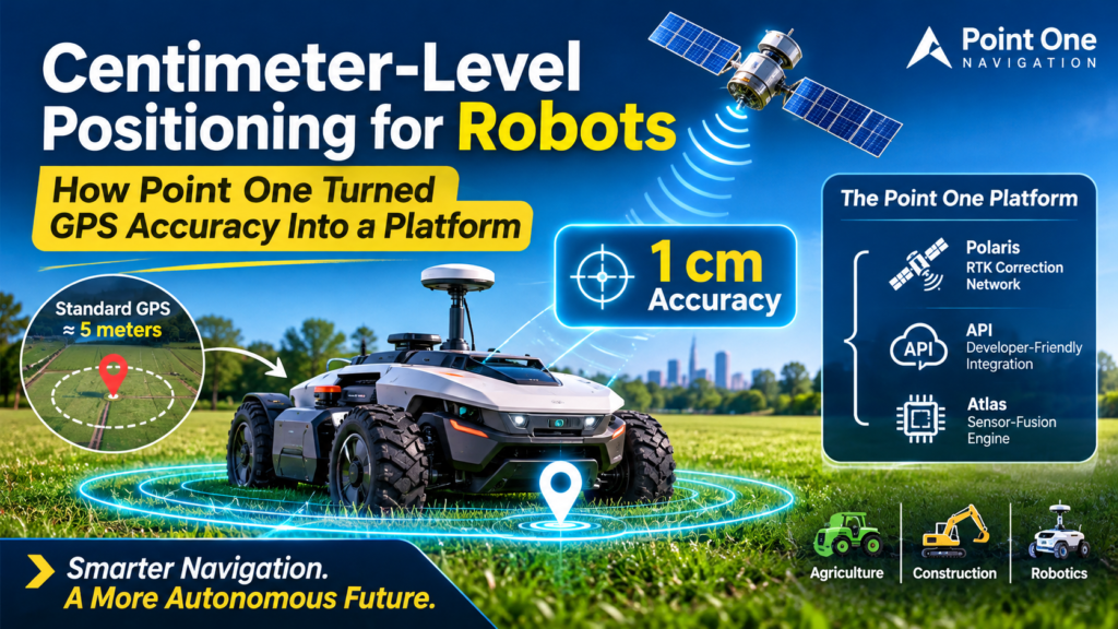
Centimeter-Level Positioning for Robots is transforming how autonomous machines navigate, move, and perform tasks with extreme precision. Standard GPS typically offers around 5-meter accuracy, which is sufficient for finding locations but inadequate for robots that need to follow precise paths, maintain mowing lines, or operate autonomously in agriculture and construction.
Point One Navigation addresses this challenge by combining RTK (Real-Time Kinematic) corrections, sensor fusion, and inertial navigation technology into a unified positioning platform. Its technology helps robot manufacturers achieve centimeter-level accuracy without building and maintaining their own GPS correction infrastructure.
That shift, from selling a component to selling positioning as infrastructure, is what makes the company worth studying. This guide explains how the technology works, what sits inside the platform, who uses it, and what other builders can take from the model.
Key Takeaways
- Standard GPS error is measured in meters, while robots need centimeters to plan paths and cover ground consistently.
- Point One Navigation bundles a correction network (Polaris), a sensor-fusion engine, and inertial hardware (Atlas) into one stack.
- Integration can be fast: one customer said the transition onto its robot took just seven days. pointonenav
- Centimeter-level positioning is turning from a premium feature into a baseline requirement for autonomous machines.
- The moat is infrastructure and integration, not a single chip.
What Is Centimeter-Level Positioning?
Centimeter-level positioning is a machine’s ability to determine its location on Earth to within a few centimeters, in real time and repeatably. In practice it combines satellite signals (GNSS), correction data from reference stations, and often inertial sensors and cameras, so the estimate holds up when conditions get hard.
The numbers are concrete. Point One’s co-founder told TechCrunch the positioning engine can resolve location to within 1 centimeter in the best conditions. The same report puts typical results in the one-to-three-centimeter range. TechCrunch
How does it differ from standard GPS?
Short answer: Centimeter-level positioning is roughly a hundred times more precise than standard GPS, which is typically good to a few meters.
The gap comes from error correction. A bare receiver suffers from atmospheric delays, clock drift, and satellite orbit errors. A corrected receiver removes most of that error using data from nearby reference stations. One Point One customer’s journey was framed as going from 5 meters to 5 centimeters. pointonenav
Why does it matter for robotics navigation?
Short answer: Every downstream system, from path planning to obstacle avoidance, inherits the error of the position estimate.
Accuracy at this level enables precise path planning, consistent coverage, and truly autonomous operation. If the robot doesn’t know where it is within a few centimeters, the rest of the stack has to compensate. Point One’s CEO has argued that “Location is one of the pillars of robotics that needs to be solved.” pointonenavTechCrunch
Why Standard GPS Breaks Down for Robots
Three failure modes explain why robotics navigation outgrew ordinary GPS.
The meters-of-error problem
A lawn robot, a crop sprayer, and a construction layout rover all work in lanes or rows that are narrower than a standard GPS error circle. Meter-level GNSS accuracy produces overlapping passes, missed strips, and drift between runs.
The tail-error problem
Average error hides the worst moments. A system reporting 50 cm accuracy at the median can produce 3-5 meter errors at the tail. Those spikes are what break autonomy: the robot is fine for ninety minutes, then steers into the wrong lane. Without centimeter-level positioning that stays stable at the tail, engineers end up building workarounds in software. pointonenav
The sky-view problem
Many autonomous vehicles operate where something obstructs the line between the GNSS receiver and the sky. Trees, buildings, and overpasses degrade satellite signals, which is why modern stacks pair GNSS with inertial sensing. designing-electronics
How RTK Works
Real-time kinematic (RTK) positioning compares the satellite signals a robot receives against the same signals measured at a fixed reference station with a known location. Because both see nearly the same errors, the difference reveals the correction, and the robot applies it instantly. RTK is the standard route to centimeter-level positioning.
Why was RTK hard to scale?
RTK has existed in surveying since the 1990s, but it requires a base station within a few dozen kilometers, broadcasting corrections in a proprietary protocol, often over a radio modem. That works for a survey crew on one site. It is painful for a fleet of robots spread across regions. yespress
Cost compounded the problem. A delivery-robot company once said some pinpoint GPS systems cost tens of thousands of dollars, which made them unworkable for affordable vehicles. Another customer reported that existing RTK solutions were too expensive and difficult to scale. Scaling centimeter-level positioning meant solving infrastructure, not just algorithms. roboticstomorrowpointonenav
What changed with network RTK?
Network RTK replaces the single base station with a managed grid of them, delivering corrections over the internet to any subscribed receiver. The robot maker no longer builds or maintains the reference infrastructure. It subscribes, and the corrections arrive wherever the network has coverage.
Inside the Point One Platform
The company’s pitch is a stack. Point One provides a positioning platform that combines a professionally managed RTK corrections network, a developer-friendly API, and a sensor-fusion positioning engine. Each layer solves a different part of the problem. spacecapital
Polaris: the RTK corrections network
Polaris is the foundation. Point One advertises 1,400+ base stations, 350K+ devices, and under five seconds of convergence time. Convergence is how long a receiver needs before it reaches full accuracy, so shorter is better for robots that power on and go. pointonenav
Coverage keeps widening. Polaris covers the United States, EU, Australia and Canada, and the UK integration is available to existing customers at no additional cost. Newer coverage also lists New Zealand and South Korea. The network also reaches thinly populated areas: TechCrunch reported it delivers centimeter-level accuracy even in sparsely populated parts of North America. A dense network is what makes centimeter-level positioning dependable outside cities. Point One Navigation Now Providing RTK Corrections in Great Britian +2
FusionEngine: the positioning engine
Satellites alone are not enough, so the software layer blends several sources. FusionEngine combines satellite signals, accelerometers, and computer vision into a single position estimate. Point One describes its technology as augmented GNSS, computer vision, and sensor fusion delivered through an API. yespressTechCrunch
Where this runs matters. The RTK engine is designed to run directly on a vehicle’s existing compute hardware, so corrections are computed on the platform with no latency from external hardware. That design keeps centimeter-level positioning inside the same compute budget as perception and planning. pointonenav
Atlas: inertial navigation hardware
Atlas packages the stack as a box. It is a standalone, reference-quality position and navigation system with GNSS, RTK corrections, and a full inertial navigation system. The company says Atlas delivers ground-truth-level accuracy in real time and is designed for large fleets. Teams that once relied on post-processing to get ground truth can now get it live, which is a big deal for mapping and validation work. For production robotics, Atlas pairs inertial dead reckoning with GNSS so centimeter-level positioning survives short signal outages. pointonenavinsidegnss
The API and subscription model
The commercial move is packaging. One analysis describes the company as selling to OEMs on a subscription, much the way Stripe sells payments. Point One’s navigation also lists a GraphQL API for managing devices and corrections. For teams that want to prototype first, a standard development kit offers a cost-effective entry point with a direct path to mass production. Selling centimeter-level positioning as a service, rather than a component, is what turns an accuracy upgrade into a platform. yespressst
Comparison: Ways to Give a Robot Its Location
| Approach | Typical accuracy | Setup effort | Scales across fleets? | Main weakness |
|---|---|---|---|---|
| Standard GPS/GNSS | Meters | Minimal | Yes | Too coarse for lane- or row-level work |
| Self-managed RTK base station | Centimeters | High: site, radio link, upkeep | Poorly | Range limits and maintenance burden |
| Network RTK (e.g., Polaris) | Centimeters | Low: subscribe and stream corrections | Yes | Needs connectivity and a decent sky view |
| GNSS + inertial fusion (e.g., Atlas) | Centimeters, held through short outages | Low to medium: added hardware | Yes | Extra hardware to integrate |
Reading the table: the middle rows show why the market moved from DIY base stations to managed networks, and the last row shows why robots increasingly pair corrections with inertial sensing.
Real-World Proof: Who Uses This
Scythe Robotics
Scythe makes the M.52, billed as the world’s first fully autonomous electric commercial lawn mower. Traditional GPS wasn’t accurate enough, so the team adopted Polaris RTK corrections. Integration was quick, and the case study notes the corrections work with either Atlas or Scythe’s in-house system. pointonenav
The path wasn’t frictionless. An early prototype suffered electromagnetic interference because the onboard computer was disrupting the GPS signal. That is a useful reminder that centimeter-level positioning is a systems problem: antenna placement and shielding matter as much as the corrections. pointonenav
Civ Robotics
Construction layout used to be manual work. Skilled workers historically carried GPS tools by hand to mark each construction spot. With Polaris RTK, Civ’s rovers translate construction plans into layout markings accurate to within less than a centimeter. The robot replaces a specialist, and the accuracy is what makes that trade credible. roboticsandautomationnewsamerisurv
Bot Auto
Autonomous trucking shows the other end of the scale. In its case study, Point One argues that GNSS gets overlooked while sensor fusion, perception, and path planning get the attention. Bot Auto, per the same source, inherited a dense, professionally managed reference network from day one and put the saved engineering hours into autonomy instead. That is the platform argument in one sentence. pointonenavpointonenav
Agriculture and turf
Farm and turf customers adopted the stack early. TRIC Robotics runs tractor-sized autonomous fleets for non-chemical pest and disease control on crops like strawberries, and Agra-GPS converts heavy farm machinery into auto-steering equipment with centimeter-level accuracy. Row crops are the clearest case where centimeters translate directly into yield and input savings. pointonenav
Why the Platform Model Works
The Point One story offers several lessons that apply well beyond navigation:
- Sell the outcome, not the part. Customers want a robot that knows where it is, not a receiver to tune.
- Make infrastructure the moat. A dense base-station network takes years to build and is hard to copy.
- Integrate where the compute already lives. Running the engine on existing hardware removes a whole class of latency and cost problems.
- Partner with silicon vendors. The ST partnership pairs Point One’s reference systems, embedded software, and development kits with ST’s GNSS portfolio. st
- Avoid lock-in. The platform lets vehicle OEMs choose their own map provider for each region. electronicsforu
- Fund the network. Point One closed a $35M Series C led by Khosla Ventures, with the money aimed at the whole stack, including Polaris. yespress
Centimeter-level positioning becomes defensible when it combines software, hardware, and a network that compounds with every new customer.
Frequently Asked Questions
How accurate is Point One Navigation?
Typical results fall in the one-to-three-centimeter range, with about one centimeter possible in the best conditions, according to the co-founder’s comments to TechCrunch. Accuracy still depends on sky view, antenna quality, and network coverage.
Do I need my own base station?
No. Polaris is a managed RTK corrections network, so your robot streams corrections from the network rather than from a station you build and maintain.
Where does Polaris work?
Coverage includes the United States, EU, Australia, Canada, and Great Britain. Check current coverage maps before deploying, since regions are being added. insidegnss
What happens when satellite signals drop?
The inertial layer keeps estimating position from motion sensors. Atlas combines GNSS, RTK corrections, and a full inertial navigation system for exactly this reason, and fusion with computer vision adds further resilience.
Is centimeter-level positioning enough for full autonomy?
No. It answers “where am I?” but not “what is around me?” Perception, planning, and safety systems are still required. Precise location simply makes every one of them more reliable.
Does GNSS accuracy matter if I already have lidar and cameras?
Yes. Onboard sensors give relative awareness, while GNSS gives absolute, repeatable location that ties a robot to maps, work orders, and survey data.
How to Evaluate Centimeter-Level Positioning for Your Robot
Use this checklist when comparing vendors:
- Define your accuracy target in centimeters, including the tail, not just the median.
- Map your operating environment: open sky, tree cover, urban canyons, or tunnels.
- Check network coverage for every region you plan to operate in.
- Measure convergence time, because it affects how fast a robot is productive after power-on.
- Plan for outages with inertial sensing and fusion.
- Test for interference, including from your own compute and motors.
- Confirm where the engine runs and what it adds to your latency and compute budget.
- Review the commercial model: per-device subscription, volume tiers, and development-kit paths.
Conclusion
Point One’s insight was that accuracy alone does not scale; infrastructure and integration do. By combining a managed correction network, a fusion engine, and inertial hardware behind one API, the company made centimeter-level positioning something a robot maker can adopt in days instead of building for years.
For builders, the takeaway is straightforward: treat location as a foundational layer of the autonomy stack, test it at the tail, and choose a provider whose network and software grow with your fleet.
ରୋବଟ୍ ପାଇଁ ସେଣ୍ଟିମିଟର-ସ୍ତରୀୟ ଅବସ୍ଥାନ ନିର୍ଦ୍ଧାରଣ (Positioning): ‘ପଏଣ୍ଟ ୱାନ୍’ (Point One) କିପରି GPS ସଠିକତାକୁ ଏକ ପ୍ଲାଟଫର୍ମରେ ପରିଣତ କଲା
ସାଧାରଣ GPS ପ୍ରାୟ ପାଞ୍ଚ ମିଟର ପର୍ଯ୍ୟନ୍ତ ସଠିକତା ପ୍ରଦାନ କରିଥାଏ। ଏହା ଏକ କଫି ଦୋକାନ ଖୋଜିବା ପାଇଁ ଠିକ୍ ଅଟେ, କିନ୍ତୁ ଯେଉଁ ରୋବଟକୁ ଏକ ନିର୍ଦ୍ଦିଷ୍ଟ ରେଖାରେ (ଯେପରିକି ଘାସ କାଟିବା ସମୟରେ) ଚାଲିବାକୁ ପଡ଼େ, ତାହା ପାଇଁ ଏହା କୌଣସି କାମରେ ଆସେ ନାହିଁ। ପାରମ୍ପାରିକ GPS/GNSS ପ୍ରାୟ ୫ ମିଟରର ସଠିକତା ଦେଇଥାଏ, ଯାହା ସବୁଜ କ୍ଷେତ୍ର (green spaces) ରକ୍ଷଣାବେକ୍ଷଣ କରୁଥିବା ରୋବଟ୍ ପାଇଁ ଯଥେଷ୍ଟ ନୁହେଁ। ‘ସେଣ୍ଟିମିଟର-ସ୍ତରୀୟ ଅବସ୍ଥାନ ନିର୍ଦ୍ଧାରଣ’ (Centimeter-level positioning) ଏହି ଅଭାବକୁ ଦୂର କରେ। ‘ପଏଣ୍ଟ ୱାନ୍ ନେଭିଗେସନ୍’ (Point One Navigation) ଏହି ଜ୍ଞାନକୌଶଳକୁ କେବଳ ସର୍ଭେକ୍ଷଣ କ୍ଷେତ୍ରରେ ସୀମିତ ନ ରଖି, ଏହାକୁ ଏକ ପ୍ଲାଟଫର୍ମରେ ପରିଣତ କରିଛି, ଯାହାକୁ ରୋବଟ୍ ନିର୍ମାତାମାନେ ଏକ ସିଙ୍ଗଲ୍ API (ଏପିଆଇ) ମାଧ୍ୟମରେ ନିଜ ସିଷ୍ଟମରେ ଯୋଡ଼ି ପାରିବେ।
ଏକ ସାଧାରଣ ଉପାଦାନ (component) ବିକ୍ରି କରିବା ପରିବର୍ତ୍ତେ, ଅବସ୍ଥାନ ନିର୍ଦ୍ଧାରଣ ସେବାକୁ ଏକ ଭିତ୍ତିଭୂମି (infrastructure) ଭାବରେ ଉପସ୍ଥାପନ କରିବାର ଏହି ପରିବର୍ତ୍ତନ ହିଁ କମ୍ପାନୀଟିକୁ ଅଧ୍ୟୟନ ଯୋଗ୍ୟ କରିଥାଏ। ଏହି ଗାଇଡ୍ରେ ବର୍ଣ୍ଣନା କରାଯାଇଛି ଯେ ଏହି ପ୍ରଯୁକ୍ତିବିଦ୍ୟା କିପରି କାମ କରେ, ଏହି ପ୍ଲାଟଫର୍ମ ମଧ୍ୟରେ କ’ଣ ରହିଛି, କିଏ ଏହାକୁ ବ୍ୟବହାର କରନ୍ତି ଏବଂ ଅନ୍ୟ ନିର୍ମାତାମାନେ ଏହି ମଡେଲ୍ରୁ କ’ଣ ଶିଖିପାରିବେ।
ମୁଖ୍ୟ ବିଷୟଗୁଡ଼ିକ
ସାଧାରଣ GPS-ରେ ତ୍ରୁଟିର ପରିମାଣ ମିଟର ହିସାବରେ ହୋଇଥାଏ, କିନ୍ତୁ ରୋବଟ୍କୁ ନିର୍ଦ୍ଦିଷ୍ଟ ପଥରେ ଚାଲିବା ଏବଂ କାର୍ଯ୍ୟ କରିବା ପାଇଁ ସେଣ୍ଟିମିଟର ସ୍ତରର ସଠିକତା ଆବଶ୍ୟକ ହୁଏ।
‘ପଏଣ୍ଟ ୱାନ୍ ନେଭିଗେସନ୍’ ଏକ ସଂଶୋଧନ ନେଟୱାର୍କ (Polaris), ସେନ୍ସର-ଫ୍ୟୁଜନ୍ ଇଞ୍ଜିନ୍ ଏବଂ ଇନର୍ସିଆଲ୍ ହାର୍ଡୱେର୍ (Atlas) କୁ ଏକତ୍ରିତ କରି ଏକ ସମ୍ପୂର୍ଣ୍ଣ ସିଷ୍ଟମ୍ (stack) ପ୍ରଦାନ କରେ।
ଏହାକୁ ଅନ୍ୟ ସିଷ୍ଟମରେ ଯୋଡ଼ିବା (integration) ବହୁତ ଦ୍ରୁତ ହୋଇପାରେ: ଜଣେ ଗ୍ରାହକଙ୍କ ଅନୁଯାୟୀ, ସେମାନଙ୍କ ରୋବଟ୍ରେ ଏହି ସିଷ୍ଟମ୍ ଏହି ପାର୍ଥକ୍ୟଟି ତ୍ରୁଟି ସଂଶୋଧନ (error correction) ପ୍ରକ୍ରିୟାରୁ ଉଦ୍ଭବ ହୋଇଥାଏ। ଏକ ସାଧାରଣ (ବିନା ସଂଶୋଧନଯୁକ୍ତ) ରିସିଭର ବା ଗ୍ରାହକ ଯନ୍ତ୍ର ବାୟୁମଣ୍ଡଳୀୟ ବିଳମ୍ବ, ଘଣ୍ଟା ସମ୍ବନ୍ଧୀୟ ବିଚ୍ୟୁତି (clock drift) ଏବଂ ଉପଗ୍ରହ କକ୍ଷପଥ ସମ୍ବନ୍ଧୀୟ ତ୍ରୁଟିର ସମ୍ମୁଖୀନ ହୋଇଥାଏ। କିନ୍ତୁ, ସଂଶୋଧନ ସୁବିଧା ଥିବା ଏକ ରିସିଭର ନିକଟସ୍ଥ ‘ରେଫରେନ୍ସ ଷ୍ଟେସନ୍’ (reference station) ଗୁଡ଼ିକରୁ ତଥ୍ୟ ସଂଗ୍ରହ କରି ଏହି ତ୍ରୁଟିଗୁଡ଼ିକର ଅଧିକାଂଶ ଅଂଶକୁ ଦୂର କରିପାରେ। ‘Point One’ କମ୍ପାନୀ ନିଜ ଗ୍ରାହକଙ୍କ ଅନୁଭୂତିକୁ ଏକ ଉଦାହରଣ ମାଧ୍ୟମରେ ବର୍ଣ୍ଣନା କରିଛି: ଏହା ୫ ମିଟରର ତ୍ରୁଟି ସୀମାରୁ ୫ ସେଣ୍ଟିମିଟରର ସଠିକତା ସ୍ତରକୁ ଉନ୍ନୀତ ହେବା ସହ ସମାନ।
ରୋବୋଟିକ୍ସ ନାଭିଗେସନ୍ (robotics navigation) ପାଇଁ ଏହା କାହିଁକି ଗୁରୁତ୍ୱପୂର୍ଣ୍ଣ?
ସଂକ୍ଷେପରେ କହିଲେ: ପଥ ନିର୍ଦ୍ଧାରଣ (path planning) ଠାରୁ ଆରମ୍ଭ କରି ବାଧାବିଘ୍ନ ଏଡ଼ାଇବା (obstacle avoidance) ପର୍ଯ୍ୟନ୍ତ, ପରବର୍ତ୍ତୀ ସମସ୍ତ ପ୍ରକ୍ରିୟା ଉପରେ ସ୍ଥାନ ନିର୍ଦ୍ଧାରଣ ସମ୍ବନ୍ଧୀୟ ତ୍ରୁଟିର ପ୍ରଭାବ ପଡ଼ିଥାଏ।
ଏହି ସ୍ତରର ସଠିକତା (accuracy) ସଠିକ୍ ପଥ ନିର୍ଦ୍ଧାରଣ, ସୁସଙ୍ଗତ କାର୍ଯ୍ୟକ୍ଷେତ୍ର କଭରେଜ୍ ଏବଂ ପ୍ରକୃତ ସ୍ୱୟଂଚାଳିତ (autonomous) ପରିଚାଳନାକୁ ସମ୍ଭବ କରିଥାଏ। ଯଦି ଏକ ରୋବୋଟ୍ ନିଜର ଅବସ୍ଥିତି ବିଷୟରେ କିଛି ସେଣ୍ଟିମିଟରର ସଠିକତା ସହ ଅବଗତ ନଥାଏ, ତେବେ ସିଷ୍ଟମର ଅନ୍ୟାନ୍ୟ ଅଂଶଗୁଡ଼ିକୁ ସେହି ତ୍ରୁଟି ସୁଧାରିବା ପାଇଁ ଅତିରିକ୍ତ ପଦକ୍ଷେପ ନେବାକୁ ପଡ଼ିଥାଏ। ‘Point One’ କମ୍ପାନୀର ସିଇଓ (CEO) କହିଛନ୍ତି ଯେ, “ରୋବୋଟିକ୍ସ କ୍ଷେତ୍ରରେ ‘ଅବସ୍ଥିତି ନିର୍ଦ୍ଧାରଣ’ (location) ଏକ ମୁଖ୍ୟ ସ୍ତମ୍ଭ, ଯାହାର ସମାଧାନ ହେବା ଅତ୍ୟନ୍ତ ଆବଶ୍ୟକ।”
ରୋବୋଟ୍ ପାଇଁ ସାଧାରଣ GPS କାହିଁକି ବିଫଳ ହୁଏ?
ତିନୋଟି ମୁଖ୍ୟ କାରଣରୁ ରୋବୋଟିକ୍ସ ନାଭିଗେସନ୍ କ୍ଷେତ୍ରରେ ସାଧାରଣ GPS ଯଥେଷ୍ଟ ହୋଇନଥାଏ।
‘ମିଟର ସ୍ତରୀୟ ତ୍ରୁଟି’ (Meters-of-error) ସମସ୍ୟା
ଘାସ କାଟୁଥିବା ରୋବୋଟ୍, ଫସଲରେ ଔଷଧ ସିଞ୍ଚନ କରୁଥିବା ରୋବୋଟ୍ କିମ୍ବା ନିର୍ମାଣ କାର୍ଯ୍ୟରେ ବ୍ୟବହୃତ ରୋବୋଟ୍ଗୁଡ଼ିକ ସାଧାରଣତଃ ଏପରି ଧାଡ କାରଣ ଉଭୟ ପ୍ରାୟ ସମାନ ତ୍ରୁଟି ଦେଖନ୍ତି, ପାର୍ଥକ୍ୟ ସଂଶୋଧନକୁ ପ୍ରକାଶ କରେ, ଏବଂ ରୋବୋଟ୍ ଏହାକୁ ତୁରନ୍ତ ପ୍ରୟୋଗ କରେ। RTK ହେଉଛି ସେଣ୍ଟିମିଟର-ସ୍ତର ସ୍ଥିତି ପାଇଁ ମାନକ ପଥ।
RTK କୁ ମାପିବା କାହିଁକି କଷ୍ଟକର ଥିଲା?
RTK 1990 ଦଶକରୁ ସର୍ଭେରେ ରହିଛି, କିନ୍ତୁ ଏହାକୁ କିଛି ଡଜନ କିଲୋମିଟର ମଧ୍ୟରେ ଏକ ବେସ୍ ଷ୍ଟେସନ୍ ଆବଶ୍ୟକ, ଏକ ମାଲିକାନା ପ୍ରୋଟୋକଲରେ ସଂଶୋଧନ ପ୍ରସାରଣ କରେ, ପ୍ରାୟତଃ ଏକ ରେଡିଓ ମୋଡେମ୍ ମାଧ୍ୟମରେ। ଏହା ଗୋଟିଏ ସାଇଟରେ ଏକ ସର୍ଭେ କ୍ରୁ ପାଇଁ କାମ କରେ। ଏହା ବିଭିନ୍ନ ଅଞ୍ଚଳରେ ବିସ୍ତାରିତ ରୋବୋଟ୍ ର ଏକ ଫ୍ଲିଟ୍ ପାଇଁ ଯନ୍ତ୍ରଣାଦାୟକ।
ହଁପ୍ରେସ୍
ମୂଲ୍ୟ ସମସ୍ୟାକୁ ଆହୁରି ବଢ଼ାଇ ଦେଇଛି। ଏକ ଡେଲିଭରି-ରୋବୋଟ୍ କମ୍ପାନୀ ଥରେ କହିଥିଲା ଯେ କିଛି ନିର୍ଦ୍ଦିଷ୍ଟ GPS ସିଷ୍ଟମ୍ ଦଶ ହଜାର ଡଲାର ମୂଲ୍ୟର, ଯାହା ସେଗୁଡ଼ିକୁ ସୁଲଭ ଯାନବାହନ ପାଇଁ ଅକାର୍ଯ୍ୟକ୍ଷମ କରିଦେଇଥିଲା। ଅନ୍ୟ ଜଣେ ଗ୍ରାହକ ରିପୋର୍ଟ କରିଛନ୍ତି ଯେ ବିଦ୍ୟମାନ RTK ସମାଧାନଗୁଡ଼ିକ ଅତ୍ୟଧିକ ମହଙ୍ଗା ଏବଂ ସ୍କେଲ୍ କରିବା କଷ୍ଟକର। ସେଣ୍ଟିମ ସ୍କେଲିଂସେଣ୍ଟିମିଟର-ସ୍ତରୀୟ (centimeter-level) ସ୍ଥାନ ନିର୍ଦ୍ଧାରଣ ପାଇଁ କେବଳ ଆଲଗୋରିଦମ୍ ନୁହେଁ, ବରଂ ଭିତ୍ତିଭୂମି ସମ୍ବନ୍ଧୀୟ ସମସ୍ୟାର ସମାଧାନ ମଧ୍ୟ ଆବଶ୍ୟକ ହୋଇଥାଏ।
ନେଟୱାର୍କ RTK (Network RTK) ଆସିବା ପରେ କ’ଣ ପରିବର୍ତ୍ତନ ଆସିଲା?
ନେଟୱାର୍କ RTK ରେ ଏକକ ବେସ୍ ଷ୍ଟେସନ୍ (single base station) ବଦଳରେ ଏକ ପରିଚାଳିତ ଗ୍ରୀଡ୍ ବ୍ୟବସ୍ଥା ବ୍ୟବହୃତ ହୁଏ। ଏହା ଇଣ୍ଟରନେଟ୍ ମାଧ୍ୟମରେ ସେବା ଗ୍ରହଣ କରୁଥିବା (subscribed) ଯେକୌଣସି ରିସିଭରକୁ ସଠିକ୍ ତଥ୍ୟ (corrections) ପ୍ରଦାନ କରିଥାଏ। ଏଥିରେ ରୋବଟ୍ ନିର୍ମାତାଙ୍କୁ ନିଜେ କୌଣସି ରେଫରେନ୍ସ ଭିତ୍ତିଭୂମି ନିର୍ମାଣ କିମ୍ବା ରକ୍ଷଣାବେକ୍ଷଣ କରିବାକୁ ପଡ଼େ ନାହିଁ। ସେମାନଙ୍କୁ କେବଳ ଏହି ସେବା ପାଇଁ ସବସ୍କ୍ରାଇବ୍ (subscribe) କରିବାକୁ ହୁଏ ଏବଂ ଯେଉଁଠାରେ ନେଟୱାର୍କର କଭରେଜ୍ ଥାଏ, ସେଠାରେ ସଂଶୋଧିତ ତଥ୍ୟ ପହଞ୍ଚିଯାଏ।
‘Point One’ ପ୍ଲାଟଫର୍ମର ବିଶେଷତା
‘Point One’ ଏକ ସମନ୍ୱିତ ପ୍ଲାଟଫର୍ମ ପ୍ରଦାନ କରେ, ଯେଉଁଥିରେ ଏକ ବୃତ୍ତିଗତ ଭାବେ ପରିଚାଳିତ RTK କରେକ୍ସନ୍ ନେଟୱାର୍କ, ଡେଭଲପର-ଅନୁକୂଳ API ଏବଂ ‘ସେନ୍ସର-ଫ୍ୟୁଜନ୍’ (sensor-fusion) ଆଧାରିତ ପୋଜିସନିଂ ଇଞ୍ଜିନ୍ ଅନ୍ତର୍ଭୁକ୍ତ। ଏହାର ପ୍ରତ୍ୟେକ ସ୍ତର (layer) ଏକ ନିର୍ଦ୍ଦିଷ୍ଟ ସମସ୍ୟାର ସମାଧାନ କରିଥାଏ।
Polaris: RTK କରେକ୍ସନ୍ ନେଟୱାର୍କ
‘Polaris’ ହେଉଛି ଏହାର ମୂଳଦୁଆ। ‘Point One’ ଅନୁଯାୟୀ, ଏଥିରେ ୧,୪୦୦ରୁ ଅଧିକ ବେସ୍ ଷ୍ଟେସନ୍ ଏବଂ ୩,୫୦,୦୦୦ରୁ ଅଧିକ ଡିଭାଇସ୍ ରହିଛି, ଯେଉଁଠାରେ ‘କନଭର୍ଜେନ୍ସ ଟାଇମ୍’ (convergence time) ପାଞ୍ଚ ସେକେଣ୍ଡରୁ ମଧ୍ୟ କମ୍ ଅଟେ। ‘କନଭର୍ଜେନ୍ସ ଟାଇମ୍’ କହିଲେ ଏକ ରିସିଭରକୁ ସମ୍ପୂର୍ଣ୍ଣ ସଠିକତା (full accuracy) ହାସଲ କରିବା ପାଇଁ ଆବଶ୍ୟକ ସମୟକୁ ବୁଝାଏ; ତେଣୁ ଯେଉଁ ରୋବଟଗୁଡ଼ିକ ଚାଲୁ ହେବା ମାତ୍ରେ କାମ ଆରମ୍ଭ କରିଦିଅନ୍ତି, ସେଗୁଡ଼ିକ ପାଇଁ ଏହି ସମୟ ଯେତେ କମ୍ ହେବ, ସେତେ ଭଲ।
ଏହାର କଭରେଜ୍ କ୍ରମାଗତ ଭାବେ ବୃଦ୍ଧି ପାଉଛି। ‘Polaris’ ବର୍ତ୍ତମାନ ଆମେରିକା, ୟୁରୋପୀୟ ସଂଘ (EU), ଅଷ୍ଟ୍ରେଲିଆ ଏବଂ କାନାଡାରେ ଉପଲବ୍ଧ। ଏହା ବ୍ୟତୀତ, ବର୍ତ୍ତମାନର ଗ୍ରାହକମାନେ କୌଣସି ଅତିରିକ୍ତ ମୂଲ୍ୟ ବିନା ବ୍ରିଟେନ୍ (UK) Point One Nav
Atlas: ଇନର୍ସିଆଲ୍ ନେଭିଗେସନ୍ (ଜଡ଼ତା-ଆଧାରିତ ନେଭିଗେସନ୍) ହାର୍ଡୱେର୍
Atlas ଏକ ବାକ୍ସ ଆକାରରେ ଏହି ସମ୍ପୂର୍ଣ୍ଣ ପ୍ରଣାଳୀକୁ ଉପସ୍ଥାପନ କରେ। ଏହା ଏକ ସ୍ୱତନ୍ତ୍ର, ଉଚ୍ଚ-ମାନକ ବିଶିଷ୍ଟ ସ୍ଥାନ ନିର୍ଦ୍ଧାରଣ ଏବଂ ନେଭିଗେସନ୍ ସିଷ୍ଟମ୍, ଯେଉଁଥିରେ GNSS, RTK ସଂଶୋଧନ (corrections) ଏବଂ ଏକ ସମ୍ପୂର୍ଣ୍ଣ ଇନର୍ସିଆଲ୍ ନେଭିଗେସନ୍ ସିଷ୍ଟମ୍ ଅନ୍ତର୍ଭୁକ୍ତ। କମ୍ପାନୀର କହିବା ଅନୁଯାୟୀ, Atlas ରିଅଲ୍-ଟାଇମ୍ରେ (ତୁରନ୍ତ) ଅତ୍ୟନ୍ତ ସଠିକ୍ ତଥ୍ୟ ପ୍ରଦାନ କରେ ଏବଂ ଏହାକୁ ବଡ଼ ସଂଖ୍ୟକ ରୋବୋଟ୍ ବା ଯନ୍ତ୍ରଗୁଡ଼ିକର ଗୋଷ୍ଠୀ (fleets) ପାଇଁ ଡିଜାଇନ୍ କରାଯାଇଛି। ଯେଉଁ ଦଳଗୁଡ଼ିକ ପୂର୍ବେ ସଠିକ୍ ତଥ୍ୟ ପାଇବା ପାଇଁ ‘ପୋଷ୍ଟ-ପ୍ରୋସେସିଂ’ (କାର୍ଯ୍ୟ ପରେ ତଥ୍ୟ ବିଶ୍ଳେଷଣ) ଉପରେ ନିର୍ଭର କରୁଥିଲେ, ସେମାନେ ବର୍ତ୍ତମାନ ଏହାକୁ ଲାଇଭ୍ ବା ତୁରନ୍ତ ପାଇପାରିବେ; ମ୍ୟାପିଂ ଏବଂ ଯାଞ୍ଚ କାର୍ଯ୍ୟ ପାଇଁ ଏହା ଏକ ବଡ଼ ସୁବିଧା ଅଟେ।
ରୋବୋଟିକ୍ସ ଉତ୍ପାଦନ କ୍ଷେତ୍ରରେ, Atlas ଇନର୍ସିଆଲ୍ ‘ଡେଡ୍ ରେକନିଂ’ (inertial dead reckoning) କୁ GNSS ସହିତ ଯୋଡ଼ିଥାଏ, ଯାହା ଫଳରେ ସିଗନାଲ୍ କିଛି ସମୟ ପାଇଁ ବାଧାପ୍ରାପ୍ତ ହେଲେ ମଧ୍ୟ ସେଣ୍ଟିମିଟର ସ୍ତରର ସଠିକତା ବଜାୟ ରହିଥାଏ।
API ଏବଂ ସବସ୍କ୍ରିପସନ୍ ମଡେଲ୍
ଏହାର ବ୍ୟବସାୟିକ ରଣନୀତି ହେଉଛି ଏକ ସମନ୍ୱିତ ପ୍ୟାକେଜ୍ ପ୍ରଦାନ କରିବା। ଏକ ବିଶ୍ଳେଷଣ ଅନୁଯାୟୀ, କମ୍ପାନୀଟି OEM (ମୂଳ ଉପକରଣ ନିର୍ମାତା) ମାନଙ୍କୁ ସବସ୍କ୍ରିପସନ୍ ଆଧାରରେ ଏହି ସେବା ବିକ୍ରି କରେ, ଯେପରି ‘Stripe’ କମ୍ପାନୀ ପେମେଣ୍ଟ ସେବା ପ୍ରଦାନ କରିଥାଏ। Point One ର ନେଭିଗେସନ୍ ସିଷ୍ଟମରେ ଡିଭାଇସ୍ ଏବଂ ସଂଶୋଧନଗୁଡ଼ିକୁ ପରିଚାଳନା କରିବା ପାଇଁ ଏକ GraphQL API ମଧ୍ୟ ଉପଲବ୍ଧ ଅଛି। ଯେଉଁ ଦଳଗୁଡ଼ିକ ପ୍ରଥମେ ଏକ ପ୍ରୋଟୋଟାଇପ୍ (ନମୁନା) ପ୍ରସ୍ତୁତ କରିବାକୁ ଚାହାଁନ୍ତି, ସେମାନଙ୍କ ପାଇଁ ଏକ ଷ୍ଟାଣ୍ଡାର୍ଡ ଡେଭଲପମେଣ୍ଟ କିଟ୍ ଉପଲବ୍ଧ ଅଛି, ଯାହା କମ୍ ଖର୍ଚ୍ଚରେ କାମ ଆରମ୍ଭ କରିବାକୁ ସୁଯୋଗ ଦିଏ ଏବଂ ପରବର୍ତ୍ତୀ ସମୟରେ ବ୍ୟାପକ ଉତ୍ପାଦନ (mass production) ପାଇଁ ମାର୍ଗ ପ୍ରଶସ୍ତ କରେ।
ସେଣ୍ଟିମିଟର ସ୍ତରର ସ୍ଥାନ ନିର୍ଦ୍ଧାରଣ ସେବାକୁ କେବଳ ଏକ ‘ଉପାଦ ପାରମ୍ପରିକ GPS ଯଥେଷ୍ଟ ସଠିକ ନଥିଲା, ତେଣୁ ଦଳ ପୋଲାରିସ୍ RTK ସଂଶୋଧନ ଗ୍ରହଣ କରିଥିଲା। ସମନ୍ୱୟ ଦ୍ରୁତ ଥିଲା, ଏବଂ କେସ୍ ଷ୍ଟଡି ଉଲ୍ଲେଖ କରେ ଯେ ସଂଶୋଧନଗୁଡ଼ିକ ଆଟଲାସ୍ କିମ୍ବା ସ୍ସାଇଥ୍ର ଇନ-ହାଉସ୍ ସିଷ୍ଟମ୍ ସହିତ କାମ କରେ।
pointonenav
ପଥଟି ଘର୍ଷଣମୁକ୍ତ ନଥିଲା। ଏକ ପ୍ରାରମ୍ଭିକ ପ୍ରୋଟୋଟାଇପ୍ ଇଲେକ୍ଟ୍ରୋମ୍ୟାଗ୍ନେଟିକ୍ ହସ୍ତକ୍ଷେପର ଶିକାର ହୋଇଥିଲା କାରଣ ଅନବୋର୍ଡ କମ୍ପ୍ୟୁଟର GPS ସିଗନାଲକୁ ବ୍ୟାଘାତ କରୁଥିଲା। ଏହା ଏକ ଉପଯୋଗୀ ସ୍ମରଣକାରୀ ଯେ ସେଣ୍ଟିମିଟର-ସ୍ତର ସ୍ଥିତିକରଣ ଏକ ସିଷ୍ଟମ୍ ସମସ୍ୟା: ଆଣ୍ଟେନା ସ୍ଥାନ ଏବଂ ସୁରକ୍ଷା ସଂଶୋଧନ ସହିତ ସମାନ।
pointonenav
ସିଭି ରୋବୋଟିକ୍ସ
ନିର୍ମାଣ ଲେଆଉଟ୍ ପୂର୍ବରୁ ମାନୁଆଲ୍ କାମ ଥିଲା। ଦକ୍ଷ ଶ୍ରମିକମାନେ ଐତିହାସିକ ଭାବରେ ପ୍ରତ୍ୟେକ ନିର୍ମାଣ ସ୍ଥାନକୁ ଚିହ୍ନିତ କରିବା ପାଇଁ ହାତରେ GPS ଉପକରଣ ବହନ କରୁଥିଲେ।
Polaris RTK ସାହାଯ୍ୟରେ, Civ କମ୍ପାନୀର ରୋଭରଗୁଡ଼ିକ ନିର୍ମାଣ ଯୋଜନାକୁ ଏପରି ଲେଆଉଟ୍ ଚିହ୍ନରେ ପରିଣତ କରନ୍ତି ଯେଉଁଥିରେ ଏକ ସେଣ୍ଟିମିଟରରୁ ମଧ୍ୟ କମ୍ ତ୍ରୁଟି (ଅର୍ଥାତ୍ ଅତ୍ୟଧିକ ସଠିକତା) ରହିଥାଏ। ଏହି ରୋବଟ୍ ଜଣେ ବିଶେଷଜ୍ଞଙ୍କ ସ୍ଥାନ ନିଏ ଏବଂ ଏହାର ସଠିକତା ହିଁ ଏହି କାର୍ଯ୍ୟକୁ ବିଶ୍ୱାସଯୋଗ୍ୟ କରିଥାଏ।
ସ୍ୱୟଂଚାଳିତ ଟ୍ରକିଂ (Autonomous trucking) ଏହି କ୍ଷେତ୍ରର ଅନ୍ୟ ଏକ ଦିଗକୁ ଦର୍ଶାଏ। Point One ନିଜର ଏକ କେସ୍ ଷ୍ଟଡିରେ ଦର୍ଶାଇଛି ଯେ, ସେନ୍ସର ଫ୍ୟୁଜନ୍ (sensor fusion), ପରିବେଶ ଅନୁଭବ (perception) ଏବଂ ପଥ ନିର୍ଦ୍ଧାରଣ (path planning) ଉପରେ ଅଧିକ ଧ୍ୟାନ ଦିଆଯାଉଥିବା ବେଳେ GNSS (ଗ୍ଲୋବାଲ୍ ନେଭିଗେସନ୍ ସାଟେଲାଇଟ୍ ସିଷ୍ଟମ୍) କୁ ଅଣଦେଖା କରାଯାଏ। ସେହି ଉତ୍ସ ଅନୁଯାୟୀ, Bot Auto ଆରମ୍ଭରୁ ହିଁ ଏକ ସୁସଂଗଠିତ ଏବଂ ବୃତ୍ତିଗତ ଭାବେ ପରିଚାଳିତ ‘ରେଫରେନ୍ସ ନେଟୱାର୍କ’ (reference network) ପାଇଥିଲା, ଯାହା ଫଳରେ ଇଞ୍ଜିନିୟରିଂ କାର୍ଯ୍ୟରେ ଲାଗୁଥିବା ସମୟ ବଞ୍ଚିଗଲା ଏବଂ ସେହି ସମୟକୁ ସ୍ୱୟଂଚାଳିତ ବ୍ୟବସ୍ଥା (autonomy) ବିକାଶରେ ଲଗାଯାଇପାରିଲା। ଏହା ହିଁ ସଂକ୍ଷେପରେ ଏହି ‘ପ୍ଲାଟଫର୍ମ ମଡେଲ୍’ର ମୁଖ୍ୟ ଯୁକ୍ତି।
କୃଷି ଏବଂ ଘାସ ପଡ଼ିଆ ପରିଚାଳନା (Agriculture and turf) କ୍ଷେତ୍ରରେ ଗ୍ରାହକମାନେ ଏହି ପ୍ରଯୁକ୍ତିବିଦ୍ୟାକୁ ବହୁତ ଆଗରୁ ଗ୍ରହଣ କରିସାରିଛନ୍ତି। TRIC Robotics ଷ୍ଟ୍ରବେରି ଭଳି ଫସଲରେ ରାସାୟନିକ ପଦାର୍ଥ ବ୍ୟବହାର ନକରି କୀଟପତଙ୍ଗ ଓ ରୋଗ ନିୟନ୍ତ୍ରଣ କରିବା ପାଇଁ ଟ୍ରାକ୍ଟର ଆକାରର ସ୍ୱୟଂଚାଳିତ ଯନ୍ତ୍ରଗୁଡ଼ିକର ବ୍ୟବହାର କରୁଛି। ସେହିପରି, Agra-GPS କୃଷି କ୍ଷେତ୍ରରେ ବ୍ୟବହୃତ ଭାରୀ ଯନ୍ତ୍ରପାତିକୁ ସ୍ୱୟଂଚାଳିତ ଚାଳନା (auto-steering) ଯନ୍ତ୍ରରେ ପରିଣତ କରେ, ଯାହା ଏକ ସେଣ୍ଟିମିଟର ସ୍ତରର ସଠିକତା ପ୍ରଦାନ କରିଥାଏ। ଧାଡ଼ି ଧାଡ଼ି ହୋଇ ଲଗାଯାଇଥିବା ଫସଲ (row crops) କ୍ଷେତ୍ରରେ ଏହା ସବୁଠାରୁ ଉପଯୋଗୀ, ଯେଉଁଠାରେ ଏହି ସଠିକତା ସିଧାସଳଖ ଅଧିକ ଅମଳ ଏବଂ ଖର୍ଚ୍ଚ ହ୍ରାସ କରିବାରେ ସାହାଯ୍ୟ କରେ।
‘ପ୍ଲାଟଫର୍ମ ମଡେଲ୍’ କାହିଁକି ସଫଳ ହୁଏ?
Point One ର ଅଭିଜ୍ଞତାରୁ କିଛି ଶିକ୍ଷା ମିଳେ ଯାହା କେବଳ ନେଭିଗେସନ୍ (ଦିଗ ନିର୍ଣ୍ଣୟ) କ୍ଷେତ୍ରରେ ନୁହେଁ ‘ଟେକକ୍ରଞ୍ଚ’ (TechCrunch) କୁ ଦେଇଥିବା ମନ୍ତବ୍ୟରେ ସହ-ପ୍ରତିଷ୍ଠାତାଙ୍କ ଅନୁଯାୟୀ, ସାଧାରଣତଃ ଫଳାଫଳଗୁଡ଼ିକ ଏକରୁ ତିନି ସେଣ୍ଟିମିଟର ପରିସର ମଧ୍ୟରେ ରହିଥାଏ ଏବଂ ସର୍ବୋତ୍ତମ ପରିସ୍ଥିତିରେ ଏହା ପ୍ରାୟ ଏକ ସେଣ୍ଟିମିଟର ପର୍ଯ୍ୟନ୍ତ ହୋଇପାରେ। ତଥାପି, ସଠିକତା ଆକାଶର ଦୃଶ୍ୟମାନତା (sky view), ଆଣ୍ଟେନା ଗୁଣବତ୍ତା ଏବଂ ନେଟୱାର୍କ କଭରେଜ୍ ଉପରେ ନିର୍ଭର କରେ।
ମୋତେ କ’ଣ ନିଜର ଏକ ‘ବେସ୍ ଷ୍ଟେସନ୍’ (base station) ଆବଶ୍ୟକ ହେବ?
ନା। ‘ପୋଲାରିସ୍’ (Polaris) ହେଉଛି ଏକ ପରିଚାଳିତ ‘RTK କରେକ୍ସନ୍ ନେଟୱାର୍କ’ (RTK corrections network); ତେଣୁ ଆପଣଙ୍କ ରୋବଟ୍ ନିଜେ ନିର୍ମାଣ ଓ ରକ୍ଷଣାବେକ୍ଷଣ କରୁଥିବା ଷ୍ଟେସନ୍ ପରିବର୍ତ୍ତେ, ଏହି ନେଟୱାର୍କରୁ ସଂଶୋଧନ (corrections) ତଥ୍ୟ ଗ୍ରହଣ କରିଥାଏ।
‘ପୋଲାରିସ୍’ (Polaris) କେଉଁ ସ୍ଥାନଗୁଡ଼ିକରେ କାମ କରେ?
ଏହାର କଭରେଜ୍ ମଧ୍ୟରେ ଯୁକ୍ତରାଷ୍ଟ୍ର ଆମେରିକା, ୟୁରୋପୀୟ ସଂଘ (EU), ଅଷ୍ଟ୍ରେଲିଆ, କାନାଡା ଏବଂ ଗ୍ରେଟ୍ ବ୍ରିଟେନ୍ ଅନ୍ତର୍ଭୁକ୍ତ। ବ୍ୟବହାର ଆରମ୍ଭ କରିବା ପୂର୍ବରୁ ବର୍ତ୍ତମାନର କଭରେଜ୍ ମାନଚିତ୍ର ଯାଞ୍ଚ କରନ୍ତୁ, କାରଣ ନୂତନ ଅଞ୍ଚଳଗୁଡ଼ିକ ଏଥିରେ ଯୋଡ଼ା ଯାଉଛି।
ଯଦି ସାଟେଲାଇଟ୍ ସିଗନାଲ୍ ଚାଲିଯାଏ, ତେବେ କ’ଣ ହେବ?
‘ଇନର୍ସିଆଲ୍ ଲେୟାର୍’ (inertial layer) ବା ଜଡ଼ତା-ଆଧାରିତ ସ୍ତର, ଗତି ସମ୍ବନ୍ଧୀୟ ସେନ୍ସରଗୁଡ଼ିକ (motion sensors) ମାଧ୍ୟମରେ ସ୍ଥାନର ଆକଳନ ଜାରି ରଖେ। ଠିକ୍ ଏହି କାରଣରୁ, ‘ଆଟଲାସ୍’ (Atlas) GNSS, RTK ସଂଶୋଧନ ଏବଂ ଏକ ସମ୍ପୂର୍ଣ୍ଣ ‘ଇନର୍ସିଆଲ୍ ନାଭିଗେସନ୍ ସିଷ୍ଟମ୍’ (inertial navigation system) କୁ ଏକତ୍ରିତ କରିଥାଏ। ଏହା ସହିତ ‘କମ୍ପ୍ୟୁଟର ଭିଜନ୍’ (computer vision) ର ମିଶ୍ରଣ ସିଷ୍ଟମକୁ ଅଧିକ ସୁଦୃଢ଼ କରିଥାଏ।
ସମ୍ପୂର୍ଣ୍ଣ ସ୍ୱୟଂଚାଳିତ (full autonomy) କାର୍ଯ୍ୟ ପାଇଁ କ’ଣ ସେଣ୍ଟିମିଟର-ସ୍ତରର ସଠିକତା ଯଥେଷ୍ଟ?
ନା। ଏହା କେବଳ “ମୁଁ କେଉଁଠାରେ ଅଛି?” (where am I?) ର ଉତ୍ତର ଦିଏ, କିନ୍ତୁ “ମୋ ଚାରିପାଖରେ କ’ଣ ଅଛି?” (what is around me?) ର ଉତ୍ତର ଦିଏ ନାହିଁ। ଏଥିପାଇଁ ପରିବେଶକୁ ବୁଝିବା (perception), ଯୋଜନା କରିବା (planning) ଏବଂ ସୁରକ୍ଷା ବ୍ୟବସ୍ଥା (safety systems) ଆବଶ୍ୟକ। ସଠିକ୍ ଅବସ୍ଥାନ (precise location) କେବଳ ଅନ୍ୟ ସମସ୍ ନିଷ୍କର୍ଷ
ପ୍ରଥମ ବିନ୍ଦୁର ଅନ୍ତର୍ଦୃଷ୍ଟି ଥିଲା ଯେ କେବଳ ସଠିକତା ସ୍କେଲ୍ କରେ ନାହିଁ; ଭିତ୍ତିଭୂମି ଏବଂ ସମନ୍ୱୟ କରେ। ଗୋଟିଏ API ପଛରେ ଏକ ପରିଚାଳିତ ସଂଶୋଧନ ନେଟୱାର୍କ, ଏକ ଫ୍ୟୁଜନ୍ ଇଞ୍ଜିନ୍ ଏବଂ ଜଡ଼ତା ହାର୍ଡୱେର୍ ମିଶ୍ରଣ କରି, କମ୍ପାନୀ ସେଣ୍ଟିମିଟର-ସ୍ତରୀୟ ସ୍ଥିତିକରଣ ଏପରି ଏକ ଜିନିଷ ତିଆରି କରିଛି ଯାହା ଏକ ରୋବୋଟ୍ ନିର୍ମାତା ବର୍ଷ ବର୍ଷ ଧରି ନିର୍ମାଣ କରିବା ପରିବର୍ତ୍ତେ ଦିନ ମଧ୍ୟରେ ଗ୍ରହଣ କରିପାରିବ।
ବିଲ୍ଡରମାନଙ୍କ ପାଇଁ, ପଦକ୍ଷେପ ସିଧାସଳଖ: ସ୍ଥାନକୁ ସ୍ୱାୟତ୍ତତା ଷ୍ଟାକର ଏକ ମୂଳ ସ୍ତର ଭାବରେ ବ୍ୟବହାର କରନ୍ତୁ, ଏହାକୁ ଟେଲରେ ପରୀକ୍ଷା କରନ୍ତୁ, ଏବଂ ଏକ ପ୍ରଦାନକାରୀ ବାଛନ୍ତୁ ଯାହାର ନେଟୱାର୍କ ଏବଂ ସଫ୍ଟୱେର୍ ଆପଣଙ୍କ ଫ୍ଲିଟ୍ ସହିତ ବଢ଼େ।