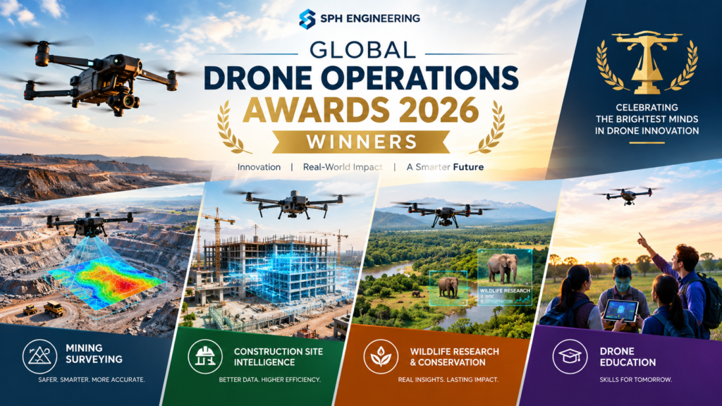
The Global Drone Operations Awards 2026 honored four projects: AB Surveying Solutions SpA (Mining Operations), Medusa Geoservices (Construction & Site Intelligence), San Diego Zoo Wildlife Alliance (Academia & Research), and Embry-Riddle Aeronautical University Worldwide & Online Campus (Jury Special Recognition). SPH Engineering announced the results on October 12, 2026, at SPH Drone Camp in Budapest, Hungary.
That is the short answer. The more interesting story is what these projects share: none of them treated a drone as a flying camera. One team flew ground-penetrating radar over an operating mine. Another used gamma-ray spectrometry to estimate peat thickness. A third collected thermal readings and breath samples from wild orcas without touching them. A fourth taught students in different places to plan real missions together. For anyone in surveying, inspection, research or drone education, the first edition of the Global Drone Operations Awards offers a clear snapshot of where professional drone work is heading.
Quick facts about the 2026 winners:
- Announced: October 12, 2026, during SPH Drone Camp in Budapest
- Organizer: SPH Engineering, a Latvian developer of drone-based surveying, inspection and mapping solutions
- Winning categories: Mining Operations, Construction & Site Intelligence, Academia & Research, plus one Jury Special Recognition
- Common thread: specialized sensors, ground validation and measurable field results rather than aerial imagery alone
This guide explains what the awards are, who won, how the winners were chosen, and what other teams can learn from the results.
What Are the Global Drone Operations Awards?
The Global Drone Operations Awards are an international recognition program, created by SPH Engineering, that honors drone-based surveying and field operations solving complex technical problems in industrial, scientific and engineering settings. The 2026 edition is the first one, and it was designed to put advanced drone work in front of a wider professional audience.
SPH Engineering opened applications on July 6, 2026. The company’s reasoning, as stated in its launch announcement, was that many of the strongest examples of advanced drone work stay hidden inside individual project teams, client reports or research documents. By collecting and recognizing them publicly, the Global Drone Operations Awards aim to turn standout projects into shared reference points for the professional community.
Who Created the Awards, and Why?
SPH Engineering is a Riga-based company best known for UgCS, its general-purpose drone mission planning and flight control software. It also builds specialized payloads such as ground-penetrating radar, magnetometers and echo sounders. The company’s CEO, Alexey Dobrovolskiy, has described the thinking behind the program in simple terms: drones have moved well beyond being cameras in the sky, and the teams proving what advanced workflows can achieve deserve recognition. Doing so also helps more industries understand why those methods are worth adopting.
What Categories Do the Global Drone Operations Awards Cover?
The program opened with four sectors in mind: Mining & Exploration, Oil & Gas, Construction & Engineering, and Academia & Research. The nomination page later listed the final award tracks as:
- Mining (called Mining Operations in the winners announcement)
- Oil & Gas Operations
- Construction & Site Intelligence
- Academia & Research
- Jury Special Recognition
One detail worth noting: the winners announcement named recipients in Mining Operations, Construction & Site Intelligence and Academia & Research, plus the Jury Special Recognition. It did not list an Oil & Gas winner.
What Is the Timeline for the Awards?
The key dates for the first edition were:
- July 6, 2026: applications opened
- September 11, 2026: the nomination window closed, after SPH Engineering extended it from an earlier deadline of July 31 following strong interest
- October 12, 2026: winners announced in Budapest
- October 12-13, 2026: SPH Drone Camp, where winners and finalists met jurors and industry peers
Who Won the Global Drone Operations Awards 2026?
Four projects won: AB Surveying Solutions SpA took Mining Operations, Medusa Geoservices took Construction & Site Intelligence, San Diego Zoo Wildlife Alliance took Academia & Research, and Embry-Riddle Aeronautical University Worldwide & Online Campus received the Jury Special Recognition. The table below summarizes each result.
| Award | Winner | Project in one line |
|---|---|---|
| Mining Operations | AB Surveying Solutions SpA | Underground utility mapping at a Chilean mine using drone and ground-based radar |
| Construction & Site Intelligence | Medusa Geoservices | Peat thickness estimation with drone gamma-ray spectrometry at an Irish wind site |
| Academia & Research | San Diego Zoo Wildlife Alliance | Non-contact health monitoring of wild orcas with thermal imaging and breath sampling |
| Jury Special Recognition | Embry-Riddle Aeronautical University Worldwide & Online Campus | A remote model that lets distributed students plan and run drone missions |
For readers searching for 2026 drone awards winners, this is the complete list from the inaugural edition.
Winner Profiles: What Each Team Actually Did
Mining Operations: AB Surveying Solutions SpA
AB Surveying Solutions won the mining award for mapping buried utilities at an operating mine in Chile. The work supported the relocation of a primary crusher, a job where an unmapped pipe or cable can cause costly delays or safety incidents.
The team compared ground-based radar with drone-mounted ground-penetrating radar and used both to build a cross-validated utility map for excavation planning. According to the announcement, the approach shortened survey times and reduced the number of people working in operational areas, all without disrupting plant operations. This is drone ground-penetrating radar doing exactly what its supporters promise: collecting subsurface data quickly while keeping people away from active equipment.
Construction & Site Intelligence: Medusa Geoservices
Medusa Geoservices won for testing drone-borne gamma-ray spectrometry as a way to estimate peat thickness at an onshore wind development in Ireland. Peat depth matters on wind projects because it affects foundations, access roads and ground stability.
The team surveyed 118 hectares in two days and compared the results against measurements from 110 existing cores. The aerial map reproduced the peat-thickness patterns seen in the core data and added detail between sampling points, which helps engineers decide where to investigate further. The team was also open about limits: ground validation remained essential, and factors such as soil moisture introduced uncertainty. That candor is part of why the project works as a model. It shows a new method alongside the evidence needed to judge it.
Academia & Research: San Diego Zoo Wildlife Alliance
San Diego Zoo Wildlife Alliance won the research award for studying wild killer whales without physical contact. Working from research vessels, the team combined thermal imaging with drone-mounted breath sampling.
The team reported sub-degree precision in repeated thermal measurements. The breath samples yielded microbiological and molecular data, and these findings were integrated into individual health profiles for the animals. The result is a baseline that researchers can use to monitor an endangered population over time. It is a strong example of drones reducing disturbance to wildlife while still producing data that would be hard to gather any other way.
Jury Special Recognition: Embry-Riddle Aeronautical University Worldwide & Online Campus
Embry-Riddle received the jury’s special recognition for its Remote Split Operations model, which expands access to practical drone education. Students in different locations research unfamiliar sites, plan faculty-supervised missions using UgCS mission planning software, and analyze the resulting data.
The model gives students experience across the full operational workflow without requiring every participant to own aircraft and sensors. In a field where hands-on skills are scarce and equipment is expensive, that is a meaningful design choice. The jury treated it as separate from the category awards, which signals that educational access was judged on its own merits rather than against industrial projects.
How Do the Four Winning Projects Compare?
The four winners differ widely in setting and technology, but each pairs a specialized sensor or workflow with a way to check the results. The comparison below highlights how they line up.
| Project | Environment | Core method | Way results were checked | Main benefit |
|---|---|---|---|---|
| AB Surveying Solutions | Operating mine, Chile | Drone-mounted and ground-based GPR | Cross-validation between the two radar approaches | Faster surveys, less personnel exposure |
| Medusa Geoservices | Onshore wind site, Ireland | Drone gamma-ray spectrometry | Comparison with 110 existing cores over 118 hectares | Detail between sampling points, guidance for further investigation |
| San Diego Zoo Wildlife Alliance | Open water, research vessels | Thermal imaging plus breath sampling | Repeated measurements with sub-degree precision | Non-contact health baseline for an endangered population |
| Embry-Riddle | Distributed classrooms and unfamiliar sites | UgCS mission planning, remote split operations | Faculty supervision of planned missions | Wider access to practical drone training |
Notice what is missing from the “core method” column: plain photography. Each project depends on a sensor, a software workflow or a teaching structure that goes beyond standard aerial mapping.
How Were the Winners Selected?
Winners were chosen by an expert jury that evaluated shortlisted projects on technical complexity, data quality, business impact, innovation and professional outreach. Earlier program materials also referred to operational execution and measurable impact, which reinforces the same idea: the Global Drone Operations Awards reward results that practitioners can assess and reuse, not just impressive hardware.
Who Sat on the Jury?
The announcement lists five jurors:
- Cian B. Dawson, hydrogeophysicist and Editor-in-Chief of EEGS FastTIMES
- Jan Francke, GPR specialist and co-founder of Geolitix
- Becky Bodger, geoscientist and Technical Solutions Manager at CE&E
- Matt Collins of Commercial UAV News and Commercial UAV Expo
- Alexey Dobrovolskiy, CEO of SPH Engineering
The mix leans toward geophysics and geoscience, which fits the technical character of the winning projects. It also includes one voice from the commercial drone media world and the organizer’s own CEO, so readers should keep in mind that the program is run by a company that sells drone software and sensors. That context does not diminish the projects, but it is worth knowing when you read the results.
What Do Winners Receive?
Winners were invited to SPH Drone Camp in Budapest on October 12-13, with participation sponsored by SPH Engineering. There they could meet jurors and guest speakers and exchange ideas with other engineers and researchers. SPH Engineering has also promoted benefits such as an official certificate and a project spotlight across its channels.
What Do the Winners Teach Other Drone Teams?
The clearest lesson is that credibility comes from validation, not from the sensor alone. Each winning team showed its work in a way other professionals could judge. Here are the practical takeaways, framed as things any team can apply:
- Validate against something independent. Medusa compared its aerial map with 110 cores, and AB Surveying cross-checked two radar methods. A new technique earns trust when it is tested against an established one.
- Report limitations openly. Medusa named moisture effects as an uncertainty. Stating limits makes a case study more useful, not less.
- Choose sensors for the question, not the platform. Radar, gamma-ray spectrometry and thermal imaging each answered a specific question that an ordinary camera could not.
- Measure operational gains. Shorter survey times and reduced personnel exposure are the kind of results that managers and clients understand.
- Lower the barrier to skills. Embry-Riddle’s remote model shows that training does not have to depend on every learner owning equipment.
SPH Engineering’s CEO made a related point in the announcement: the most useful projects give others something to build on, and the goal is to help that knowledge travel further.
What Is Drone-Based Surveying, and Why Does It Matter Here?
Drone-based surveying is the use of uncrewed aircraft, carrying specialized sensors, to collect measurement-grade data about terrain, structures, subsurface conditions or the environment. It goes beyond photography and mapping to include radar, magnetometers, gamma-ray spectrometers, echo sounders, thermal sensors and more.
The category matters because drones are increasingly used where conventional methods are slow, costly or hazardous. Walking a mine site with radar, probing peat across a wind farm or approaching whales by boat all carry cost or risk. A drone can shorten the work, keep people out of harm’s way or reduce disturbance. The Global Drone Operations Awards exist to showcase that kind of drone-based surveying in a form others can learn from.
How Does Drone Ground-Penetrating Radar Compare With Ground-Based Radar?
Drone ground-penetrating radar can cover an area faster and keep personnel out of active zones, while ground-based radar remains a useful reference for checking results. The Chilean mine project used both and cross-validated them rather than assuming one was automatically better. That pairing is a sensible approach for any team introducing a new data source into a high-stakes job like excavation planning.
How Can Your Team Prepare for Future Awards?
SPH Engineering has not published the next edition’s details in the announcement, so treat the steps below as practical preparation drawn from what the 2026 winners did, not as official entry rules:
- Document the problem first. Describe the operational challenge and why conventional mapping could not solve it.
- Record your method. Note the sensors, flight planning software and data processing steps you used.
- Capture a validation dataset. Compare your drone results with ground truth, core samples, existing surveys or a second method.
- Quantify the outcome. Track time saved, exposure reduced or accuracy achieved.
- List the caveats. Write down what the method cannot do and what uncertainties remain.
- Plan to share it. Be ready to present your findings to a professional audience, since outreach is part of how the jury evaluates entries.
For eligibility, deadlines and criteria, check the official awards page on the SPH Engineering website.
Frequently Asked Questions
When were the Global Drone Operations Awards 2026 winners announced?
The winners were announced on October 12, 2026, during SPH Drone Camp in Budapest, Hungary. The camp ran October 12-13.
Who organizes the Global Drone Operations Awards?
SPH Engineering, a drone-based surveying, inspection and mapping solutions company based in Riga, Latvia, organizes the program. The 2026 edition was the first.
How many winners were there?
There were four recognized projects: three category winners (Mining Operations, Construction & Site Intelligence, and Academia & Research) and one Jury Special Recognition.
What did the orca research project involve?
San Diego Zoo Wildlife Alliance combined thermal imaging with drone-mounted breath sampling from research vessels. The team collected thermal measurements and microbiological and molecular data without physical contact, then built individual health profiles for the animals.
Was an Oil & Gas winner named?
The winners announcement did not list an Oil & Gas recipient, although Oil & Gas appeared among the sectors when the program opened.
Are the Global Drone Operations Awards only for SPH Engineering customers?
The announcement does not state that entrants must be customers, but one winner, Embry-Riddle, used SPH’s UgCS software. The program is described as open to teams advancing commercial drone and field operations, and the official awards page has the eligibility details.
Conclusion
The inaugural Global Drone Operations Awards recognized a mine-site radar survey in Chile, a gamma-ray peat study in Ireland, a non-contact health study of wild orcas and a remote training model for drone students. Together they make a convincing case that professional drone work is defined by sensors, validation and measurable outcomes, not by imagery alone. If your team has a project with those qualities, document it carefully, because the Global Drone Operations Awards show that the industry is ready to learn from it.