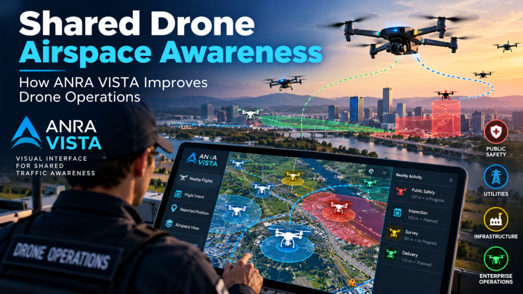
Two drone teams can follow every rule and still end up in the same patch of sky without knowing the other is there. ANRA Technologies introduced VISTA on October 14, 2026 to close that gap. It gives authorized operators a receive-only view of nearby drone flight intent and reported positions drawn from UAS Traffic Management (UTM) services. In practical terms, it is a step toward shared drone airspace awareness that doesn’t ask operators to change the aircraft or flight apps they already use.
That is the short answer. The sections below explain what VISTA is, what it deliberately does not do, why the timing makes sense, and how a drone program can decide whether it belongs in its toolkit. The facts come from ANRA’s launch materials and related reporting. Where I’m offering interpretation, I say so.
Key Takeaways
- What it is: ANRA VISTA stands for Visual Interface for Shared Traffic Awareness, an application that presents available UTM information in an easy-to-read visual format.
- What it isn’t: It is receive-only. It doesn’t connect aircraft to UTM, submit flight plans, or detect every drone in the sky.
- Who it’s for: Public safety agencies, enterprise drone programs, utilities, infrastructure operators, and other authorized users.
- Proof of demand: ANRA says more than 20 organizations, mostly Drone as First Responder (DFR) programs, already use its visualization capability.
- Scale context: ANRA says its UTM platform supports roughly one drone mission every 15 seconds during daytime operations.
- Availability: ANRA is offering demonstrations. The launch materials I reviewed did not list pricing or a general release date.
What Is Shared Drone Airspace Awareness?
Definition: What the Term Means
Shared drone airspace awareness is an operator’s working knowledge of which other drone missions are planned or underway near their own, including missions run by different organizations. It answers two practical questions: what else is flying around me, and what is it about to do?
Expansion: The Three Ingredients
The concept breaks into three parts:
- Flight intent. Where other operators plan to fly, and roughly when.
- Reported position. Where those aircraft are according to the data available now.
- Accessibility. Whether that information reaches the right person, at the right moment, in a form they can interpret in seconds.
Most of the difficulty lives in the third ingredient. Flight intent and position data may exist inside various UTM services, but data that sits in a system an operator never opens doesn’t change any decisions.
Notice what the definition leaves out. Shared drone airspace awareness is informational. It helps a human decide to hold a launch, adjust a route, or call a neighboring team. It doesn’t command aircraft, issue clearances, or replace the rules that keep drones apart.
Question: How Is Awareness Different From Deconfliction?
Direct answer: Deconfliction resolves conflicts between planned flights, while awareness lets people see the picture so they can act on it.
Strategic deconfliction is typically handled before flight, when a UTM service checks planned missions against each other and flags overlaps. Awareness is broader and softer. It covers what an operator can see and understand around their mission area, including activity coordinated through other organizations’ services. The two work best together. Deconfliction reduces the number of conflicts, and awareness helps people notice and handle the ones that remain.
What Is ANRA VISTA?
Question: What Does VISTA Stand For, and What Does It Do?
Direct answer: VISTA stands for Visual Interface for Shared Traffic Awareness. ANRA VISTA displays available drone flight intent and reported position information from UTM services through a visual interface, so operators can make better-informed decisions before and during flight.
ANRA, a Washington, D.C.-based provider of digital airspace and mission management software, positions the app as an additional layer of situational awareness. Operators consult it before takeoff and while a mission is underway.
Question: Does VISTA Connect Aircraft to UTM or File Flight Plans?
Direct answer: No. ANRA describes VISTA as receive-only. It doesn’t connect aircraft to UTM, and it doesn’t submit flight plans.
That design choice matters. Because the app only consumes information, it can sit beside whatever an organization already flies and whatever flight software it already trusts. ANRA’s stated pitch is that operators can gain awareness “without requiring operators to change how they fly,” in the words of CEO Amit Ganjoo. Nothing needs replacing and no aircraft needs recertifying. My reading is that this lowers the adoption barrier considerably for agencies that already have established fleets and procedures.
Core Capabilities
According to ANRA, VISTA provides four capabilities:
- Nearby operational awareness: view available information on drone flight intentions and reported positions around a mission area
- Simple airspace visualization: see shared operational information in a format operators can interpret quickly
- Preflight and in-flight awareness: check relevant drone activity before launch and keep watching as a mission progresses
- Operational flexibility: access shared airspace information without replacing aircraft, flight applications, or existing operational systems
Who ANRA Built It For
ANRA names public safety agencies, enterprise drone programs, utilities, infrastructure operators, and “other authorized operators.” The wording “authorized” suggests access is controlled, though the launch materials don’t detail how.
For agencies where shared drone airspace awareness is becoming an operational requirement rather than a nice-to-have, the pairing of DFR and infrastructure inspection is telling. Both are growing categories where several organizations may fly in the same area on short notice.
Why Shared Drone Airspace Awareness Matters Now
Low-Altitude Airspace Is Getting Busier
ANRA’s own numbers show how quickly activity is climbing. In July 2026, the company said its Mission Manager X platform supported more than 55,000 commercial drone operations per month in the United States, which works out to over 1,800 per day. In the VISTA announcement, ANRA says its UTM platform supports approximately one drone mission every 15 seconds during daytime operations.
Those figures come from one company’s platform and are not a measure of the whole national airspace. Still, they illustrate a real shift. Drone delivery, DFR programs, utility inspection, and other commercial work have moved from pilots to routine operations, and more aircraft from more organizations now share the same low altitudes.
UTM Coordinates Missions, but Visibility Is Uneven
ANRA’s release makes a candid point: although UTM services coordinate operations, a drone operator may have limited awareness of nearby activity, particularly when those flights are managed by different organizations.
This is the gap VISTA targets. A single UTM service can know a great deal about the missions it manages. A pilot or incident commander on the ground, however, may not have an easy way to see what other services know. Shared drone airspace awareness is partly a user-interface problem, and VISTA is ANRA’s answer to it.
Regulation Is Pointing Toward Managed Airspace
The regulatory backdrop adds weight. According to Wikipedia’s overview of UTM, the FAA had begun issuing Letters of Acceptance to service providers supporting strategic deconfliction in shared airspace by 2025. ANRA received what it called the first FAA Letter of Acceptance for a non-vertically integrated UTM service supplier. EASA issued its first U-space service provider certificate to ANRA in May 2025.
I’d read VISTA in that context. As low-altitude airspace management becomes more formal, the people on the ground will need better tools for seeing what the system already knows.
How VISTA Works in Practice
The following scenarios are drawn from the use cases ANRA describes. The details of how each plays out are my illustration, not documented behavior.
Before Takeoff
A pilot preparing a mission checks the app for other drone activity near the planned area. If another organization’s flight intent overlaps, the pilot can delay, shift a route, or coordinate directly. The value here is time: a conflict spotted on the ground costs minutes, while one spotted in the air costs much more.
During the Mission
ANRA says operators can maintain awareness as a mission progresses. Conditions change, and a flight that looked clear at launch may no longer be clear twenty minutes later. A continuously updated view helps the operator stay oriented without leaving their existing flight application.
Drone as First Responder Operations
For public safety, ANRA says VISTA can show other drone operations near emergency scenes, helping DFR teams make informed decisions while responding to incidents. This is probably the strongest use case. An emergency scene is exactly where several drones might converge, including a police DFR aircraft, a media drone, or an inspection flight that was already scheduled nearby. Knowing which of those are coordinated through UTM services is useful information for an incident commander.
Utilities and Infrastructure Inspections
ANRA says utilities, infrastructure operators, and commercial programs can use the app to gain visibility into activity around inspections, maintenance missions, and other routine operations. These flights often run along corridors such as power lines, pipelines, and rail, where different crews may work close together.
Shared Drone Airspace Awareness vs. Related Technologies
A common mistake is treating every airspace tool as interchangeable. They answer different questions. The table below separates them. Entries other than VISTA describe the general category, not any specific product’s features.
| Approach | Main purpose | What it relies on | Key limitation |
|---|---|---|---|
| Awareness app (e.g., ANRA VISTA) | Show nearby flight intent and positions to people | Information available through UTM services | Only as complete as the data available; doesn’t detect every drone |
| Strategic deconfliction via UTM | Resolve conflicts between planned missions before flight | Operators filing plans with UTM services | Depends on participation; doesn’t itself give pilots a live picture |
| Network Remote ID | Identify and locate drones through broadcast or network data | Compliant aircraft and reporting infrastructure | Covers identification, not intent or coordination |
| Radar and sensor detection | Find drones, including non-cooperating ones | Ground or airborne sensors | Needs hardware and installation; a different cost profile |
| Onboard detect-and-avoid | Let the aircraft sense and avoid hazards itself | Sensors and software on the drone | Aircraft-specific; doesn’t give other users a shared picture |
For context, ANRA has previously partnered with Echodyne to add radar for non-cooperative small-drone detection to its SIOP offering. That shows the company treats detection and awareness as different layers. VISTA sits on the awareness side, and ANRA says explicitly that it is not designed to detect every drone.
The practical lesson: no single layer covers everything. Shared drone airspace awareness works as one layer in a stack with deconfliction, identification, and detection.
What VISTA Signals About ANRA’s Strategy
The launch fits a pattern. ANRA has been building from several directions at once.
- Scale. The 55,000-operations-per-month milestone positions ANRA as a high-volume UTM provider, and VISTA draws on that data foundation.
- Certification. The company holds the FAA’s first Letter of Acceptance for a non-vertically integrated UTM supplier and EASA’s first U-space service provider certificate.
- Research. On October 5, 2026, the FAA announced $12 million for 19 drone research projects. ANRA won four of them: connecting air taxi operations with vertiports and flight procedures, a common altitude reference for drones, a link between drone traffic systems and airport air traffic control, and AI tools to identify different drone types.
My interpretation: VISTA is a small product with a larger strategic role. It gives ANRA a lightweight, low-friction entry point into organizations that may not yet run a full UTM deployment, and it showcases the value of shared data to people who aren’t UTM specialists. The more users consult that shared picture, the stronger the case for participating in it. That is a plausible reading, not something ANRA has said.
Also note the existing base. The 20-plus organizations, mostly DFR programs, already using ANRA’s visualization capability suggest VISTA grows out of something with real users rather than a concept demo.
Limits and Open Questions
Honest analysis includes what the announcement leaves unanswered.
- Coverage depends on participation. VISTA shows what UTM services make available. A drone flown outside those services may not appear. ANRA itself says it isn’t meant to detect every drone.
- Receive-only cuts both ways. It’s easy to adopt, but it offers no way to send information back or coordinate through the app.
- Complement, not substitute. ANRA states the app is meant to complement existing operational and safety procedures. Agencies shouldn’t treat it as a replacement for visual observers, radio coordination, or established deconfliction processes.
- Unpublished specifics. The launch materials I reviewed didn’t say how fresh the data is, how access is authorized, or what the app costs. Those details matter for any operational decision.
- Interoperability across providers. The release mentions information available through “the UTM ecosystem,” but how broadly that spans competing UTM services isn’t spelled out.
None of these are criticisms of the product. They are the questions a careful buyer should ask during the demonstration ANRA is offering.
How to Evaluate VISTA for Your Program
If you run a DFR team, utility drone program, or enterprise fleet, here’s a practical way to assess it:
- Map your neighbors. Which other organizations fly near you, and do they use UTM services?
- Ask about data coverage. Which UTM services feed the display in your operating area?
- Test the latency. How quickly do position updates and new flight intents appear?
- Check the access model. Who counts as an “authorized operator,” and how is that verified?
- Fit it into procedures. Decide when crews consult it (preflight briefing, launch checklist, incident command) and write that into your SOPs.
- Define the failure mode. If the app has no data for an area, what does a pilot do? An empty screen shouldn’t be read as an empty sky.
FAQ
What is shared drone airspace awareness in one sentence?
It is the ability to see which other drones, flown by any organization, are planned or active near your mission, so you can make informed decisions before and during flight.
Does VISTA replace Remote ID, deconfliction, or radar detection?
No. ANRA describes VISTA as an additional awareness layer that complements existing safety procedures. It doesn’t connect aircraft to UTM, file flight plans, or detect every drone.
Do I need new aircraft or software to use it?
According to ANRA, no. The application is designed to provide shared airspace information without replacing aircraft, flight applications, or existing systems.
Who can use ANRA VISTA?
ANRA names public safety agencies, enterprise drone programs, and other authorized operators, including utilities and infrastructure operators.
How do I get access?
ANRA says interested organizations can contact the company to schedule a demonstration. A public sign-up or pricing page was not part of the announcement I reviewed.
Why does this matter for drone as first responder programs?
DFR missions often launch quickly toward emergency scenes where other drone operations may already be present. ANRA says VISTA can show those nearby operations, which supports faster, better-informed decisions during response.
Bottom Line
ANRA VISTA is a modest product aimed at a real and growing problem. As low-altitude airspace fills with delivery, inspection, and public safety flights, the people flying them need to see what others are doing. VISTA makes shared drone airspace awareness more accessible by turning UTM data into a visual, receive-only view that works alongside existing aircraft and software.
Its limits are just as clear. It shows what the UTM ecosystem knows, not everything that flies, and it is designed to complement existing procedures rather than replace them. For agencies and operators already working in busy airspace, the right next step is to request a demonstration, ask the hard questions about coverage and latency, and decide where shared drone airspace awareness fits in the safety stack. For everyone else, the launch is a useful signal: the industry is moving from simply coordinating drone flights to making that coordination visible to the people doing the flying.